安塞纸坊沟流域1:1万地貌图(1995年)
收藏国家地球系统科学数据中心2023-04-07 更新2024-03-04 收录
下载链接:
https://www.geodata.cn/data/datadetails.html?dataguid=179644211543703&docId=6011
下载链接
链接失效反馈官方服务:
资源简介:
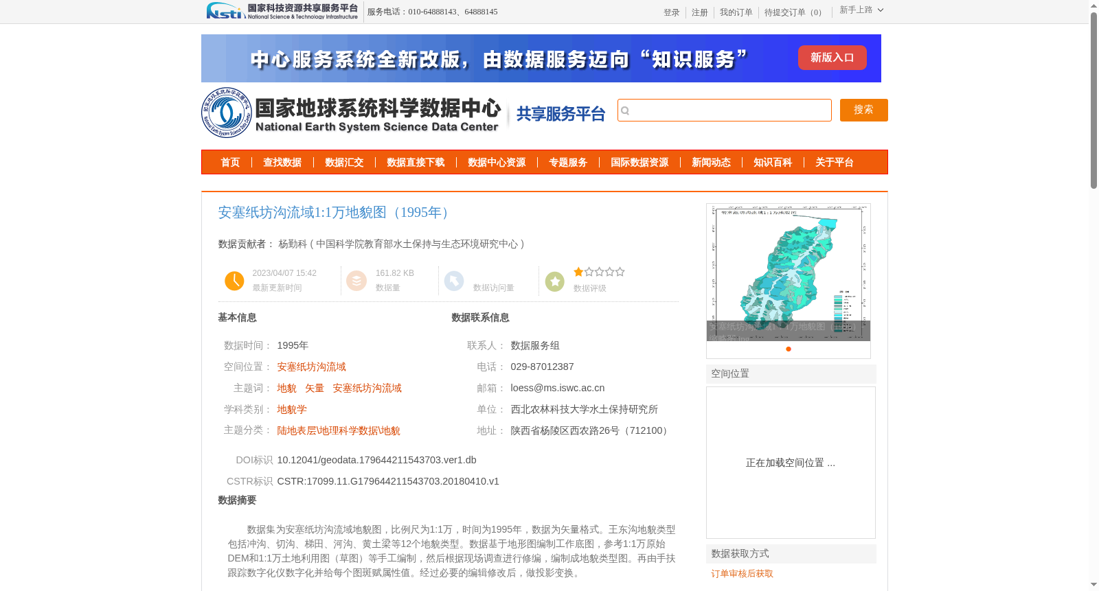
数据集为安塞纸坊沟流域地貌图,比例尺为1:1万,时间为1995年,数据为矢量格式。王东沟地貌类型包括冲沟、切沟、梯田、河沟、黄土梁等12个地貌类型。数据基于地形图编制工作底图,参考1:1万原始DEM和1:1万土地利用图(草图)等手工编制,然后根据现场调查进行修编,编制成地貌类型图。再由手扶跟踪数字化仪数字化并给每个图斑赋属性值。经过必要的编辑修改后,做投影变换。
This dataset is a geomorphic map of the Zhifanggou Watershed in Ansai, with a scale of 1:10,000, finalized in 1995, and stored in vector format. The geomorphic types within the Wangdonggou area consist of 12 categories including gullies, incised gullies, terraces, stream gullies, loess ridges, and others. The map was manually compiled using a topographic map as the base, with reference to 1:10,000 original DEMs and 1:10,000 sketched land use maps, then revised based on field investigations to produce the formal geomorphic type map. Next, it was digitized with a hand-operated tracing digitizer, and attribute values were assigned to each polygon. After necessary editing and modification, projection transformation was performed on the dataset.
提供机构:
中国科学院教育部水土保持与生态环境研究中心
创建时间:
2018-04-10
搜集汇总
数据集介绍
背景与挑战
背景概述
该数据集提供了1995年安塞纸坊沟流域的详细地貌信息,比例尺为1:1万,包含冲沟、切沟、梯田等多种地貌类型,数据格式为矢量,适用于地貌学研究和相关领域应用。
以上内容由遇见数据集搜集并总结生成


