武陵源世界遗产地遥感监测数据集
收藏地球大数据科学工程2024-03-04 收录
下载链接:
https://data.casearth.cn/sdo/detail/6538a75d819aec0f2615c39b
下载链接
链接失效反馈官方服务:
资源简介:
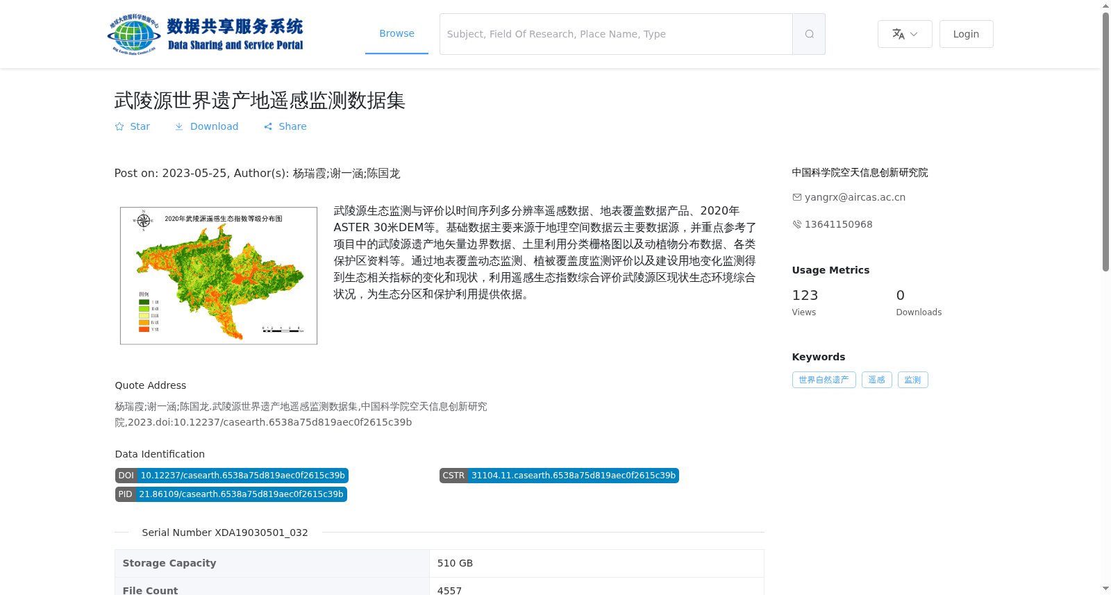
武陵源生态监测与评价以时间序列多分辨率遥感数据、地表覆盖数据产品、2020年ASTER 30米DEM等。基础数据主要来源于地理空间数据云主要数据源,并重点参考了项目中的武陵源遗产地矢量边界数据、土里利用分类栅格图以及动植物分布数据、各类保护区资料等。通过地表覆盖动态监测、植被覆盖度监测评价以及建设用地变化监测得到生态相关指标的变化和现状,利用遥感生态指数综合评价武陵源区现状生态环境综合状况,为生态分区和保护利用提供依据。
Wulingyuan ecological monitoring and evaluation is based on time-series multi-resolution remote sensing data, land cover data products, 2020 ASTER 30m DEM, and other related data. The basic data mainly comes from the main data sources of the Geospatial Data Cloud, with key references to the vector boundary data of the Wulingyuan Heritage Site, land use classification raster maps, flora and fauna distribution data, and various protected area materials obtained from the project. Through dynamic land cover monitoring, vegetation coverage monitoring and evaluation, and construction land change monitoring, the changes and current status of ecological-related indicators are acquired. The Remote Sensing Ecological Index (RSEI) is then utilized to comprehensively assess the overall ecological environment status of Wulingyuan District, providing a scientific basis for ecological zoning, protection and utilization.
提供机构:
中国科学院空天信息创新研究院
搜集汇总
数据集介绍
背景与挑战
背景概述
该数据集是一个用于武陵源世界遗产地生态监测的遥感数据集,基于时间序列多分辨率遥感数据、地表覆盖数据产品和2020年ASTER 30米DEM等,通过地表覆盖动态监测、植被覆盖度评价和建设用地变化监测,获取生态指标变化和现状,并利用遥感生态指数综合评价生态环境,为生态分区和保护利用提供科学依据。数据集存储容量为510 GB,包含4557个文件,格式为tif、shp和png,产品类型为世界自然遗产遥感监测数据,由中国科学院空天信息创新研究院于2023年发布。
以上内容由遇见数据集搜集并总结生成


