青藏高原1:300万冻土图(1983-1996)
收藏国家青藏高原科学数据中心2021-04-19 更新2024-03-01 收录
下载链接:
https://data.tpdc.ac.cn/zh-hans/data/908817ef-e574-4cdb-9582-f65945a86068
下载链接
链接失效反馈官方服务:
资源简介:
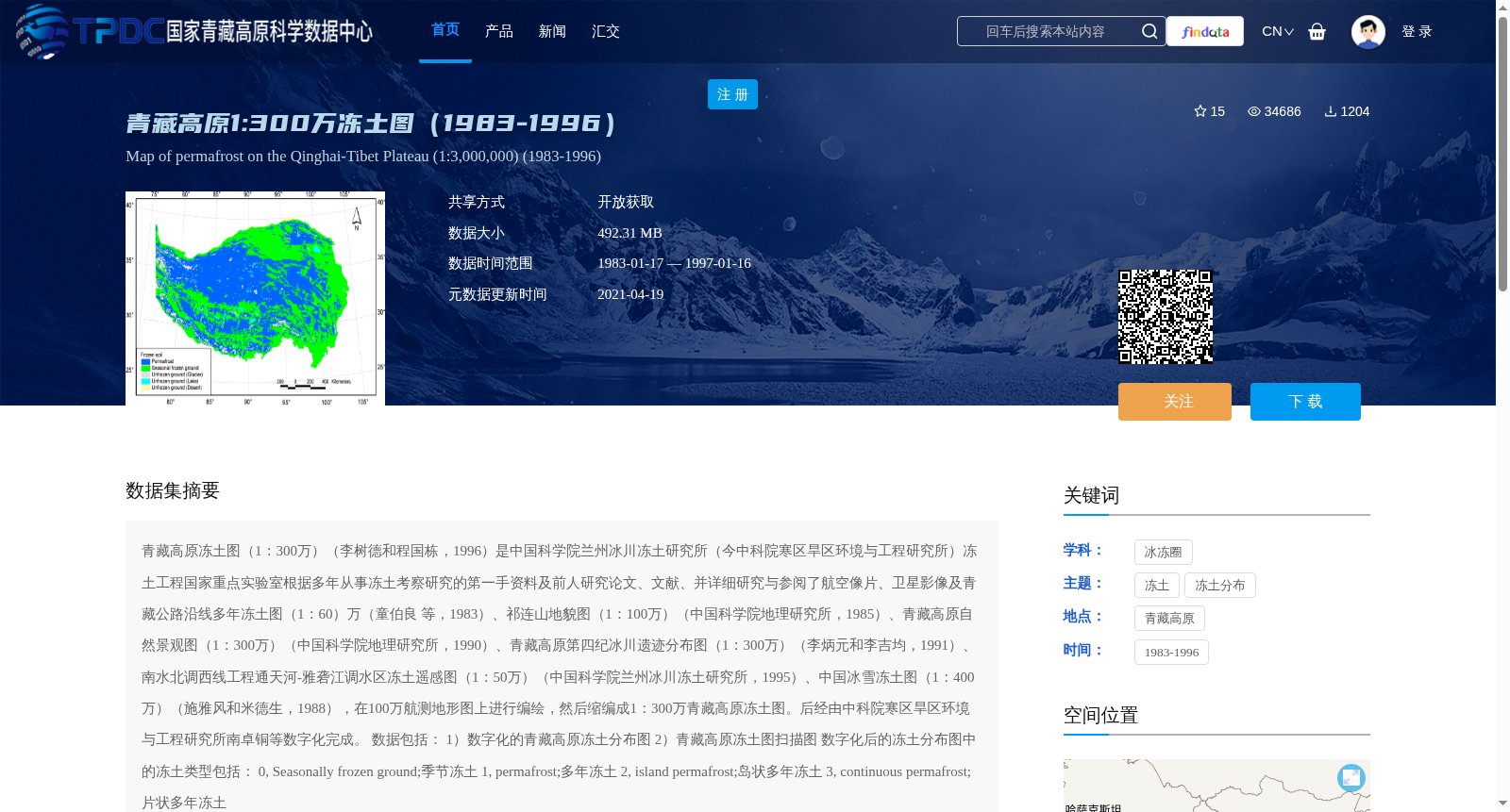
青藏高原冻土图(1:300万)(李树德和程国栋,1996)是中国科学院兰州冰川冻土研究所(今中科院寒区旱区环境与工程研究所)冻土工程国家重点实验室根据多年从事冻土考察研究的第一手资料及前人研究论文、文献、并详细研究与参阅了航空像片、卫星影像及青藏公路沿线多年冻土图(1:60)万(童伯良 等,1983)、祁连山地貌图(1:100万)(中国科学院地理研究所,1985)、青藏高原自然景观图(1:300万)(中国科学院地理研究所,1990)、青藏高原第四纪冰川遗迹分布图(1:300万)(李炳元和李吉均,1991)、南水北调西线工程通天河-雅砻江调水区冻土遥感图(1:50万)(中国科学院兰州冰川冻土研究所,1995)、中国冰雪冻土图(1:400万)(施雅风和米德生,1988),在100万航测地形图上进行编绘,然后缩编成1:300万青藏高原冻土图。后经由中科院寒区旱区环境与工程研究所南卓铜等数字化完成。
数据包括:
1)数字化的青藏高原冻土分布图
2)青藏高原冻土图扫描图
数字化后的冻土分布图中的冻土类型包括:
0, Seasonally frozen ground;季节冻土
1, permafrost;多年冻土
2, island permafrost;岛状多年冻土
3, continuous permafrost;片状多年冻土
The 1:3,000,000 Permafrost Map of the Qinghai-Tibet Plateau (Li & Cheng, 1996) was developed by the State Key Laboratory of Frozen Soil Engineering, Lanzhou Institute of Glaciology and Geocryology, Chinese Academy of Sciences (now the Cold and Arid Regions Environmental and Engineering Research Institute, Chinese Academy of Sciences). The compilation was based on first-hand field investigation data from years of permafrost research, published literature and previous studies, as well as detailed analysis and reference to aerial photographs, satellite imagery, the 1:600,000 Permafrost Map along the Qinghai-Tibet Highway (Tong et al., 1983), the 1:1,000,000 Geomorphological Map of the Qilian Mountains (Institute of Geographic Sciences, Chinese Academy of Sciences, 1985), the 1:3,000,000 Natural Landscape Map of the Qinghai-Tibet Plateau (Institute of Geographic Sciences, Chinese Academy of Sciences, 1990), the 1:3,000,000 Quaternary Glacial Relic Distribution Map of the Qinghai-Tibet Plateau (Li & Li, 1991), the 1:500,000 Remote Sensing Permafrost Map of the Tongtian River-Yalong River Water Transfer Zone for the West Route of the South-to-North Water Diversion Project (Lanzhou Institute of Glaciology and Geocryology, Chinese Academy of Sciences, 1995), and the 1:4,000,000 Snow and Permafrost Map of China (Shi & Mi, 1988). The map was initially drafted on 1:1,000,000 aerial survey topographic maps, then scaled down to the final 1:3,000,000 version. Subsequently, it was digitized by Nan Zhuotong et al. from the Cold and Arid Regions Environmental and Engineering Research Institute, Chinese Academy of Sciences.
The dataset includes two parts:
1) Digitized permafrost distribution map of the Qinghai-Tibet Plateau
2) Scanned copy of the Permafrost Map of the Qinghai-Tibet Plateau
Permafrost categories in the digitized distribution map are defined as follows:
0: Seasonally frozen ground
1: Permafrost
2: Island permafrost
3: Continuous permafrost
提供机构:
程国栋,李树德,南卓铜,童伯良
创建时间:
2011-03-21
搜集汇总
数据集介绍
背景与挑战
背景概述
该数据集是1:300万比例尺的青藏高原冻土图,覆盖1983-1996年,包含数字化的冻土分布图和扫描图,冻土类型分为季节冻土、多年冻土、岛状多年冻土和片状多年冻土。数据由中国科学院相关研究所编绘并数字化,适用于冻土分布研究。
以上内容由遇见数据集搜集并总结生成


