LessRad SWDR_Terrain 青藏高原考虑地形效应的日均短波下行辐射数据集(2016-2018)
收藏国家青藏高原科学数据中心2025-11-11 更新2025-10-18 收录
下载链接:
https://data.tpdc.ac.cn/zh-hans/data/e8f44b34-0e84-443c-920d-a3e4e5157a42
下载链接
链接失效反馈官方服务:
资源简介:
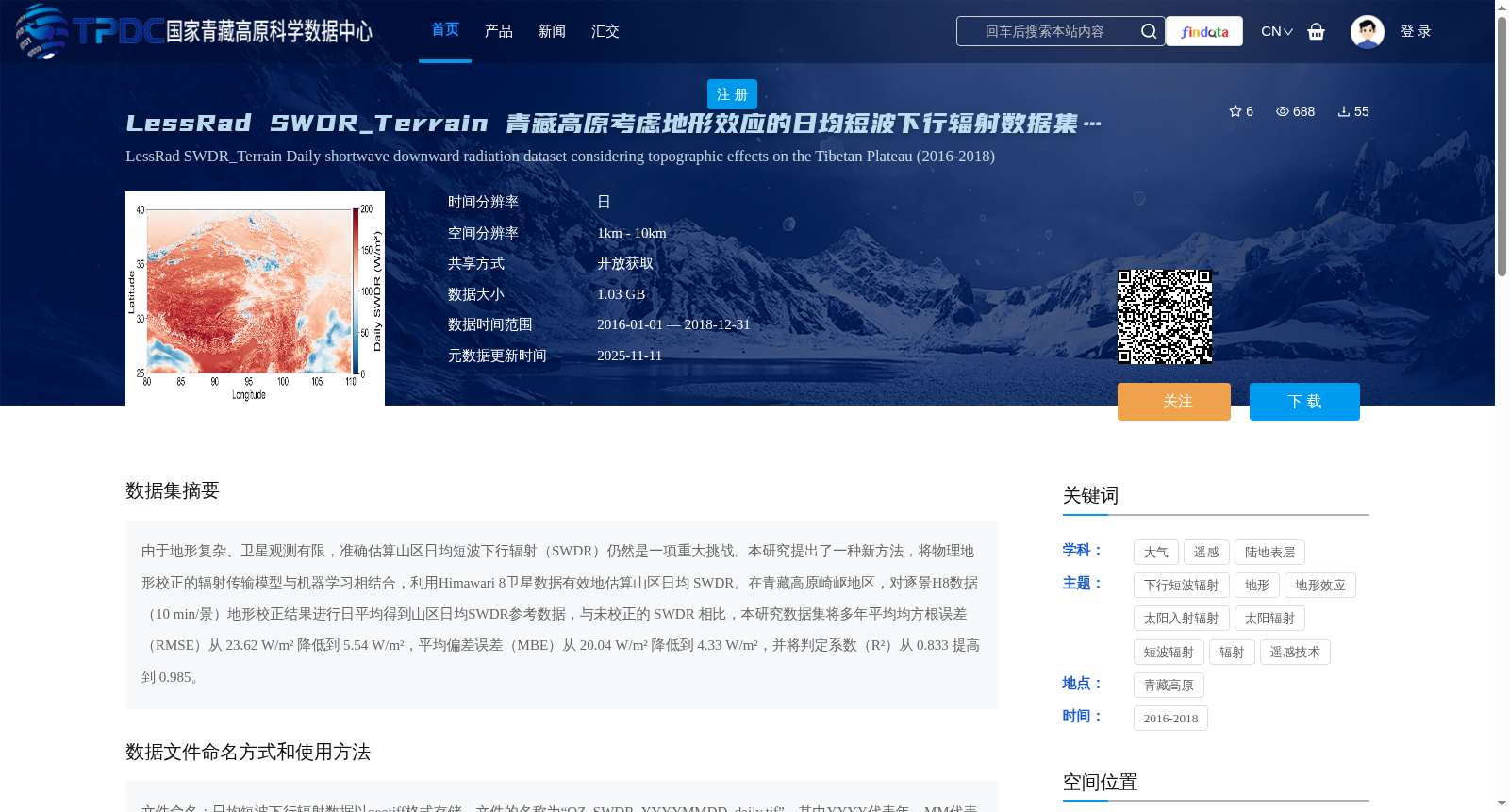
由于地形复杂、卫星观测有限,准确估算山区日均短波下行辐射(SWDR)仍然是一项重大挑战。本研究提出了一种新方法,将物理地形校正的辐射传输模型与机器学习相结合,利用Himawari 8卫星数据有效地估算山区日均 SWDR。在青藏高原崎岖地区,对逐景H8数据(10 min/景)地形校正结果进行日平均得到山区日均SWDR参考数据,与未校正的 SWDR 相比,本研究数据集将多年平均均方根误差(RMSE)从 23.62 W/m² 降低到 5.54 W/m²,平均偏差误差(MBE)从 20.04 W/m² 降低到 4.33 W/m²,并将判定系数(R²)从 0.833 提高到 0.985。
Accurate estimation of daily mean shortwave downward radiation (SWDR) in mountainous areas remains a significant challenge due to complex terrain and limited satellite observations. This study proposes a novel method that combines physically based topographically corrected radiative transfer models with machine learning to efficiently estimate daily mean SWDR in mountainous areas using Himawari 8 satellite data. In the rugged terrain of the Qinghai-Tibet Plateau, reference data of daily mean SWDR in mountainous areas was obtained by daily averaging the topographically corrected results of per-scene Himawari 8 data (10 minutes per scene). Compared with uncorrected SWDR, the dataset developed in this study reduced the multi-year average root mean square error (RMSE) from 23.62 W/m² to 5.54 W/m², the mean bias error (MBE) from 20.04 W/m² to 4.33 W/m², and improved the coefficient of determination (R²) from 0.833 to 0.985.
提供机构:
冼宇阳,王天星,杜艺涵,余沛
创建时间:
2025-08-11
搜集汇总
数据集介绍
背景与挑战
背景概述
该数据集是2016-2018年青藏高原地区考虑地形效应的日均短波下行辐射数据,通过融合物理地形校正模型和机器学习方法,基于Himawari 8卫星观测生成,显著提高了山区辐射估算精度(如均方根误差降低至5.54 W/m²)。数据以GeoTIFF格式提供,时间分辨率为日,空间分辨率为1km-10km,适用于大气科学和遥感研究。
以上内容由遇见数据集搜集并总结生成


