长三角月度10m植被指数(NDVI)数据集(2019-2023年)
收藏国家地球系统科学数据中心2024-09-29 更新2024-09-21 收录
下载链接:
https://www.geodata.cn/data/datadetails.html?dataguid=173250442387746&docId=2569
下载链接
链接失效反馈官方服务:
资源简介:
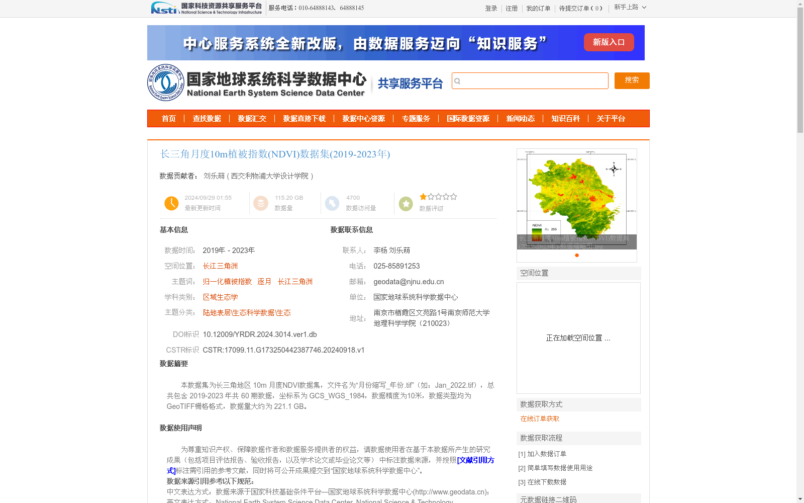
本数据集为长三角地区 10m 月度NDVI数据集,文件名为“月份缩写_年份.tif”(如:Jan_2022.tif),总共包含 2019-2023 年共 60 期数据,坐标系为 GCS_WGS_1984,数据精度为10米,数据类型均为GeoTIFF栅格格式,数据量大约为 221.1 GB。
This dataset is a monthly 10-meter NDVI dataset covering the Yangtze River Delta region. The file naming convention follows the format "month_abbreviation_year.tif" (e.g., Jan_2022.tif). It contains a total of 60 datasets spanning from 2019 to 2023. The coordinate system is GCS_WGS_1984, with a spatial resolution of 10 meters. All data are stored in GeoTIFF raster format, and the total data volume is approximately 221.1 GB.
提供机构:
西交利物浦大学设计学院
创建时间:
2024-09-18
搜集汇总
数据集介绍
背景与挑战
背景概述
该数据集提供了长江三角洲地区2019年至2023年共60个月的月度归一化植被指数(NDVI)数据,空间分辨率高达10米,数据格式为GeoTIFF。数据基于Sentinel-2卫星影像,通过Google Earth Engine平台进行云处理、合成和计算,并经过严格质量控制,包括线性插值填充空值区,适用于区域生态监测和研究。
以上内容由遇见数据集搜集并总结生成


