中国青藏高原地区土壤水分数据集(2003-2022)
收藏国家青藏高原科学数据中心2025-01-03 更新2025-03-29 收录
下载链接:
https://data.tpdc.ac.cn/zh-hans/data/d026c4c6-52a8-4817-ab04-1cba86dc3724
下载链接
链接失效反馈官方服务:
资源简介:
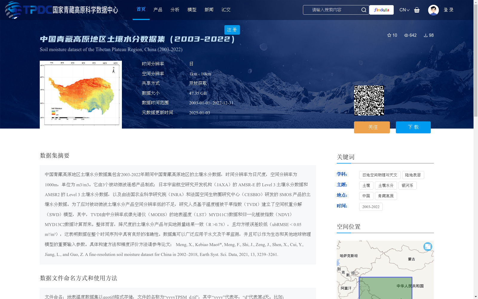
中国青藏高原地区土壤水分数据集包含2003-2022年期间中国青藏高原地区的土壤水分数据,时间分辨率为日尺度,空间分辨率为1000m,单位为 m3/m3。它由3个被动微波遥感产品制成:日本宇宙航空研究开发机构(JAXA)的 AMSR-E 的 Level 3 土壤水分数据和 AMSR2 的 Level 3 土壤水分数据,以及由法国农业科学研究院(INRA)和法国空间生物圈研究中心(CESBIO)研发的 SMOS 产品的土壤水分数据。为了应对被动微波土壤水分产品空间分辨率低的不足,研究人员基于温度植被干旱指数(TVDI)建立了空间权重分解(SWD)模型,其中,TVDI由中分辨率成像光谱仪(MODIS)的地表温度(LST)MYD11C3数据和归一化植被指数(NDVI)MYD13C2数据计算而来。整体而言,降尺度的土壤水分产品与实地测量结果一致(R >0.78),且均方根误差较低(ubRMSE < 0.05 m³/m³),这表明数据在整个时间序列中具有良好的准确性。数据集可以广泛应用于水文及干旱监测,并且可以作为生态和其他地球物理模型的重要输入参数。具体构建方法和精度评价方法请参考论文:
Meng, X., Kebiao Mao#*, Meng, F., Shi, J., Zeng, J., Shen, X., Cui, Y., Jiang, L., and Guo, Z. A fine-resolution soil moisture dataset for China in 2002–2018, Earth Syst. Sci. Data, 2021, 13, 3239–3261.
Soil Moisture Dataset over the Qinghai-Tibet Plateau of China contains soil moisture data from 2003 to 2022, with a temporal resolution of daily scale, spatial resolution of 1000 m, and the unit of m³/m³.
This dataset is developed based on three passive microwave remote sensing products: the Level 3 soil moisture data of AMSR-E and AMSR2 from the Japan Aerospace Exploration Agency (JAXA), and the soil moisture data of SMOS product developed by the French National Institute for Agricultural Research (INRA) and the French Space Biosphere Research Center (CESBIO).
To address the low spatial resolution issue of passive microwave soil moisture products, researchers established a spatial weight decomposition (SWD) model based on the Temperature Vegetation Drought Index (TVDI). The TVDI is calculated from the Moderate Resolution Imaging Spectroradiometer (MODIS) land surface temperature (LST) product MYD11C3 and normalized difference vegetation index (NDVI) product MYD13C2.
Overall, the downscaled soil moisture products are consistent with in-situ measurements (R > 0.78) with a low unbiased root mean square error (ubRMSE < 0.05 m³/m³), indicating that the dataset has excellent accuracy across the entire time series.
This dataset can be widely used in hydrological and drought monitoring, and serve as an important input parameter for ecological and other geophysical models.
For specific construction and accuracy evaluation methods, please refer to the paper: Meng, X., Kebiao Mao#*, Meng, F., Shi, J., Zeng, J., Shen, X., Cui, Y., Jiang, L., and Guo, Z. A fine-resolution soil moisture dataset for China in 2002–2018, Earth Syst. Sci. Data, 2021, 13, 3239–3261.
提供机构:
毛克彪
创建时间:
2024-10-19
搜集汇总
数据集介绍
背景与挑战
背景概述
该数据集提供了2003年至2022年中国青藏高原地区的日尺度土壤水分数据,空间分辨率为1公里,数据量达47.35 GB。它融合了多个被动微波遥感产品,并采用降尺度技术提升精度,验证显示与实地测量高度一致(R >0.78),适用于水文监测和生态模型输入。数据开放获取,需按规定引用相关文献。
以上内容由遇见数据集搜集并总结生成


