青藏高原生态系统降水调节服务格网数据集(2008-2017)
收藏国家青藏高原科学数据中心2025-01-09 更新2025-03-22 收录
下载链接:
https://data.tpdc.ac.cn/zh-hans/data/98ea636b-217c-4064-b856-dd1f5cdc3879
下载链接
链接失效反馈官方服务:
资源简介:
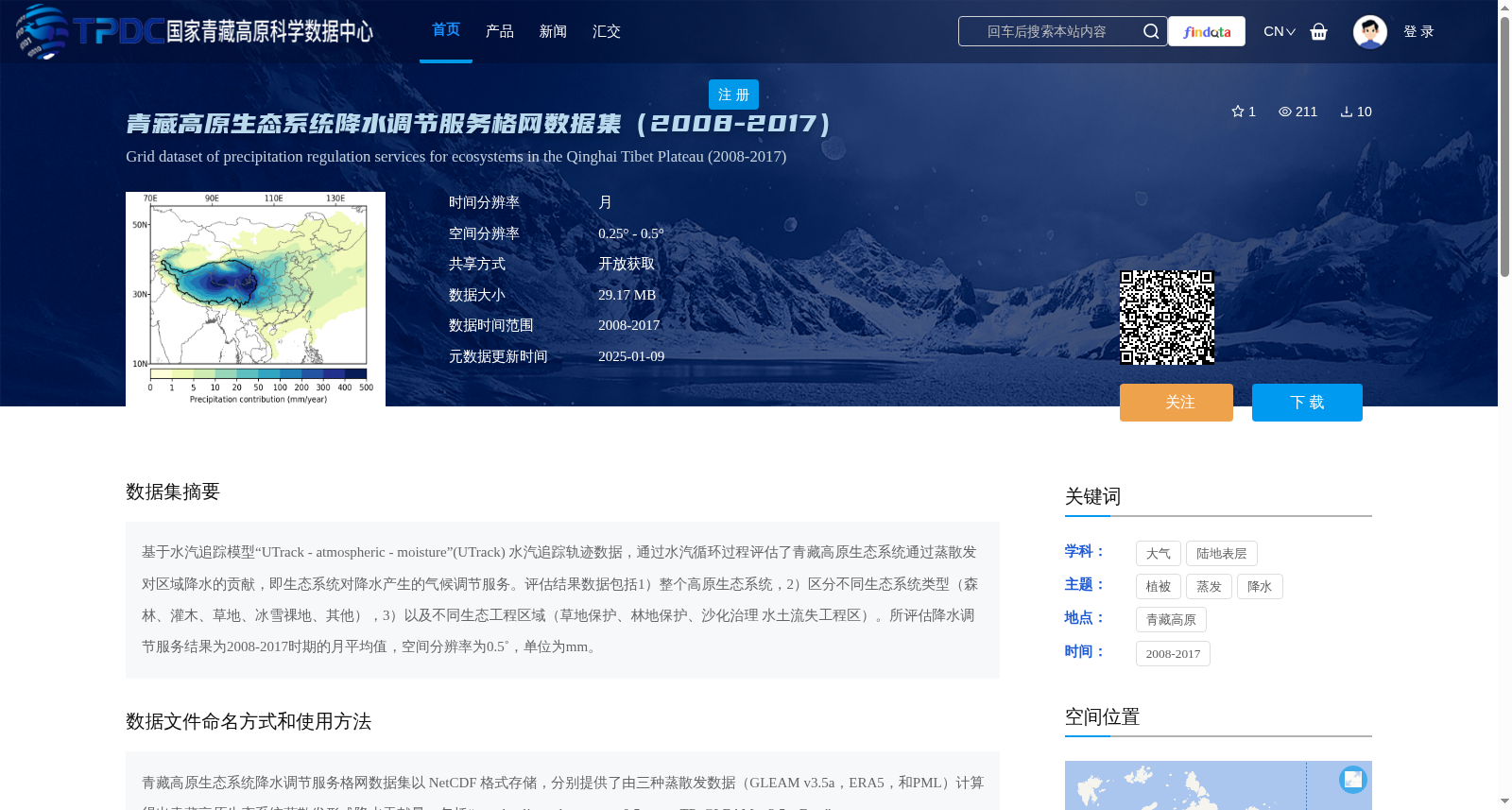
基于水汽追踪模型“UTrack - atmospheric - moisture”(UTrack) 水汽追踪轨迹数据,通过水汽循环过程评估了青藏高原生态系统通过蒸散发对区域降水的贡献,即生态系统对降水产生的气候调节服务。评估结果数据包括1)整个高原生态系统,2)区分不同生态系统类型(森林、灌木、草地、冰雪祼地、其他),3)以及不同生态工程区域(草地保护、林地保护、沙化治理 水土流失工程区)。所评估降水调节服务结果为2008-2017时期的月平均值,空间分辨率为0.5˚,单位为mm。
Utilizing water vapor tracking trajectory data derived from the atmospheric moisture tracking model "UTrack - atmospheric - moisture" (hereafter abbreviated as UTrack), this dataset assesses the contribution of the Qinghai-Tibet Plateau ecosystem to regional precipitation via evapotranspiration during the water cycle, namely the climate regulation service that the ecosystem provides for precipitation. The assessment results cover three categories: 1) the entire plateau ecosystem; 2) different ecosystem types (forest, shrubland, grassland, snow/ice and bare land, others); 3) various ecological engineering zones (grassland protection, forest land protection, desertification control, and soil and water conservation engineering zones). The evaluated precipitation regulation service results are monthly average values for the period 2008-2017, with a spatial resolution of 0.5° and a unit of mm.
提供机构:
李琰
创建时间:
2025-01-09
搜集汇总
数据集介绍
背景与挑战
背景概述
该数据集基于水汽追踪模型UTrack,评估了2008-2017年青藏高原生态系统通过蒸散发对区域降水的贡献,即降水调节服务。数据包括整个高原、不同生态系统类型(如森林、草地)和生态工程区域(如草地保护、沙化治理)的月平均结果,空间分辨率为0.5°,以NetCDF格式提供,支持开放获取。
以上内容由遇见数据集搜集并总结生成


