重点区域20国300米分辨率降雨侵蚀力R因子数据集(1986-2015)
收藏国家青藏高原科学数据中心2021-10-11 更新2024-03-07 收录
下载链接:
https://data.tpdc.ac.cn/zh-hans/data/e1512e2e-ae58-4674-afda-d0659300d083
下载链接
链接失效反馈官方服务:
资源简介:
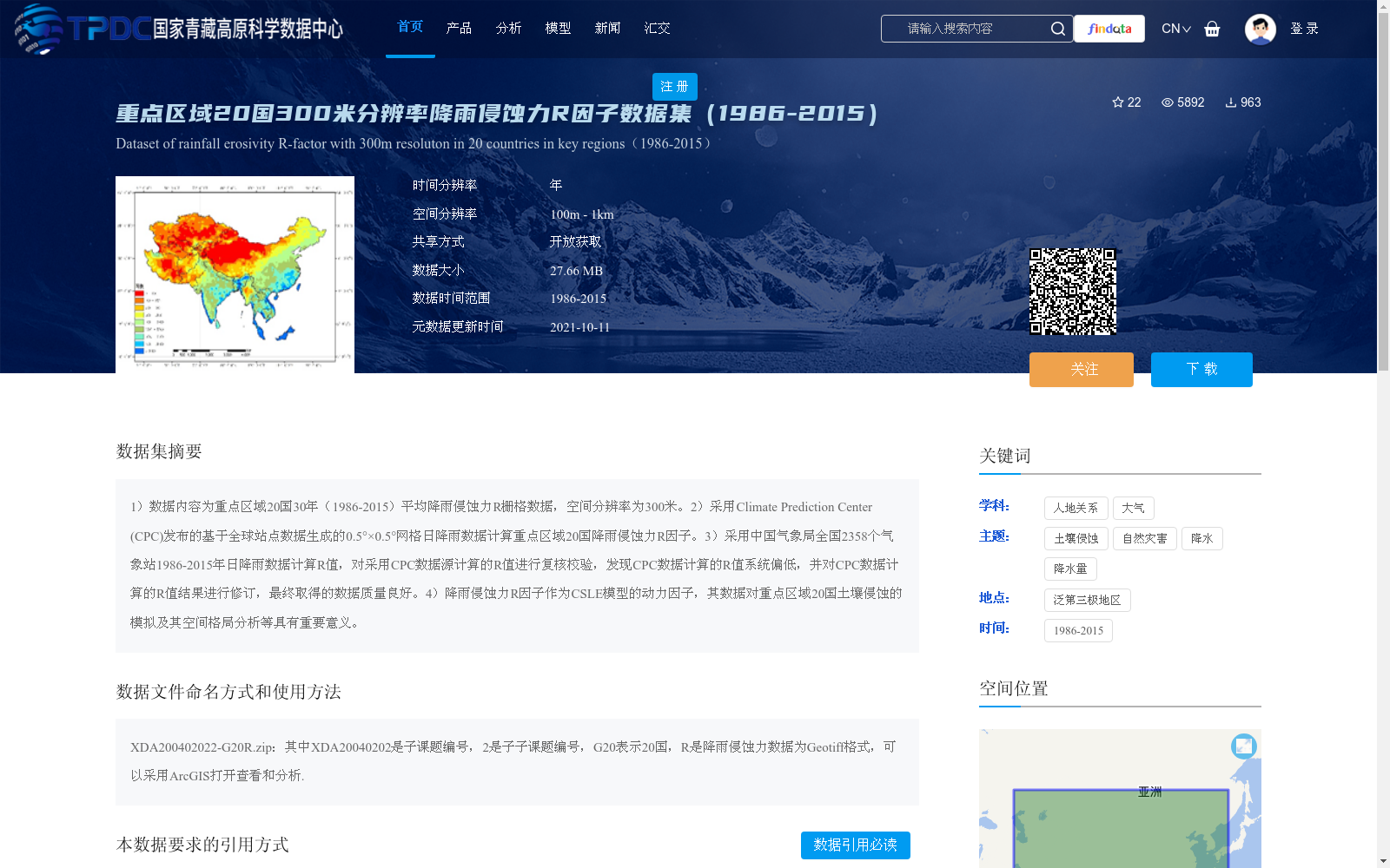
1)数据内容为重点区域20国30年(1986-2015)平均降雨侵蚀力R栅格数据,空间分辨率为300米。2)采用Climate Prediction Center (CPC)发布的基于全球站点数据生成的0.5°×0.5°网格日降雨数据计算重点区域20国降雨侵蚀力R因子。3)采用中国气象局全国2358个气象站1986-2015年日降雨数据计算R值,对采用CPC数据源计算的R值进行复核校验,发现CPC数据计算的R值系统偏低,并对CPC数据计算的R值结果进行修订,最终取得的数据质量良好。4)降雨侵蚀力R因子作为CSLE模型的动力因子,其数据对重点区域20国土壤侵蚀的模拟及其空间格局分析等具有重要意义。
1) The dataset contains 30-year (1986-2015) average rainfall erosivity R raster data for 20 countries in key regions, with a spatial resolution of 300 meters.
2) The rainfall erosivity R factor for the 20 countries in the key regions was calculated using the 0.5°×0.5° daily gridded rainfall product released by the Climate Prediction Center (CPC), which was developed from global station observations.
3) The R values derived from the CPC dataset were validated and calibrated using daily rainfall records from 2,358 national meteorological stations under the China Meteorological Administration (CMA) spanning 1986 to 2015. It was found that the CPC-calculated R values were systematically underestimated, so the CPC-derived R results were revised accordingly. The final dataset exhibited excellent data quality.
4) As a critical dynamic driving factor of the Chinese Soil Loss Equation (CSLE) model, the rainfall erosivity R factor data plays a vital role in soil erosion simulation and spatial pattern analysis for the 20 countries in the key regions.
提供机构:
章文波
创建时间:
2021-10-03
搜集汇总
数据集介绍
背景与挑战
背景概述
该数据集提供了重点区域20个国家在1986-2015年间的平均降雨侵蚀力R因子栅格数据,空间分辨率为300米,基于CPC日降雨数据计算并经过中国气象局数据校验修订,质量可靠。数据作为CSLE模型的动力因子,对土壤侵蚀模拟和空间格局分析具有重要应用价值。
以上内容由遇见数据集搜集并总结生成


