那曲流域冻土地质雷达数据集(2024)
收藏国家青藏高原科学数据中心2025-04-09 更新2025-02-15 收录
下载链接:
https://data.tpdc.ac.cn/zh-hans/data/1c2a24a7-5498-47fa-ba32-7328e9f2aef8
下载链接
链接失效反馈官方服务:
资源简介:
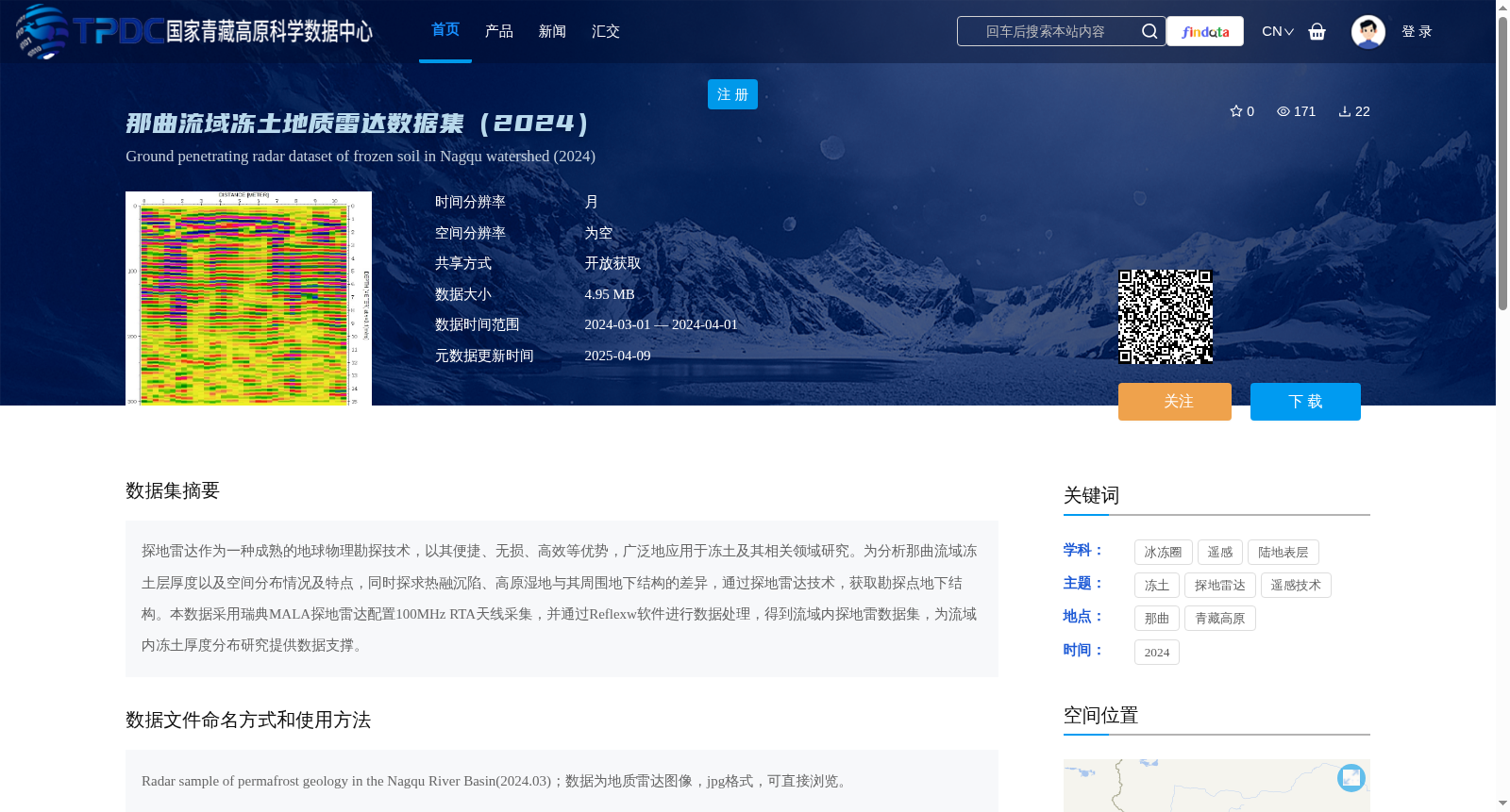
探地雷达作为一种成熟的地球物理勘探技术,以其便捷、无损、高效等优势,广泛地应用于冻土及其相关领域研究。为分析那曲流域冻土层厚度以及空间分布情况及特点,同时探求热融沉陷、高原湿地与其周围地下结构的差异,通过探地雷达技术,获取勘探点地下结构。本数据采用瑞典MALA探地雷达配置100MHz RTA天线采集,并通过Reflexw软件进行数据处理,得到流域内探地雷数据集,为流域内冻土厚度分布研究提供数据支撑。
Ground Penetrating Radar (GPR) is a mature geophysical exploration technology that has been widely applied in permafrost and related field research due to its advantages of convenience, non-destructiveness and high efficiency. To analyze the thickness, spatial distribution pattern and characteristics of permafrost in the Nagqu River Basin, as well as to explore the differences between thermokarst subsidence, plateau wetlands and their surrounding underground structures, underground structure data at survey points were collected using GPR technology. The dataset was collected with a Swedish MALA ground penetrating radar equipped with a 100MHz RTA antenna, and processed via Reflexw software, yielding a GPR dataset for the Nagqu River Basin, which provides data support for studies on permafrost thickness distribution in the basin.
提供机构:
李家存
创建时间:
2024-12-18
搜集汇总
数据集介绍
背景与挑战
背景概述
该数据集是2024年那曲流域的冻土地质雷达数据,使用探地雷达技术采集,旨在分析冻土层厚度、空间分布及热融沉陷等特征,为青藏高原冻土研究提供支持。数据以图像格式(jpg)提供,时间覆盖2024年3月至4月,共享方式为开放获取,适用于冰冻圈和遥感领域的研究。
以上内容由遇见数据集搜集并总结生成


