鄱阳湖湖体时空分布数据集(1960s-2020年)
收藏国家地球系统科学数据中心2024-12-27 更新2024-09-14 收录
下载链接:
https://www.geodata.cn/data/datadetails.html?dataguid=193039939438954&docId=1940
下载链接
链接失效反馈官方服务:
资源简介:
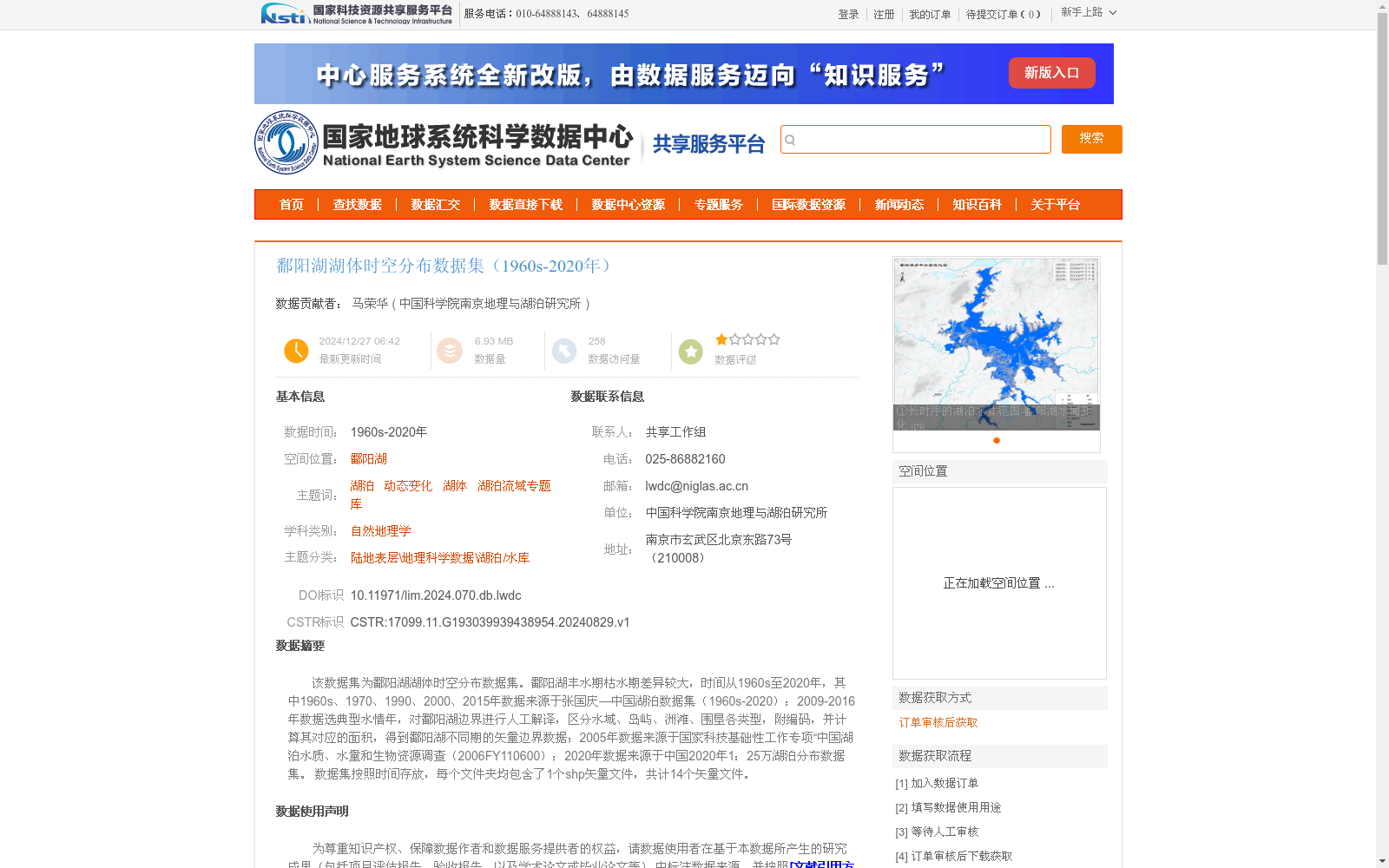
该数据集为鄱阳湖湖体时空分布数据集。鄱阳湖丰水期枯水期差异较大,时间从1960s至2020年,其中1960s、1970、1990、2000、2015年数据来源于张国庆—中国湖泊数据集(1960s-2020);2009-2016年数据选典型水情年,对鄱阳湖边界进行人工解译,区分水域、岛屿、洲滩、围垦各类型,附编码,并计算其对应的面积,得到鄱阳湖不同期的矢量边界数据;2005年数据来源于国家科技基础性工作专项“中国湖泊水质、水量和生物资源调查(2006FY110600);2020年数据来源于中国2020年1:25万湖泊分布数据集。
数据集按照时间存放,每个文件夹均包含了1个shp矢量文件,共计14个矢量文件。
This dataset is the spatio-temporal distribution dataset of Poyang Lake. Poyang Lake shows significant differences between its wet and dry seasons, with the temporal scope ranging from the 1960s to 2020. Data for the 1960s, 1970, 1990, 2000 and 2015 were derived from Zhang Guoqing's China Lake Dataset (1960s-2020); For the period 2009–2016, typical hydrological years were selected, and manual interpretation was carried out on the boundary of Poyang Lake to distinguish and categorize different types including water areas, islands, shoals and reclaimed lands, with attached codes and calculation of their corresponding areas, thereby obtaining the vector boundary data of Poyang Lake in different periods; Data for 2005 was sourced from the National Special Project for Basic Scientific and Technological Work "Investigation on Water Quality, Water Quantity and Biological Resources of China's Lakes (2006FY110600)"; Data for 2020 was obtained from the 1:250,000 Lake Distribution Dataset of China in 2020. The dataset is stored by time period, with each folder containing one shapefile (shp) vector file, totaling 14 vector files.
提供机构:
中国科学院南京地理与湖泊研究所
创建时间:
2024-08-29
搜集汇总
数据集介绍
背景与挑战
背景概述
该数据集提供了鄱阳湖湖体从1960年代至2020年的时空分布数据,涵盖丰水期和枯水期的动态变化。数据来源于多源遥感影像和人工解译,包括14个shp矢量文件,区分了水域、岛屿、洲滩和围垦等类型,并计算了对应面积,适用于湖泊变化研究和地理分析。
以上内容由遇见数据集搜集并总结生成


