可可西里地区热融湖塘分布数据(1980s-2018)
收藏国家青藏高原科学数据中心2022-12-22 更新2024-03-06 收录
下载链接:
https://data.tpdc.ac.cn/zh-hans/data/a2423ec4-a6e2-45de-8ba3-917bb1a59b26
下载链接
链接失效反馈官方服务:
资源简介:
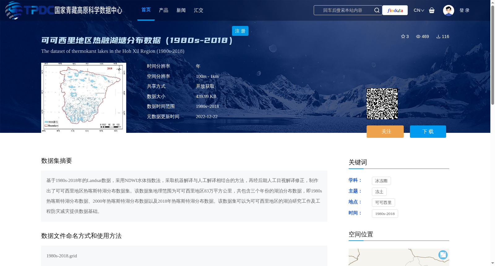
基于1980s-2018年的Landsat数据,采用NDWI水体指数法,采取机器解译与人工解译相结合的方法,再经后期人工目视解译修正,制作出了可可西里地区热喀斯特湖分布数据集。该数据集地理范围为可可西里地区83万平方公里,共包含三个年份的湖泊分布数据,即1980s热喀斯特湖分布数据、2000年热喀斯特湖分布数据以及2018年热喀斯特湖分布数据。该数据集可以为可可西里地区的湖泊研究工作及工程防灾减灾提供数据基础。
A thermokarst lake distribution dataset for the Hoh Xil region was developed using Landsat data spanning the 1980s to 2018, employing the Normalized Difference Water Index (NDWI) method, combining machine and manual interpretation workflows, and further revised through post-processing manual visual interpretation. This dataset covers an area of 830,000 square kilometers across the Hoh Xil region, and contains lake distribution data for three key years: thermokarst lake distribution datasets from the 1980s, 2000, and 2018. This dataset can serve as a foundational data resource for lake-related research and engineering disaster prevention and mitigation efforts in the Hoh Xil region.
提供机构:
倪万魁
创建时间:
2022-12-12
搜集汇总
数据集介绍
背景与挑战
背景概述
该数据集基于1980s-2018年的Landsat数据,采用NDWI水体指数法结合机器与人工解译,生成了可可西里地区83万平方公里范围内三个年份(1980s、2000年、2018年)的热融湖塘分布数据。数据具有年时间分辨率和100m-1km的空间分辨率,旨在为湖泊研究和工程防灾减灾提供基础支持。
以上内容由遇见数据集搜集并总结生成


