中国黄土高原中部XF剖面磁化率和粒度数据
收藏国家青藏高原科学数据中心2023-08-15 更新2024-03-06 收录
下载链接:
https://data.tpdc.ac.cn/zh-hans/data/0232ae36-7e0c-499b-8631-0e42c969029a
下载链接
链接失效反馈官方服务:
资源简介:
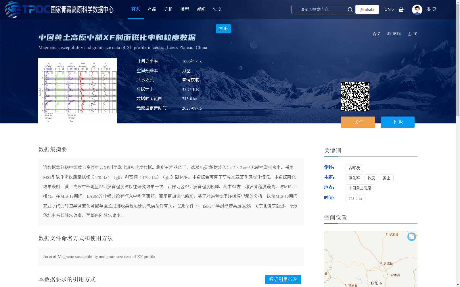
该数据集包括中国黄土高原中部XF剖面磁化率和粒度数据。将所有样品风干,选取5 g沉积物装入2 × 2 × 2 cm3无磁性塑料盒中,采用MS2型磁化率仪测量低频(470 Hz)(χlf)和高频(4700 Hz)(χhf)磁化率。本数据集可用于研究东亚夏季风变化情况。本数据研究结果表明,黄土高原中部地区S5-1发育程度与以往研究结果一致,西部地区S5-1发育程度较弱,其中S4古土壤发育程度最高。与MIS-11相比,在MIS-13期间,EASM的北锋并没有深入中华区西部,而是更加偏北偏东。基于对热带太平洋海温记录的分析,认为MIS-13期间东亚水汽的时空异常变化可能与强拉尼娜或类拉尼娜的气候条件有关。在此条件下,西太平洋副热带高压减弱,向东北偏东后退,导致华北中东部降水偏多,西部内陆降水偏少。
This dataset includes magnetic susceptibility and grain size data from the XF section in the central Chinese Loess Plateau. All samples were air-dried, and 5 g of sediment was weighed and packed into a 2 × 2 × 2 cm³ non-magnetic plastic container. Low-frequency (470 Hz, χlf) and high-frequency (4700 Hz, χhf) magnetic susceptibilities were measured using an MS2 magnetic susceptibility meter. This dataset can be used to investigate variations of the East Asian summer monsoon (EASM). Findings from this dataset show that the pedogenic development of S5-1 in the central Loess Plateau is consistent with previous studies, while S5-1 in the western region is less developed, and the S4 paleosol exhibits the highest degree of pedogenic development. Compared with Marine Isotope Stage (MIS) 11, during MIS 13, the northern boundary of the EASM did not extend into western China, but shifted further north and eastward. Based on an analysis of sea surface temperature (SST) records from the tropical Pacific, it is inferred that the anomalous spatio-temporal variations of East Asian water vapor during MIS 13 may be related to strong La Niña or La Niña-like climatic conditions. Under such conditions, the Western Pacific Subtropical High (WPSH) weakened and retreated towards the northeast-east direction, resulting in increased precipitation in the central and eastern parts of North China and decreased precipitation in the western inland areas.
提供机构:
贾佳
创建时间:
2023-08-13
搜集汇总
数据集介绍
背景与挑战
背景概述
该数据集提供了中国黄土高原中部XF剖面的磁化率和粒度数据,时间覆盖74.3万年前至今,时间分辨率约为1000年,数据量较小(35.75 KB)。数据集通过测量沉积物的磁化率和粒度,主要用于研究东亚夏季风的历史变化,分析结果表明古土壤发育程度和气候事件(如MIS-13期间的强拉尼娜条件)对区域降水模式的影响。
以上内容由遇见数据集搜集并总结生成


