CCD-Maize: A twenty-year dataset of maize distribution with high spatial resolution in China
收藏DataCite Commons2025-04-27 更新2025-05-18 收录
下载链接:
https://www.scidb.cn/detail?dataSetId=111aee7914884f59bbdd077d7b2e926b
下载链接
链接失效反馈官方服务:
资源简介:
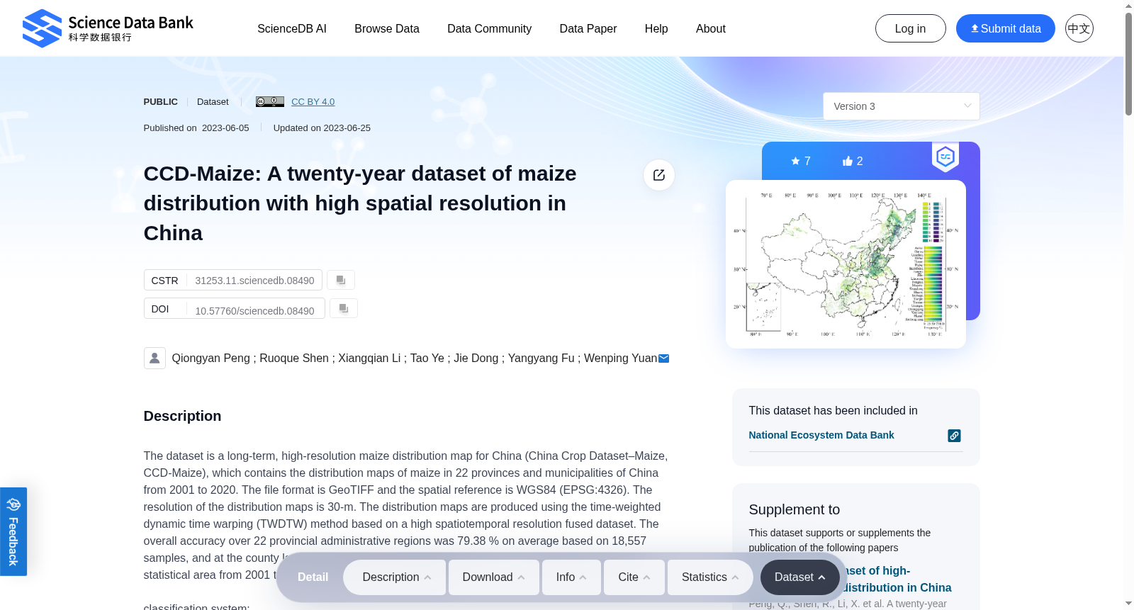
The dataset is a long-term, high-resolution maize distribution map for China (China Crop Dataset–Maize, CCD-Maize), which contains the distribution maps of maize in 22 provinces and municipalities of China from 2001 to 2020. The file format is GeoTIFF and the spatial reference is WGS84 (EPSG:4326). The resolution of the distribution maps is 30-m. The distribution maps are produced using the time-weighted dynamic time warping (TWDTW) method based on a high spatiotemporal resolution fused dataset. The overall accuracy over 22 provincial administrative regions was 79.38 % on average based on 18,557 samples, and at the county level, the correlation coefficient (R2) between the identified area and the statistical area from 2001 to 2020 ranged from 0.657 to 0.903.classification system:0: non-maize1: maize
本数据集为中国长期高分辨率玉米分布图谱(中国作物数据集-玉米,China Crop Dataset–Maize,CCD-Maize),涵盖2001年至2020年中国22个省市的玉米分布数据。文件格式为GeoTIFF,空间参考系采用WGS84(EPSG:4326),空间分辨率为30米。本分布图谱基于高时空分辨率融合数据集,采用时间加权动态时间规整(time-weighted dynamic time warping,TWDTW)方法生成。基于18557个样本,22个省级行政区的总体平均分类精度为79.38%;在县域尺度下,2001年至2020年的识别种植面积与统计种植面积的决定系数(R²)介于0.657至0.903之间。分类体系为:0代表非玉米种植区,1代表玉米种植区。
提供机构:
Science Data Bank
创建时间:
2023-06-05
搜集汇总
数据集介绍
背景与挑战
背景概述
CCD-Maize是一个长期、高分辨率的中国玉米分布数据集,覆盖2001至2020年,包含22个省份和直辖市的30米分辨率分布图,采用TWDTW方法生成,整体准确率为79.38%。数据集以GeoTIFF格式提供,空间参考为WGS84。
以上内容由遇见数据集搜集并总结生成


