塔里木河下游地下水位数据集(2000-2007)
收藏国家青藏高原科学数据中心2020-07-17 更新2024-03-01 收录
下载链接:
https://data.tpdc.ac.cn/zh-hans/data/1aa5bcea-f637-41f1-88e4-2296ed712e7b
下载链接
链接失效反馈官方服务:
资源简介:
在塔里木河下游,地下水是维系天然植被生存的惟一水源。地下水位变化直接影响着植物的生长和衰败,控制着植物群落的演变与组成。加强地下水化学特征研究是水资源质量评价的重要内容,对流域水资源利用方式、可持续发展、管理及生态环境的保护与建设都具有重要意义。
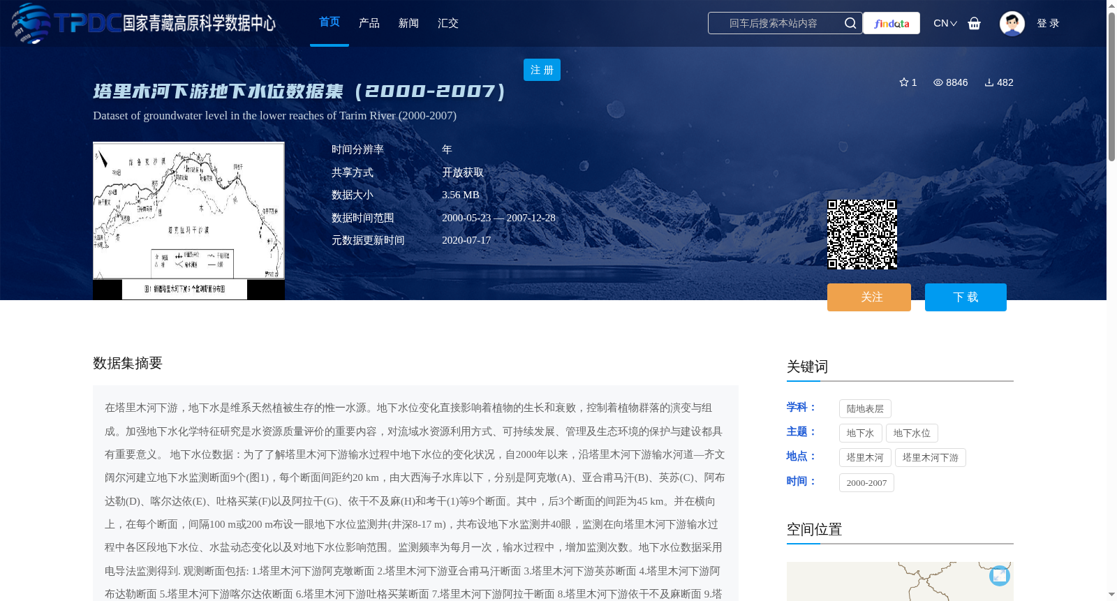
地下水位数据:为了了解塔里木河下游输水过程中地下水位的变化状况,自2000年以来,沿塔里木河下游输水河道—齐文阔尔河建立地下水监测断面9个(图1),每个断面间距约20 km,由大西海子水库以下,分别是阿克墩(A)、亚合甫马汗(B)、英苏(C)、阿布达勒(D)、喀尔达依(E)、吐格买莱(F)以及阿拉干(G)、依干不及麻(H)和考干(1)等9个断面。其中,后3个断面的间距为45 km。并在横向上,在每个断面,间隔100 m或200 m布设一眼地下水位监测井(井深8-17 m),共布设地下水监测井40眼,监测在向塔里木河下游输水过程中各区段地下水位、水盐动态变化以及对地下水位影响范围。监测频率为每月一次,输水过程中,增加监测次数。地下水位数据采用电导法监测得到.
观测断面包括:
1.塔里木河下游阿克墩断面
2.塔里木河下游亚合甫马汗断面
3.塔里木河下游英苏断面
4.塔里木河下游阿布达勒断面
5.塔里木河下游喀尔达依断面
6.塔里木河下游吐格买莱断面
7.塔里木河下游阿拉干断面
8.塔里木河下游依干不及麻断面
9.塔里木河下游考干断面
In the lower reaches of the Tarim River, groundwater is the sole water source sustaining the survival of natural vegetation. Changes in groundwater level directly affect plant growth and decline, and control the succession and composition of plant communities. Strengthening research on groundwater chemical characteristics is an important component of water resource quality assessment, which is of great significance for water resource utilization patterns, sustainable development, management, and ecological environment protection and construction in the basin.
Groundwater level data: To understand the changes in groundwater level during the water conveyance process in the lower reaches of the Tarim River, 9 groundwater monitoring sections (Figure 1) have been established along the water conveyance channel—Qiwenkuoer River since 2000. The distance between each section is approximately 20 km. Starting from below the Daxihaizi Reservoir, the 9 sections are Akedun (A), Yahefumahan (B), Yingsu (C), Abudale (D), Kaerdayi (E), Tugemailai (F), Alagan (G), Yiganbujima (H), and Kaogan (I). The distance between the last three sections is 45 km. Laterally, one groundwater level monitoring well (with a well depth of 8–17 m) is arranged every 100 m or 200 m at each section, totaling 40 monitoring wells. These wells are deployed to monitor the groundwater level, dynamic changes of water and salt in each section during the water conveyance to the lower reaches of the Tarim River, as well as the influence scope of groundwater level changes. The monitoring frequency is once per month, and the frequency will be increased during water conveyance periods. Groundwater level data were monitored using the electrical conductivity method.
Observation sections include:
1. Akedun Section in the lower reaches of the Tarim River
2. Yahefumahan Section in the lower reaches of the Tarim River
3. Yingsu Section in the lower reaches of the Tarim River
4. Abudale Section in the lower reaches of the Tarim River
5. Kaerdayi Section in the lower reaches of the Tarim River
6. Tugemailai Section in the lower reaches of the Tarim River
7. Alagan Section in the lower reaches of the Tarim River
8. Yiganbujima Section in the lower reaches of the Tarim River
9. Kaogan Section in the lower reaches of the Tarim River
提供机构:
陈亚宁,郝兴明
创建时间:
2013-06-09
搜集汇总
数据集介绍
背景与挑战
背景概述
该数据集记录了2000-2007年塔里木河下游9个监测断面的地下水位变化数据,旨在研究输水过程中地下水位动态及其对植被生态的影响,数据以文本格式存储,开放获取。
以上内容由遇见数据集搜集并总结生成


