中亚地区荒漠化(土地沙化、盐渍化和植被退化)专题数据(2015)
收藏地球大数据科学工程2024-03-04 收录
下载链接:
https://data.casearth.cn/sdo/detail/5feae825819aec33049b7bfc
下载链接
链接失效反馈官方服务:
资源简介:
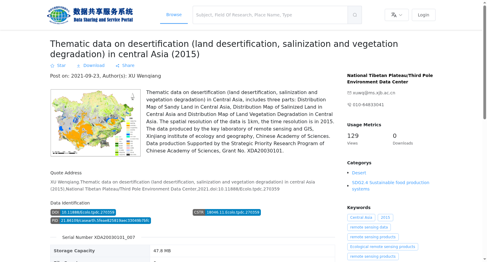
中亚地区荒漠化(土地沙化、盐渍化和植被退化)专题数据主要包括:中亚地区沙化土地分布图、中亚地区盐渍化土地分布图和中亚地区土地植被退化分布图,空间分辨率为1km,时间分辨率为年。中亚地区盐渍化土地分布图将盐渍化土地分为了轻度、中度、重度和极重度盐渍化土地四类。中亚地区土地植被退化分布图将植被退化状况分为了显著改善、轻微改善、稳定或无植被、轻微退化和显著退化五类。数据由中国科学院新疆生态与地理研究所遥感与GIS重点实验室生产,生产费用由“中国科学院战略性先导科技专项XDA20030101资助”。
The thematic dataset focused on desertification (encompassing land sandification, soil salinization and vegetation degradation) in Central Asia primarily consists of three parts: the distribution map of sandy land in Central Asia, the distribution map of saline-alkali land in Central Asia, and the distribution map of vegetation degradation in Central Asia.
The spatial resolution of the dataset is 1 km, with an annual temporal resolution.
The distribution map of saline-alkali land in Central Asia classifies saline-alkali lands into four categories: mild, moderate, severe, and extreme severe saline-alkali lands.
The distribution map of vegetation degradation in Central Asia categorizes vegetation degradation status into five types: significant improvement, slight improvement, stable or non-vegetated, slight degradation, and significant degradation.
This dataset was produced by the Key Laboratory of Remote Sensing and GIS, Xinjiang Institute of Ecology and Geography, Chinese Academy of Sciences, and its production was funded by the Strategic Priority Research Program of the Chinese Academy of Sciences (Grant No. XDA20030101).
提供机构:
国家青藏高原科学数据中心
搜集汇总
数据集介绍
背景与挑战
背景概述
该数据集包含2015年中亚地区土地沙化、盐渍化和植被退化的分布图,空间分辨率为1km,由中国科学院新疆生态与地理研究所遥感与GIS重点实验室生产。数据支持了中国科学院战略性先导科技专项项目(XDA20030101)。
以上内容由遇见数据集搜集并总结生成


