青海省大通河流域水电站航拍数据集(2020)
收藏国家青藏高原科学数据中心2021-09-06 更新2024-03-07 收录
下载链接:
https://data.tpdc.ac.cn/zh-hans/data/23618afd-040a-4f63-9a34-0af4d355c562
下载链接
链接失效反馈官方服务:
资源简介:
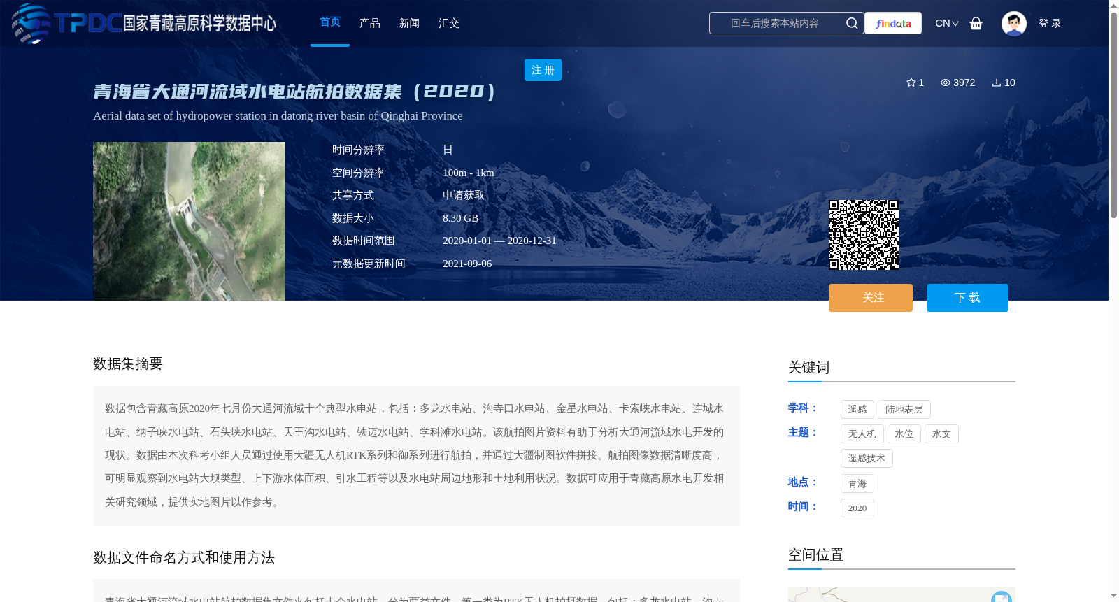
数据包含青藏高原2020年七月份大通河流域十个典型水电站,包括:多龙水电站、沟寺口水电站、金星水电站、卡索峡水电站、连城水电站、纳子峡水电站、石头峡水电站、天王沟水电站、铁迈水电站、学科滩水电站。该航拍图片资料有助于分析大通河流域水电开发的现状。数据由本次科考小组人员通过使用大疆无人机RTK系列和御系列进行航拍,并通过大疆制图软件拼接。航拍图像数据清晰度高,可明显观察到水电站大坝类型、上下游水体面积、引水工程等以及水电站周边地形和土地利用状况。数据可应用于青藏高原水电开发相关研究领域,提供实地图片以作参考。
This dataset contains ten typical hydropower stations in the Datong River Basin on the Qinghai-Tibet Plateau, collected in July 2020. The stations include Duolong Hydropower Station, Gousikou Hydropower Station, Jinxing Hydropower Station, Kasuo Gorge Hydropower Station, Liancheng Hydropower Station, Nazixia Hydropower Station, Shitouxia Hydropower Station, Tianwanggou Hydropower Station, Tiemai Hydropower Station, and Xuedutan Hydropower Station. This aerial image dataset supports analysis of the current status of hydropower development in the Datong River Basin. The data was obtained via aerial photography by the field expedition team using DJI RTK series and Mavic series unmanned aerial vehicles (UAVs), and the images were mosaicked with DJI mapping software. The aerial imagery has high clarity, allowing clear observation of the dam types of the hydropower stations, water areas upstream and downstream, water diversion projects, as well as the surrounding terrain and land use conditions of the stations. This dataset can be applied to research fields related to hydropower development on the Qinghai-Tibet Plateau, providing on-site photographic references for relevant studies.
提供机构:
傅斌
创建时间:
2021-04-27
搜集汇总
数据集介绍
背景与挑战
背景概述
该数据集是2020年青海省大通河流域十个典型水电站的航拍图片集合,由大疆无人机RTK系列和御系列拍摄,图像清晰度高,可用于分析水电站大坝类型、水体面积和周边地形。数据大小为8.30 GB,空间分辨率为100m - 1km,主要应用于青藏高原水电开发相关研究,提供实地参考图片。
以上内容由遇见数据集搜集并总结生成


