全球逐日0.05°时空连续地表温度数据集(2002-2020)
收藏地球大数据科学工程2024-03-04 收录
下载链接:
https://data.casearth.cn/sdo/detail/6538a12a819aec0f2611cdd8
下载链接
链接失效反馈官方服务:
资源简介:
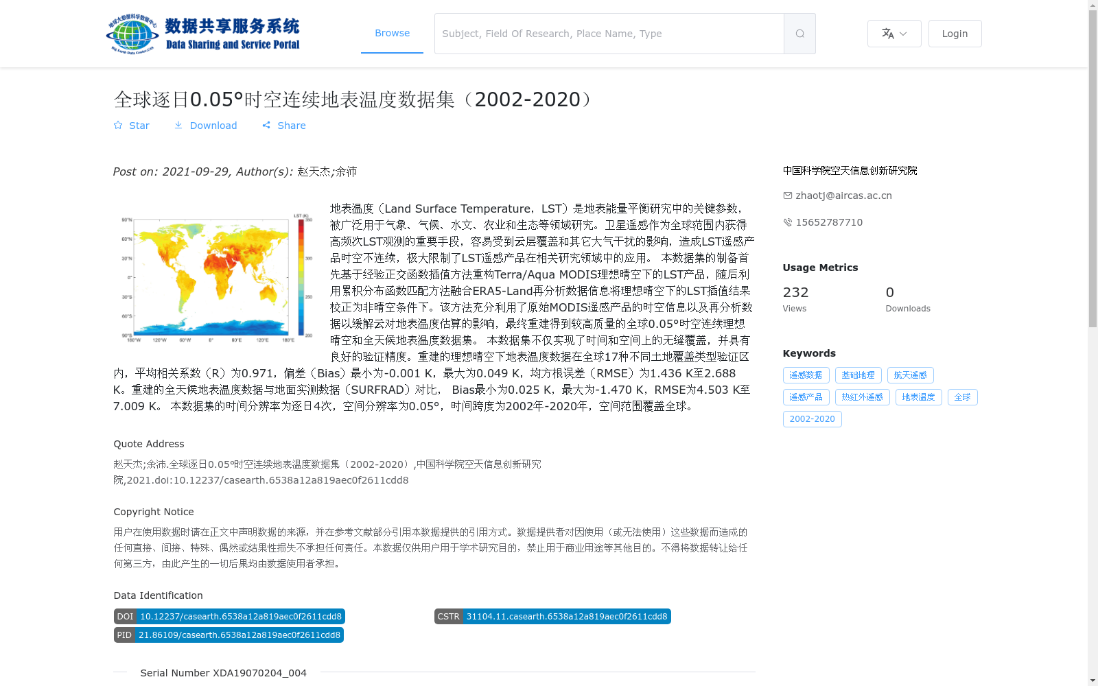
地表温度(Land Surface Temperature,LST)是地表能量平衡研究中的关键参数,被广泛用于气象、气候、水文、农业和生态等领域研究。卫星遥感作为全球范围内获得高频次LST观测的重要手段,容易受到云层覆盖和其它大气干扰的影响,造成LST遥感产品时空不连续,极大限制了LST遥感产品在相关研究领域中的应用。
本数据集的制备首先基于经验正交函数插值方法重构Terra/Aqua MODIS理想晴空下的LST产品,随后利用累积分布函数匹配方法融合ERA5-Land再分析数据信息将理想晴空下的LST插值结果校正为非晴空条件下。该方法充分利用了原始MODIS遥感产品的时空信息以及再分析数据以缓解云对地表温度估算的影响,最终重建得到较高质量的全球0.05°时空连续理想晴空和全天候地表温度数据集。
本数据集不仅实现了时间和空间上的无缝覆盖,并具有良好的验证精度。重建的理想晴空下地表温度数据在全球17种不同土地覆盖类型验证区内,平均相关系数(R)为0.971,偏差(Bias)最小为-0.001 K,最大为0.049 K,均方根误差(RMSE)为1.436 K至2.688 K。重建的全天候地表温度数据与地面实测数据(SURFRAD)对比, Bias最小为0.025 K,最大为-1.470 K,RMSE为4.503 K至7.009 K。
本数据集的时间分辨率为逐日4次,空间分辨率为0.05°,时间跨度为2002年-2020年,空间范围覆盖全球。
Land Surface Temperature (LST) is a critical parameter in surface energy balance research, and has been widely applied in studies related to meteorology, climatology, hydrology, agriculture, ecology and other fields. Satellite remote sensing, as an important approach to acquire high-frequency LST observations globally, is susceptible to cloud cover and other atmospheric interferences, leading to spatially and temporally discontinuous LST remote sensing products, which greatly restricts the application of LST remote sensing products in relevant research domains.
This dataset was developed by first reconstructing the Terra/Aqua MODIS LST product under ideal clear-sky conditions using the Empirical Orthogonal Function (EOF) interpolation method, then correcting the interpolated LST results under ideal clear-sky conditions to non-clear-sky conditions by fusing information from ERA5-Land reanalysis data via the cumulative distribution function (CDF) matching method. This method makes full use of the spatio-temporal information of the original MODIS remote sensing products and reanalysis data to mitigate the impacts of clouds on LST estimation, and finally reconstructs a high-quality global 0.05° spatio-temporally continuous LST dataset under both ideal clear-sky and all-sky conditions.
This dataset not only achieves seamless spatio-temporal coverage, but also exhibits excellent validation accuracy. For the reconstructed LST data under ideal clear-sky conditions, in global validation areas of 17 different land cover types, the average correlation coefficient (R) is 0.971, the bias ranges from a minimum of -0.001 K to a maximum of 0.049 K, and the root mean square error (RMSE) ranges from 1.436 K to 2.688 K. Compared with in-situ measured data (SURFRAD), the reconstructed all-sky LST data has a bias ranging from a minimum of 0.025 K to a maximum of -1.470 K, with RMSE values between 4.503 K and 7.009 K.
The temporal resolution of this dataset is 4 times per day, the spatial resolution is 0.05°, the time span ranges from 2002 to 2020, and the spatial coverage covers the entire globe.
提供机构:
中国科学院空天信息创新研究院
搜集汇总
数据集介绍
背景与挑战
背景概述
该数据集是一个全球范围的逐日地表温度数据集,时间跨度为2002年至2020年,空间分辨率为0.05°,旨在通过融合MODIS遥感产品和ERA5-Land再分析数据,解决云层干扰导致的时空不连续问题,提供理想晴空和全天候条件下的高质量地表温度数据。数据集具有高精度验证,理想晴空下平均相关系数达0.971,均方根误差在1.436 K至2.688 K之间,适用于气象、气候、水文等领域研究。数据以hdf5格式存储,容量为795.06 GB,包含77个文件,覆盖全球范围。
以上内容由遇见数据集搜集并总结生成


