MUNO21
收藏资源简介:
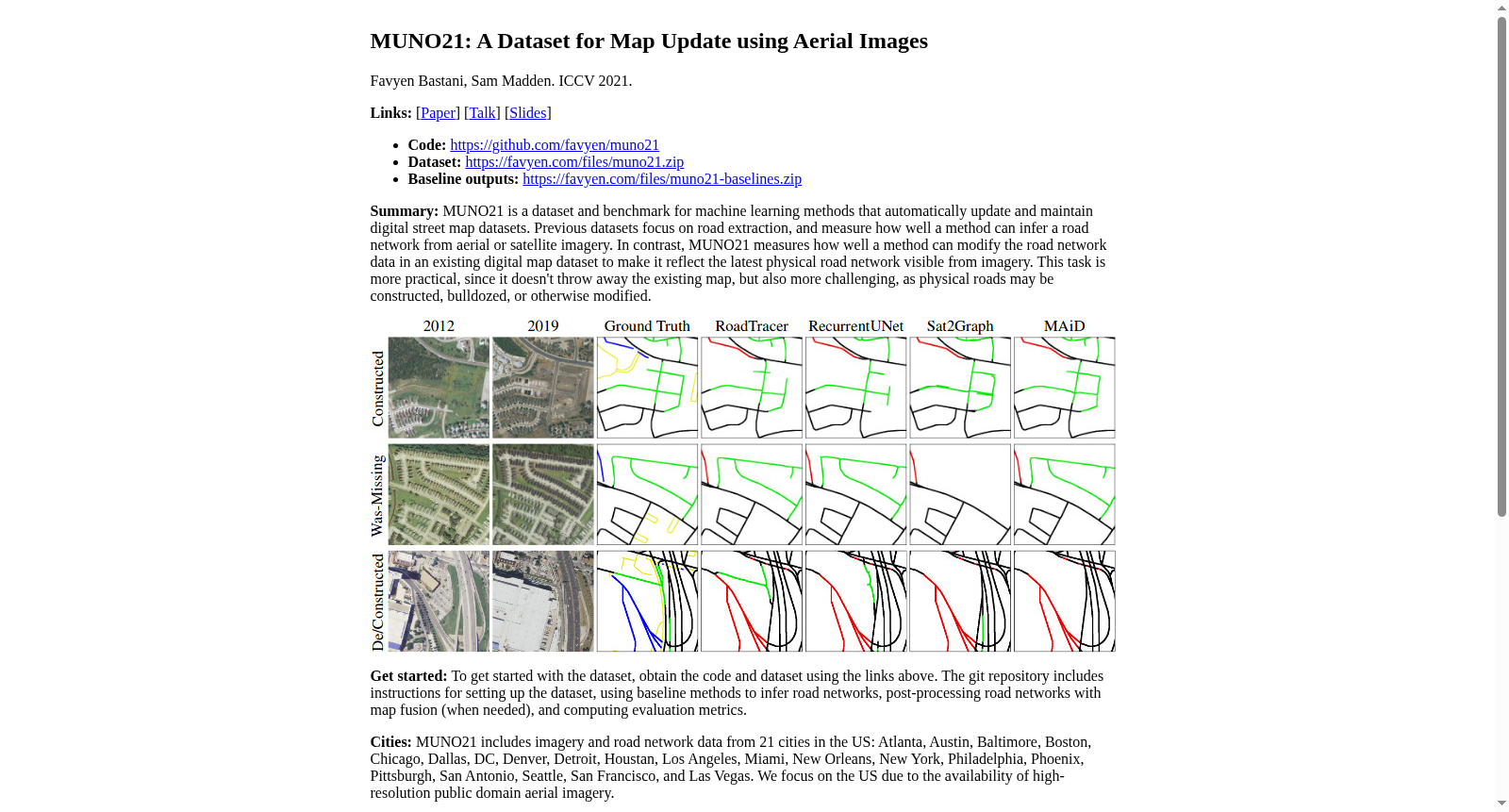
MUNO21数据集是由麻省理工学院计算机科学与人工智能实验室开发的,用于地图更新任务的全面数据集。该数据集覆盖了美国21个城市,总面积超过6000平方公里,包含了2012年至2019年间的NAIP航空影像和OpenStreetMap数据。MUNO21数据集的核心是514个地图更新场景,这些场景记录了在这八年间道路网络的重大变化。数据集不仅用于研究道路提取,更专注于实际的地图更新任务,如道路的添加、删除和移动,同时保持现有地图的准确性。MUNO21数据集的应用领域包括自动地图更新,旨在解决现有地图与实际道路网络不符的问题,提高地图的实时性和准确性。
The MUNO21 dataset is a comprehensive dataset developed by the Computer Science and Artificial Intelligence Laboratory (CSAIL) of the Massachusetts Institute of Technology (MIT) for map update tasks. Spanning 21 cities across the United States with a total area of over 6,000 square kilometers, it contains NAIP aerial imagery and OpenStreetMap data collected between 2012 and 2019. The core of the MUNO21 dataset comprises 514 map update scenarios that document major changes to road networks over this 8-year period. Beyond research on road extraction, the dataset focuses on practical map update tasks such as road addition, deletion, and relocation, while maintaining the accuracy of existing maps. The application scope of the MUNO21 dataset includes automated map update, which aims to resolve the discrepancies between existing maps and real-world road networks and improve the timeliness and accuracy of maps.