青藏高原农牧区草地退化500m网格数据集(2015)
收藏国家青藏高原科学数据中心2023-02-21 更新2024-03-01 收录
下载链接:
https://data.tpdc.ac.cn/zh-hans/data/77176712-f248-4ec0-a15c-a6efc9aa0448
下载链接
链接失效反馈官方服务:
资源简介:
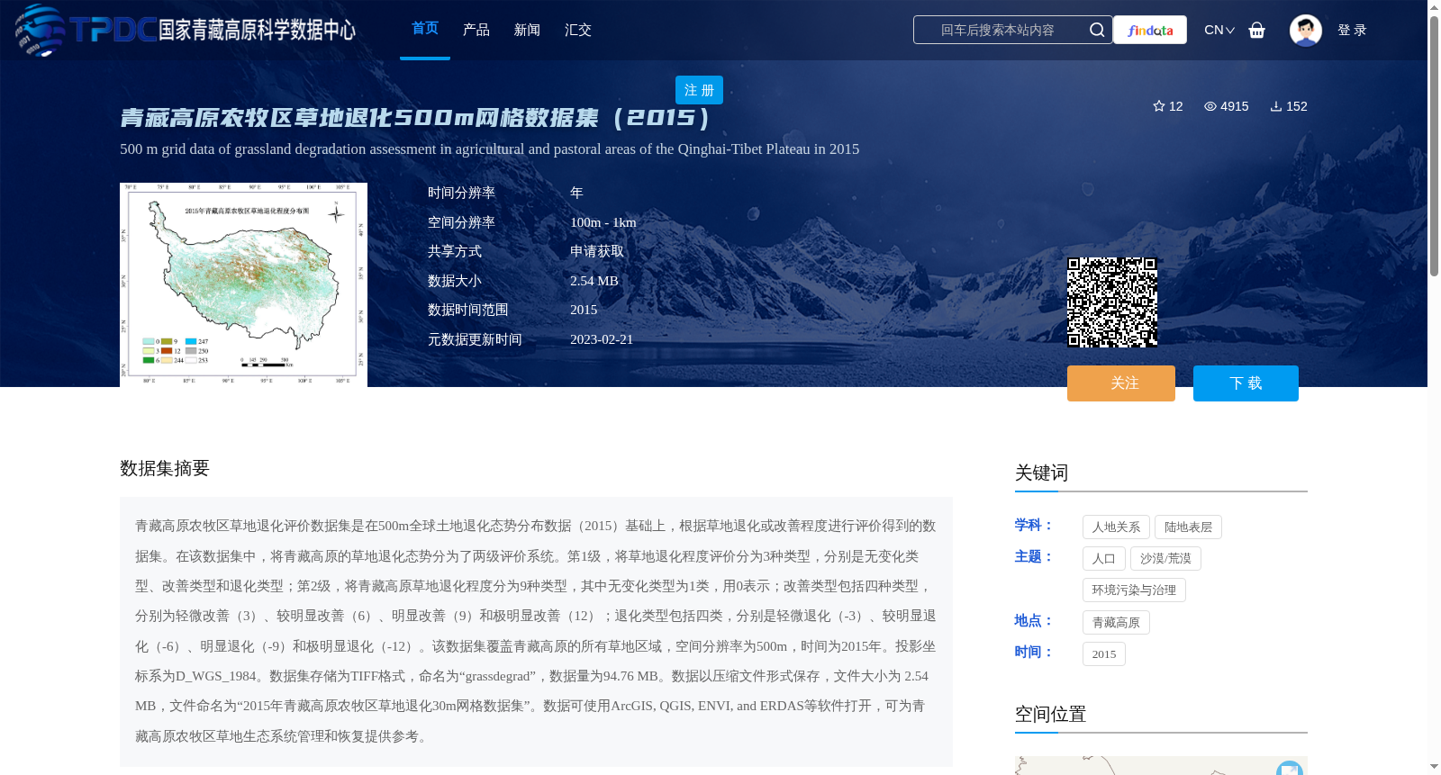
青藏高原农牧区草地退化评价数据集是在500m全球土地退化态势分布数据(2015)基础上,根据草地退化或改善程度进行评价得到的数据集。在该数据集中,将青藏高原的草地退化态势分为了两级评价系统。第1级,将草地退化程度评价分为3种类型,分别是无变化类型、改善类型和退化类型;第2级,将青藏高原草地退化程度分为9种类型,其中无变化类型为1类,用0表示;改善类型包括四种类型,分别为轻微改善(3)、较明显改善(6)、明显改善(9)和极明显改善(12);退化类型包括四类,分别是轻微退化(-3)、较明显退化(-6)、明显退化(-9)和极明显退化(-12)。该数据集覆盖青藏高原的所有草地区域,空间分辨率为500m,时间为2015年。投影坐标系为D_WGS_1984。数据集存储为TIFF格式,命名为“grassdegrad”,数据量为94.76 MB。数据以压缩文件形式保存,文件大小为 2.54 MB,文件命名为“2015年青藏高原农牧区草地退化30m网格数据集”。数据可使用ArcGIS, QGIS, ENVI, and ERDAS等软件打开,可为青藏高原农牧区草地生态系统管理和恢复提供参考。
The Grassland Degradation Evaluation Dataset for Farming-Pastoral Areas of the Qinghai-Tibet Plateau was developed based on the 500m global land degradation status distribution data (2015) by assessing the degree of grassland degradation or improvement. This dataset adopts a two-level evaluation system for classifying grassland degradation status on the Qinghai-Tibet Plateau. Level 1 divides the grassland degradation degree into three categories: no change, improvement, and degradation. Level 2 categorizes the grassland degradation degree into 9 types: the no change category is type 1, represented by 0; the improvement category includes four sub-types: slight improvement (3), relatively significant improvement (6), significant improvement (9), and extremely significant improvement (12); the degradation category includes four sub-types: slight degradation (-3), relatively significant degradation (-6), significant degradation (-9), and extremely significant degradation (-12). This dataset covers all grassland areas of the Qinghai-Tibet Plateau, with a spatial resolution of 500m and a temporal scope of 2015. Its projected coordinate system is D_WGS_1984. The dataset is stored in TIFF format under the name "grassdegrad", with an uncompressed size of 94.76 MB. It is saved as a compressed file with a size of 2.54 MB, named "2015 Qinghai-Tibet Plateau Farming-Pastoral Areas Grassland Degradation 30m Grid Dataset". This dataset can be opened using software such as ArcGIS, QGIS, ENVI, and ERDAS, and can provide references for grassland ecosystem management and restoration in the farming-pastoral areas of the Qinghai-Tibet Plateau.
提供机构:
刘世梁,孙永秀,刘轶轩
创建时间:
2021-01-12
搜集汇总
数据集介绍
背景与挑战
背景概述
该数据集是基于500m全球土地退化态势分布数据(2015)对青藏高原农牧区草地退化或改善程度进行评价的结果,采用两级评价系统(3种一级类型和9种二级类型),覆盖青藏高原所有草地区域,空间分辨率为500m,时间为2015年,数据格式为TIFF,可为草地生态系统管理和恢复提供参考。
以上内容由遇见数据集搜集并总结生成


