five

imageomics/KABR-telemetry|无人机遥测数据集|动物行为识别数据集

收藏
hugging_face2024-04-02 更新2024-03-04 收录
无人机遥测
动物行为识别
下载链接:
https://hf-mirror.com/datasets/imageomics/KABR-telemetry
下载链接
链接失效反馈
资源简介:
--- license: cc0-1.0 task_categories: - robotics language: - en tags: - drone - ecology - zebra - Grevy's zebra - conservation - UAV size_categories: - 100K<n<1M configs: - config_name: telemetry_data data_files: "consolidated_metadata.csv" default: true - config_name: column_information data_files: "kabr_telemetry_metadata.csv" --- # Dataset Card for KABR Telemetry: In-Situ Dataset for Kenyan Animal Behavior Recognition from Drone Videos ## Dataset Details ### Dataset Description This dataset contains the drone telemetry data associated with the [KABR](https://huggingface.co/datasets/imageomics/KABR) dataset. The KABR dataset contains annotated video behavior of zebras and giraffes at the Mpala Research Centre. This telemetry dataset contains information about the status drone during the missions, including location and altitude, along with the bounding box dimensions of the wildlife in the frame and behavior annotation information. Please see the "kabr_telemetry_metadata.csv" for more details. - **Paper:** [Integrating Biological Data into Autonomous Remote Sensing Systems for In Situ Imageomics: A Case Study for Kenyan Animal Behavior Sensing with Unmanned Aerial Vehicles (UAVs)](https://jennamk14.github.io/images/Integrating%20Biological%20Data%20into%20Autonomous%20Remote%20Sensing%20Systems%20for%20In%20Situ%20Imageomics-%20A%20Case%20Study%20for%20Kenyan%20Animal%20Behavior%20Sensing%20with%20Unmanned%20Aerial%20Vehicles%20(UAVs).pdf) - **Point of Contact:** Jenna Kline, kline.377@osu.edu - **Curated by:** Jenna Kline, Maksim Kholiavchenko, Otto Brookes, Tanya Berger-Wolf, Charles V. Stewart, and Christopher Stewart - **Funded by:** Imageomics - **Shared by:** Jenna Kline ## Uses This dataset is intended to be used to provide guidance on executing wildlife behavior collection missions with drones, which can be conducted by drone pilots manually, or integrated into an autonomous navigation framework. ## Dataset Creation ### Curation Rationale This dataset was curated to provide additional context to the KABR dataset, and provide spatial information which can be used to develop autonomous navigation algorithms for wildlife data collection. #### Data Collection and Processing This data was collected at the Mpala Research Centre in Laikipia, Kenya in January 2023. A DJI Mavic Air 2 drone was used to collect the data, and [AirData](https://airdata.com/) was used to process DJI telemetry files. ### Annotations Please refer to the [KABR]((https://huggingface.co/datasets/imageomics/KABR)) dataset and associated paper for details on the annotation process. ## Additional Information ### Authors * Jenna Kline (The Ohio State University) * Maksim Kholiavchenko (Rensselaer Polytechnic Institute) - ORCID: 0000-0001-6757-1957 * Otto Brookes (University of Bristol) * Tanya Berger-Wolf (The Ohio State University) - ORCID: 0000-0001-7610-1412 * Charles V. Stewart (Rensselaer Polytechnic Institute) * Christopher Stewart (The Ohio State University) ### Licensing Information This dataset is dedicated to the public domain for the benefit of scientific pursuits. We ask that you cite the dataset and journal paper using the below citations if you make use of it in your research. ### Citation Information #### Dataset ``` @misc{KABR_telemetry, author = {Kline, Jenna, Kholiavchenko, Maksim and Berger-Wolf, Tanya and Stewart, Charles V. and Stewart, Christopher}, title = {KABR Telemetry}, year = {2024}, url = {https://huggingface.co/datasets/imageomics/KABR-telemetry}, doi = {doi:10.57967/hf/1745}, publisher = {Hugging Face} } ``` #### Paper ``` @inproceedings{kline_kabr_telemetry, title={Integrating Biological Data into Autonomous Remote Sensing Systems for In Situ Imageomics: A Case Study for Kenyan Animal Behavior Sensing with Unmanned Aerial Vehicles (UAVs)}, author={Kline, Jenna and Kholiavchenko, Maksim and Berger-Wolf, Tanya and Stewart, Charles V. and Stewart, Christopher}}, booktitle={Proceedings of the First Workshop on Imageomics: Discovering Biological Knowledge from Images using AI, held as part of AAAI 24}, year={2024} } ``` ### Contributions The [Imageomics Institute](https://imageomics.org) is funded by the US National Science Foundation's Harnessing the Data Revolution (HDR) program under [Award #2118240](https://www.nsf.gov/awardsearch/showAward?AWD_ID=2118240) (Imageomics: A New Frontier of Biological Information Powered by Knowledge-Guided Machine Learning). Any opinions, findings and conclusions or recommendations expressed in this material are those of the author(s) and do not necessarily reflect the views of the National Science Foundation.
提供机构:
imageomics
原始信息汇总

数据集卡片:KABR遥测数据集 - 肯尼亚动物行为识别无人机视频实地数据集

数据集详情

数据集描述

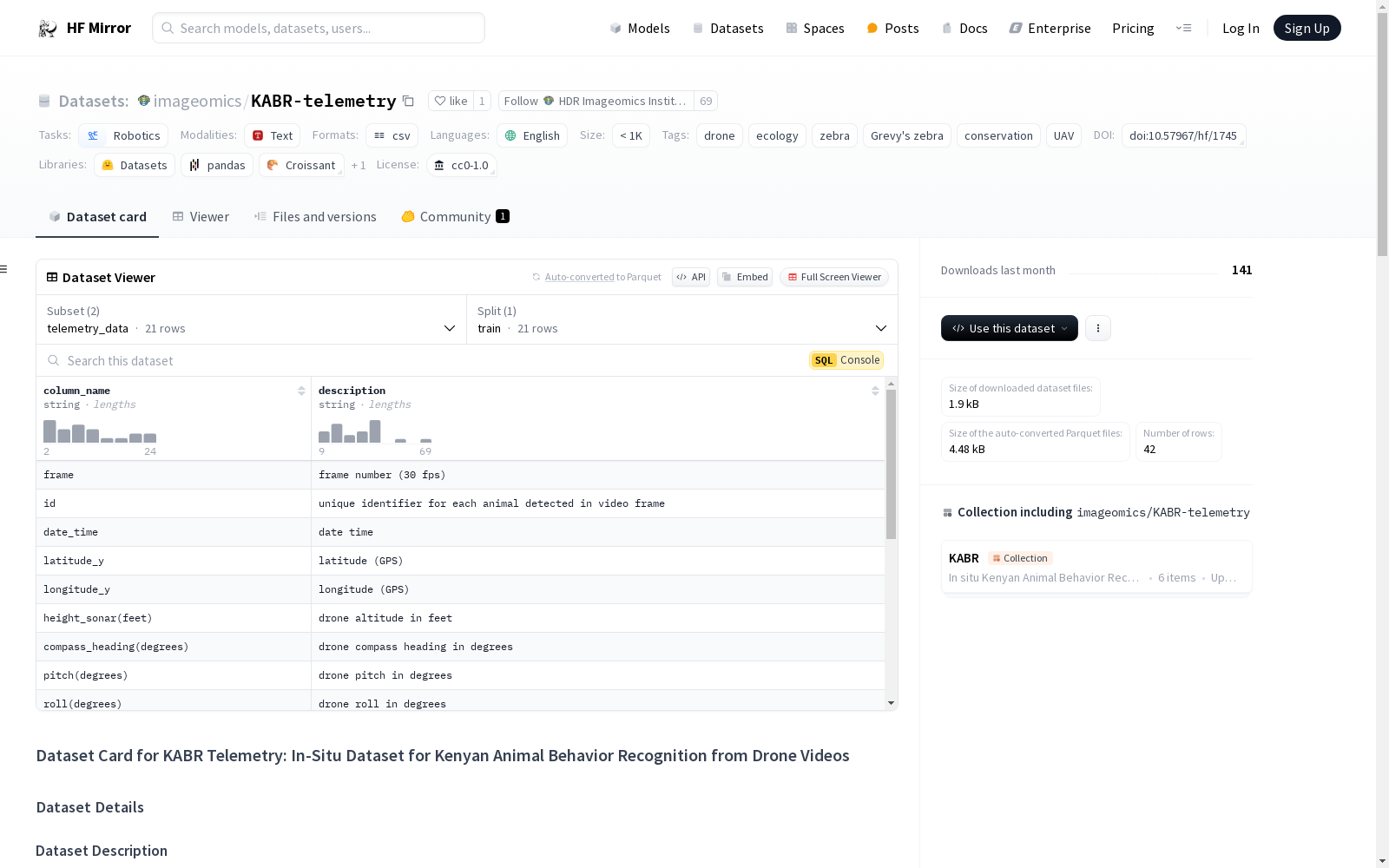
该数据集包含与KABR数据集相关的无人机遥测数据。KABR数据集包含在Mpala研究中心对斑马和长颈鹿行为的注释视频。此遥测数据集包含无人机在任务期间的状态信息,包括位置和高度,以及野生动物在画面中的边界框尺寸和行为注释信息。更多详情请参见“kabr_telemetry_metadata.csv”文件。

用途

该数据集旨在为使用无人机进行野生动物行为收集任务提供指导,这些任务可以由无人机飞行员手动执行,或集成到自主导航框架中。

数据集创建

策划理由

该数据集是为了为KABR数据集提供额外上下文,并提供可用于开发野生动物数据收集自主导航算法的空间信息而策划的。

数据收集和处理

该数据于2023年1月在肯尼亚莱基皮亚的Mpala研究中心收集。使用DJI Mavic Air 2无人机收集数据,并使用AirData处理DJI遥测文件。

注释

有关注释过程的详细信息,请参阅KABR数据集和相关论文。

附加信息

作者

  • Jenna Kline (俄亥俄州立大学)
  • Maksim Kholiavchenko (伦斯勒理工学院) - ORCID: 0000-0001-6757-1957
  • Otto Brookes (布里斯托大学)
  • Tanya Berger-Wolf (俄亥俄州立大学) - ORCID: 0000-0001-7610-1412
  • Charles V. Stewart (伦斯勒理工学院)
  • Christopher Stewart (俄亥俄州立大学)

许可信息

该数据集致力于公共领域,以促进科学研究。如果您在研究中使用该数据集,请引用数据集和期刊论文。

引用信息

数据集

@misc{KABR_telemetry, author = {Kline, Jenna, Kholiavchenko, Maksim and Berger-Wolf, Tanya and Stewart, Charles V. and Stewart, Christopher}, title = {KABR Telemetry}, year = {2024}, url = {https://huggingface.co/datasets/imageomics/KABR-telemetry}, doi = {doi:10.57967/hf/1745}, publisher = {Hugging Face} }

论文

@inproceedings{kline_kabr_telemetry, title={Integrating Biological Data into Autonomous Remote Sensing Systems for In Situ Imageomics: A Case Study for Kenyan Animal Behavior Sensing with Unmanned Aerial Vehicles (UAVs)}, author={Kline, Jenna and Kholiavchenko, Maksim and Berger-Wolf, Tanya and Stewart, Charles V. and Stewart, Christopher}}, booktitle={Proceedings of the First Workshop on Imageomics: Discovering Biological Knowledge from Images using AI, held as part of AAAI 24}, year={2024} }

AI搜集汇总
数据集介绍
main_image_url
构建方式
该数据集的构建旨在为KABR数据集提供额外的上下文信息,特别是通过无人机在肯尼亚Mpala研究中心收集的野生动物行为视频数据。数据收集于2023年1月,使用DJI Mavic Air 2无人机进行,并通过AirData平台处理DJI的遥测文件。这些数据包括无人机的位置、高度以及视频帧中野生动物的边界框尺寸和行为注释信息。
特点
KABR-telemetry数据集的主要特点在于其结合了无人机遥测数据与野生动物行为注释,提供了空间信息和行为数据的结合。这种结合不仅有助于理解野生动物的行为模式,还为开发用于野生动物数据收集的自主导航算法提供了基础。此外,该数据集的公开使用有助于推动生态保护和机器人技术的发展。
使用方法
该数据集适用于研究野生动物行为、无人机自主导航算法以及生态保护等领域。用户可以通过分析无人机的位置和高度数据,结合野生动物的行为注释,开发和优化无人机在野生动物监测中的应用。此外,数据集的公开使用需遵循CC0-1.0许可证,并建议在使用时引用相关文献和数据集信息。
背景与挑战
背景概述
KABR-telemetry数据集是由Jenna Kline及其团队在Imageomics项目的支持下,于2023年1月在肯尼亚的Mpala研究中心创建的。该数据集旨在为KABR数据集提供额外的空间信息,特别是通过无人机收集的动物行为视频中的无人机状态数据,包括位置、高度以及野生动物的边界框尺寸和行为注释信息。这一数据集的创建旨在推动野生动物行为研究,特别是通过无人机进行自主导航和数据收集的算法开发,从而在生态保护和动物行为学领域产生深远影响。
当前挑战
KABR-telemetry数据集在构建过程中面临多项挑战。首先,数据收集需在复杂的环境中进行,如肯尼亚的Mpala研究中心,这要求无人机具备高精度的导航和稳定的飞行性能。其次,数据处理涉及对DJI无人机原始数据的解析和转换,这需要专业的技术支持。此外,确保数据集的准确性和一致性,特别是在行为注释方面,是一个持续的挑战。最后,如何将这些数据有效整合到自主导航系统中,以实现高效的野生动物行为监测,是该数据集未来应用中的主要挑战。
常用场景
经典使用场景
在生态学与机器人学的交叉领域,KABR-telemetry数据集的经典使用场景主要集中在无人机对野生动物行为的实时监测与分析。通过整合无人机在任务中的位置、高度及野生动物的边界框信息,该数据集为研究者提供了丰富的空间与行为数据,从而支持开发自动化导航算法,以优化野生动物数据收集的效率与准确性。
解决学术问题
KABR-telemetry数据集在学术研究中解决了多个关键问题,特别是在野生动物行为监测与保护领域。通过提供详细的无人机遥测数据,该数据集使得研究者能够精确分析野生动物的行为模式,进而开发出更为智能的无人机导航系统,以减少对野生动物的干扰,提高数据收集的科学价值。
衍生相关工作
基于KABR-telemetry数据集,研究者们开展了一系列相关工作,特别是在无人机自主导航与野生动物行为识别领域。例如,有研究利用该数据集开发了基于深度学习的野生动物行为分类模型,显著提高了行为识别的准确率。此外,还有研究探讨了如何将无人机遥测数据与地面传感器数据融合,以构建更为全面的野生动物监测网络。
以上内容由AI搜集并总结生成
用户留言
有没有相关的论文或文献参考?
这个数据集是基于什么背景创建的?
数据集的作者是谁?
能帮我联系到这个数据集的作者吗?
这个数据集如何下载?
点击留言
数据主题
具身智能
数据集  4099个
机构  8个
大模型
数据集  439个
机构  10个
无人机
数据集  37个
机构  6个
指令微调
数据集  36个
机构  6个
蛋白质结构
数据集  50个
机构  8个
空间智能
数据集  21个
机构  5个
5,000+
优质数据集
54 个
任务类型
进入经典数据集
热门数据集

PCLT20K

PCLT20K数据集是由湖南大学等机构创建的一个大规模PET-CT肺癌肿瘤分割数据集,包含来自605名患者的21,930对PET-CT图像,所有图像都带有高质量的像素级肿瘤区域标注。该数据集旨在促进医学图像分割研究,特别是在PET-CT图像中肺癌肿瘤的分割任务。

arXiv 收录

AIS数据集

该研究使用了多个公开的AIS数据集,这些数据集经过过滤、清理和统计分析。数据集涵盖了多种类型的船舶,并提供了关于船舶位置、速度和航向的关键信息。数据集包括来自19,185艘船舶的AIS消息,总计约6.4亿条记录。

github 收录

HazyDet

HazyDet是由解放军工程大学等机构创建的一个大规模数据集,专门用于雾霾场景下的无人机视角物体检测。该数据集包含383,000个真实世界实例,收集自自然雾霾环境和正常场景中人工添加的雾霾效果,以模拟恶劣天气条件。数据集的创建过程结合了深度估计和大气散射模型,确保了数据的真实性和多样性。HazyDet主要应用于无人机在恶劣天气条件下的物体检测,旨在提高无人机在复杂环境中的感知能力。

arXiv 收录

UIEB, U45, LSUI

本仓库提供了水下图像增强方法和数据集的实现,包括UIEB、U45和LSUI等数据集,用于支持水下图像增强的研究和开发。

github 收录

中国近海台风路径集合数据集(1945-2024)

1945-2024年度,中国近海台风路径数据集,包含每个台风的真实路径信息、台风强度、气压、中心风速、移动速度、移动方向。 数据源为获取温州台风网(http://www.wztf121.com/)的真实观测路径数据,经过处理整合后形成文件,如使用csv文件需使用文本编辑器打开浏览,否则会出现乱码,如要使用excel查看数据,请使用xlsx的格式。

国家海洋科学数据中心 收录