重点区域(热水河和汶川地区)1:5万坡面-小流域跨尺度山地灾害易发性评估图件(2019-2024年)(热水河易发性)
收藏国家地球系统科学数据中心2024-06-05 更新2024-08-03 收录
下载链接:
https://www.geodata.cn/data/datadetails.html?dataguid=21232323953268&docId=3131
下载链接
链接失效反馈官方服务:
资源简介:
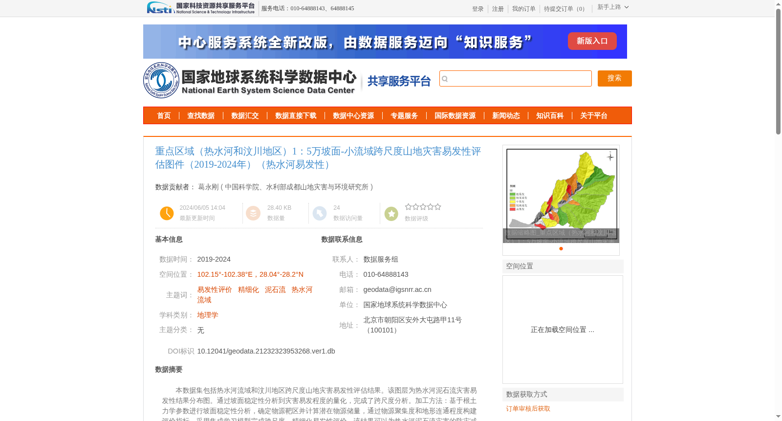
本数据集包括热水河流域和汶川地区跨尺度山地灾害易发性评估结果。该图层为热水河泥石流灾害易发性结果分布图。通过坡面稳定性分析到灾害易发程度的量化,完成了跨尺度分析。加工方法:基于根土力学参数进行坡面稳定性分析,确定物源靶区并计算潜在物源储量,通过物源聚集度和地形连通程度构建评价指标,采用集成学习模型完成跨尺度、精细化易发性评价。该结果可以为热水河泥石流灾害的防灾减灾提供参考。
This dataset covers the cross-scale mountain disaster susceptibility assessment results for the Reshui River Basin and the Wenchuan region. This particular layer is the distribution map of debris flow susceptibility in the Reshui River area. Cross-scale analysis was performed by quantifying the disaster susceptibility level through slope stability analysis. The processing methodology is as follows: slope stability analysis was conducted based on root-soil mechanical parameters to identify source target zones and calculate potential source reserves; evaluation indicators were constructed using source aggregation degree and topographic connectivity, and an ensemble learning model was employed to complete cross-scale and refined susceptibility assessment. This outcome can serve as a reference for debris flow disaster prevention and mitigation in the Reshui River Basin.
提供机构:
中国科学院、水利部成都山地灾害与环境研究所
创建时间:
2024-06-05
搜集汇总
数据集介绍
背景与挑战
背景概述
该数据集提供了热水河流域2019-2024年期间1:5万比例尺的泥石流灾害易发性评估结果,通过坡面稳定性分析和集成学习模型实现跨尺度、精细化评价,旨在为防灾减灾提供科学参考。数据集空间范围覆盖东经102.15°-102.38°、北纬28.04°-28.2°,主题包括易发性评价和泥石流灾害。
以上内容由遇见数据集搜集并总结生成


