中国高分辨率国家土壤信息格网基本属性数据集_90米土壤砂粒含量(2010-2018)
收藏国家地球系统科学数据中心2024-04-18 更新2024-04-21 收录
下载链接:
https://www.geodata.cn/data/datadetails.html?dataguid=61082909775177&docId=3347
下载链接
链接失效反馈官方服务:
资源简介:
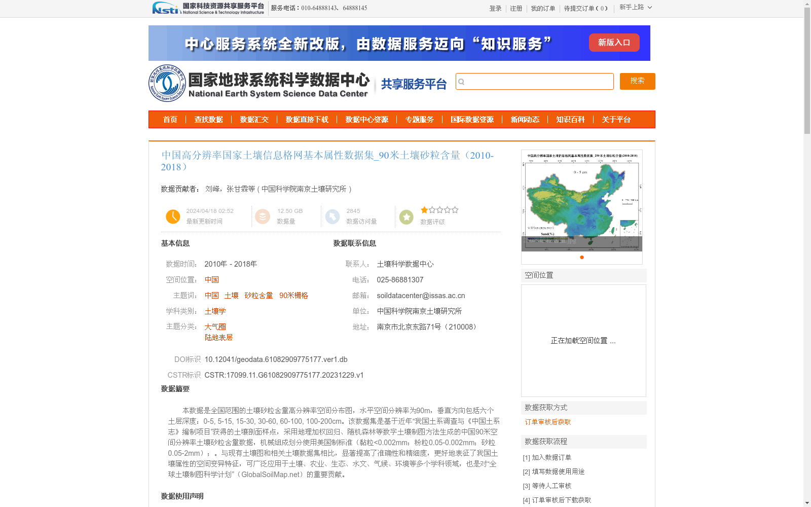
本数据是全国范围的土壤砂粒含量高分辨率空间分布图,水平空间分辨率为90m,垂直方向包括六个土层深度:0-5, 5-15, 15-30, 30-60, 60-100, 100-200cm。该数据集是基于近年“我国土系调查与《中国土系志》编制项目”获得的土壤剖面样点,采用地理加权回归、随机森林等数字土壤制图方法生成的中国90米空间分辨率土壤砂粒含量数据,机械组成划分使用美国制标准(黏粒<0.002mm;粉粒0.05-0.002mm;砂粒0.05-2mm);。与现有土壤图和相关土壤数据集相比,显著提高了准确性和精细度,更好地表征了我国土壤属性的空间变异特征,可广泛应用于土壤、农业、生态、水文、气候、环境等多个学科领域,也是对“全球土壤制图科学计划”(GlobalSoilMap.net)的重要贡献。
This dataset is a high-resolution spatial distribution map of soil sand content across China, with a horizontal spatial resolution of 90 meters, covering six vertical soil layer depths: 0–5, 5–15, 15–30, 30–60, 60–100, and 100–200 cm. It was developed based on soil profile sampling points collected from the recent national soil series survey and compilation project of *Soil Series of China*, and generated using digital soil mapping methods including Geographically Weighted Regression (GWR) and Random Forest (RF), producing 90-meter spatial resolution soil sand content data for the entire country. The mechanical composition classification follows the US standard: clay < 0.002 mm; silt 0.05–0.002 mm; sand 0.05–2 mm. Compared with existing soil maps and related soil datasets, this dataset significantly improves both accuracy and spatial detail, and better characterizes the spatial variability of soil properties in China. It can be widely applied across multiple disciplines including soil science, agriculture, ecology, hydrology, climatology, environmental science and other related fields, and represents an important contribution to the GlobalSoilMap.net initiative.
提供机构:
中国科学院南京土壤研究所
创建时间:
2023-12-30
搜集汇总
数据集介绍
背景与挑战
背景概述
该数据集是中国范围内土壤砂粒含量的高分辨率空间分布图,空间分辨率为90米,覆盖2010年至2018年,并包括六个不同土层深度。它基于全国5000多个土壤剖面样点,采用地理加权回归和随机森林等先进数字土壤制图方法生成,显著提高了土壤属性空间变异的准确性和精细度,适用于土壤学、农业、生态学等多个学科领域。
以上内容由遇见数据集搜集并总结生成


