青藏高原陆表实际蒸散发数据集(2000-2022)
收藏国家青藏高原科学数据中心2025-03-18 更新2025-04-19 收录
下载链接:
https://data.tpdc.ac.cn/zh-hans/data/6225d3e0-9f36-4c62-bbbf-3e2b66dd7e18
下载链接
链接失效反馈官方服务:
资源简介:
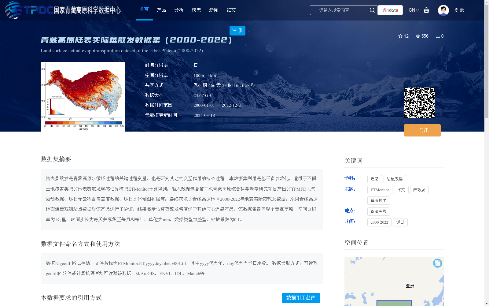
陆表蒸散发是青藏高原水循环过程的关键过程变量,也是研究其地气交互作用的核心过程。本数据集利用是基于多参数化、适用于不同土地覆盖类型的地表蒸散发遥感估算模型ETMonitor计算得到,输入数据包含第二次青藏高原综合科学考察研究项目产出的TPMFD大气驱动数据、逐日无云积雪覆盖度数据、逐日水体制图数据等,最终获取了青藏高原地区2000-2022年地表实际蒸散发数据。采用青藏高原地面通量观测站点数据对该产品进行了验证,结果显示估算蒸散发精度优于其他同类遥感产品。该数据集覆盖整个青藏高原,空间分辨率为1公里,时间步长为每天并累积至每月和每年,单位为mm,数据类型为整型,缩放系数为0.1。
Land surface evapotranspiration (ET) is a key process variable in the water cycle of the Tibetan Plateau, and a core process for investigating land-atmosphere interactions over the region. This dataset is computed using the ETMonitor remote sensing-based evapotranspiration estimation model, which features multi-parameterization and is applicable to diverse land cover types. The input data encompasses TPMFD atmospheric forcing data, daily cloud-free snow cover fraction data, daily water body mapping data, and other related datasets generated by the Second Tibetan Plateau Scientific Expedition and Research (STEP) Program. The final actual land surface evapotranspiration dataset for the Tibetan Plateau spanning 2000 to 2022 is thus produced. This dataset product was validated using ground flux observation station data across the entire Tibetan Plateau, and the results indicated that the ET estimation accuracy of this product outperforms other comparable remote sensing products. This dataset covers the full extent of the Tibetan Plateau, with a spatial resolution of 1 km, a daily temporal resolution, and data aggregated to monthly and annual scales. The unit of the dataset is millimeter (mm), the data type is integer, and the scaling factor is 0.1.
提供机构:
郑超磊,贾立,胡光成
创建时间:
2025-03-03
搜集汇总
数据集介绍
背景与挑战
背景概述
该数据集提供了青藏高原地区2000年至2022年的陆表实际蒸散发数据,基于ETMonitor遥感估算模型生成,空间分辨率为1公里,时间步长包括每日、每月和每年,单位为毫米。数据集经过地面站点验证,精度优于同类产品,适用于研究青藏高原水循环和地气交互作用。
以上内容由遇见数据集搜集并总结生成


