非洲萨赫勒地区30m土地利用/覆盖数据集(1990-2020)
收藏国家青藏高原科学数据中心2022-07-06 更新2024-03-01 收录
下载链接:
https://data.tpdc.ac.cn/zh-hans/data/1b128d7a-ccf6-4930-99b8-1ec23c8f4160
下载链接
链接失效反馈官方服务:
资源简介:
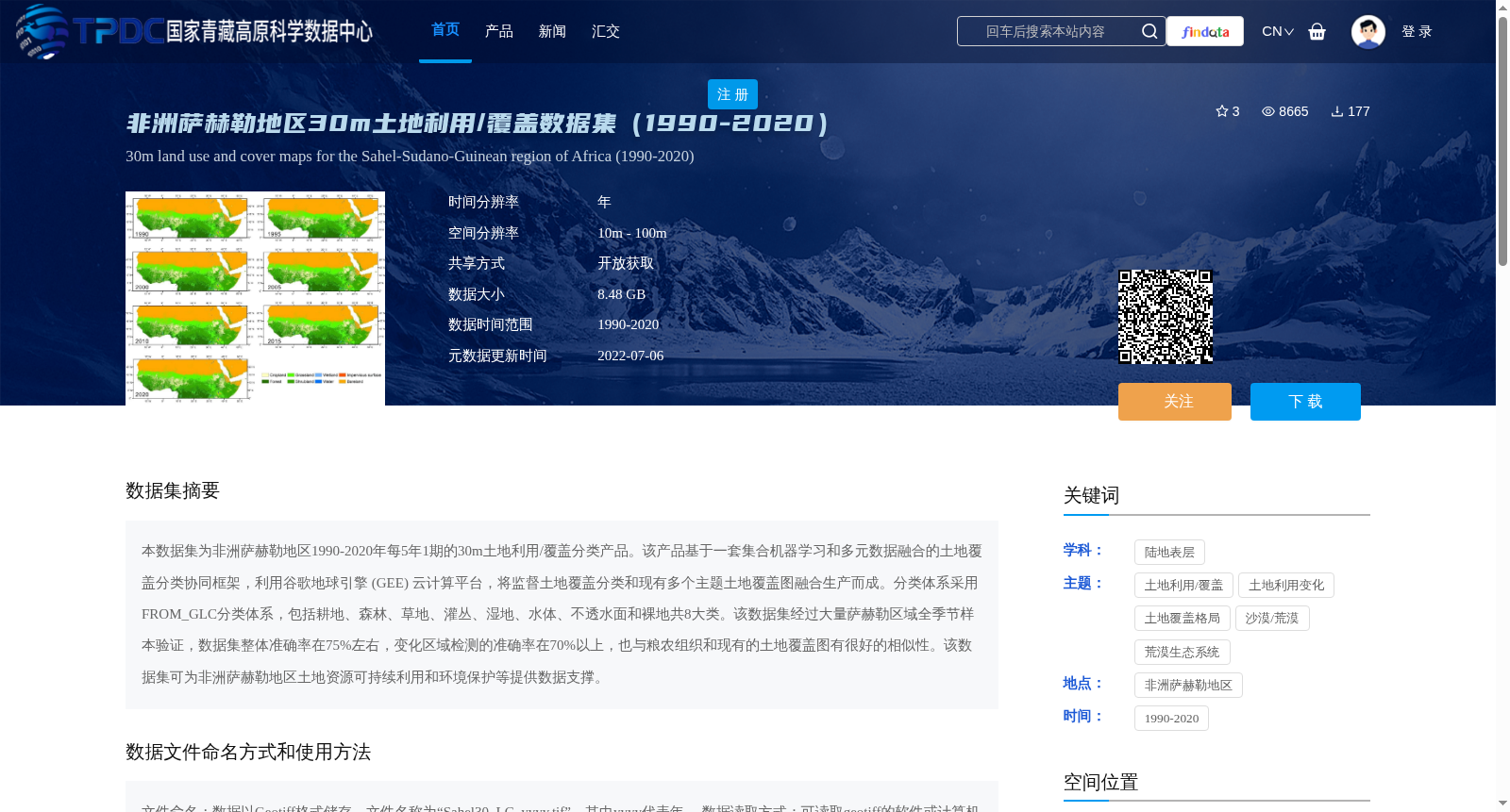
本数据集为非洲萨赫勒地区1990-2020年每5年1期的30m土地利用/覆盖分类产品。该产品基于一套集合机器学习和多元数据融合的土地覆盖分类协同框架,利用谷歌地球引擎 (GEE) 云计算平台,将监督土地覆盖分类和现有多个主题土地覆盖图融合生产而成。分类体系采用FROM_GLC分类体系,包括耕地、森林、草地、灌丛、湿地、水体、不透水面和裸地共8大类。该数据集经过大量萨赫勒区域全季节样本验证,数据集整体准确率在75%左右,变化区域检测的准确率在70%以上,也与粮农组织和现有的土地覆盖图有很好的相似性。该数据集可为非洲萨赫勒地区土地资源可持续利用和环境保护等提供数据支撑。
This dataset is a 30 m land use/cover classification product for the Sahel region of Africa, with one release every 5 years spanning from 1990 to 2020. Developed based on a collaborative land cover classification framework integrating ensemble machine learning and multi-source data fusion, this product was generated by fusing supervised land cover classification results with multiple existing thematic land cover maps via the Google Earth Engine (GEE) cloud computing platform. The classification system adopts the FROM_GLC taxonomy, which includes 8 major categories: cropland, forest, grassland, shrubland, wetland, water bodies, impervious surfaces, and bare land. This dataset has been validated using a large number of all-season samples collected from the Sahel region. The overall accuracy of the dataset is approximately 75%, while the accuracy of change area detection exceeds 70%. Additionally, it exhibits good similarity with the land cover maps from the Food and Agriculture Organization (FAO) and existing thematic land cover products. This dataset can provide data support for sustainable land resource utilization and environmental protection in the Sahel region of Africa.
提供机构:
俞乐
创建时间:
2022-02-17
搜集汇总
数据集介绍
背景与挑战
背景概述
该数据集提供了非洲萨赫勒地区1990-2020年每5年1期的30m土地利用/覆盖分类产品,采用FROM_GLC分类体系,包括8大类。数据集基于机器学习和多元数据融合方法生产,整体准确率约75%,变化区域检测准确率70%以上,适用于土地资源可持续利用和环境保护研究。
以上内容由遇见数据集搜集并总结生成


