1990、2000、2010、2014年中国大陆岸线数据集
收藏地球大数据科学工程2024-03-04 收录
下载链接:
https://data.casearth.cn/sdo/detail/60e55fca819aec59a2af7074
下载链接
链接失效反馈官方服务:
资源简介:
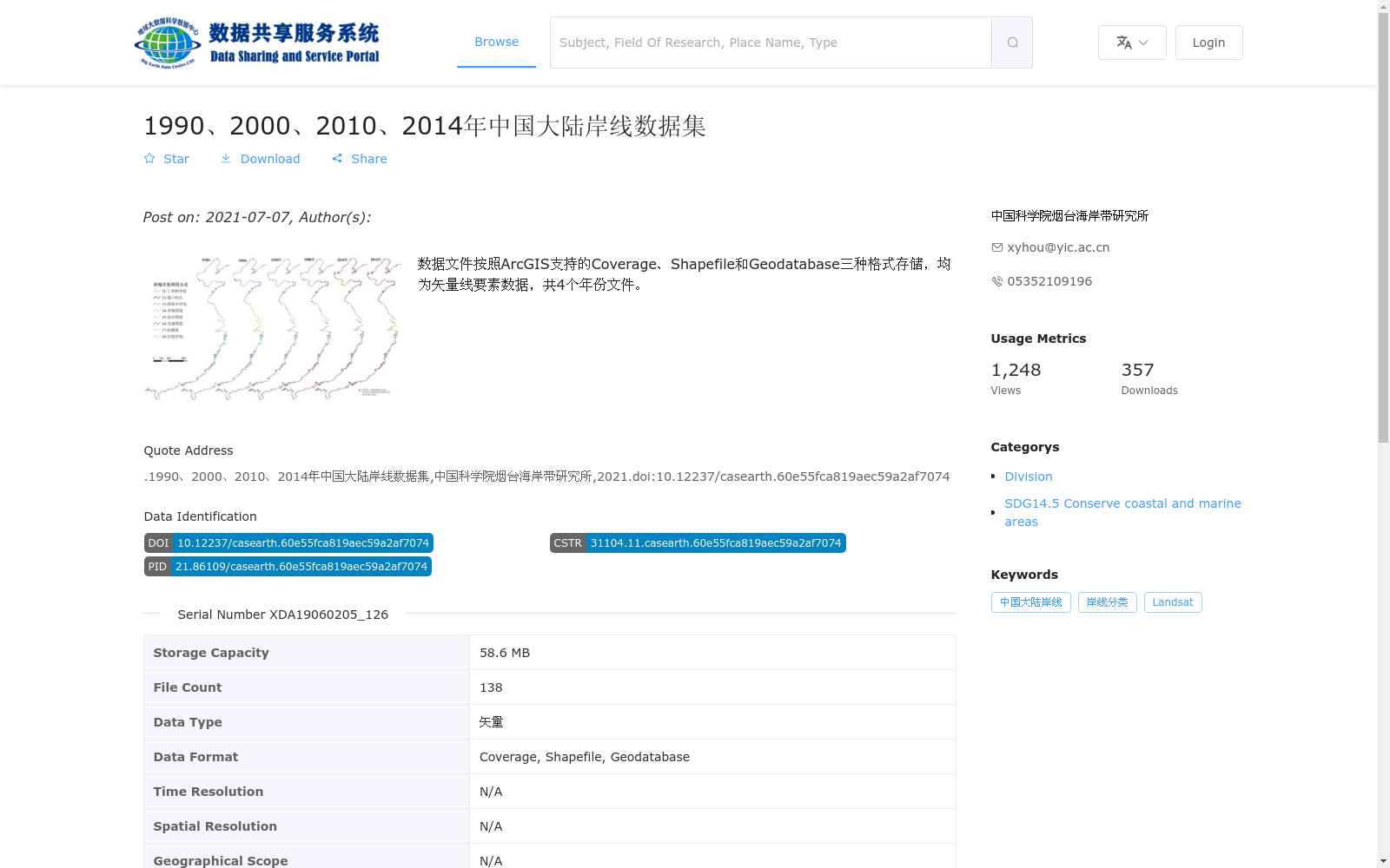
数据文件按照ArcGIS支持的Coverage、Shapefile和Geodatabase三种格式存储,均为矢量线要素数据,共4个年份文件。
The data files are stored in three formats supported by ArcGIS: Coverage, Shapefile and Geodatabase. All of these files are vector line feature data, with a total of 4 annual files.
提供机构:
中国科学院烟台海岸带研究所
搜集汇总
数据集介绍
背景与挑战
背景概述
该数据集是一个时间序列矢量数据集,覆盖1990、2000、2010和2014年四个年份的中国大陆岸线,以ArcGIS支持的Coverage、Shapefile和Geodatabase格式存储,适用于海岸线变化分析。数据由中国科学院烟台海岸带研究所基于遥感解译(可能使用Landsat影像)生产,旨在支持沿海保护和可持续发展目标(SDG14.5)研究。
以上内容由遇见数据集搜集并总结生成


