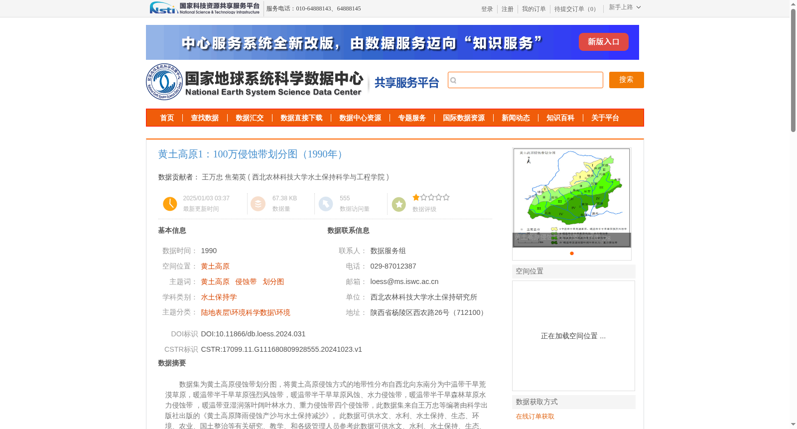
黄土高原1:100万侵蚀带划分图(1990年)
收藏国家地球系统科学数据中心2025-01-03 更新2024-12-29 收录
下载链接:
https://www.geodata.cn/data/datadetails.html?dataguid=111680809928555&docId=1895
下载链接
链接失效反馈官方服务:
资源简介:
数据集为黄土高原侵蚀带划分图,将黄土高原侵蚀方式的地带性分布自西北向东南分为中温带干旱荒漠草原,暖温带半干旱草原强烈风蚀带,暖温带半干旱草原风蚀、水力侵蚀带,暖温带半干旱森林草原水力侵蚀带
,暖温带亚湿润落叶阔叶林水力、重力侵蚀带四个侵蚀带,此数据集来自王万忠等编著由科学出版社出版的《黄土高原降雨侵蚀产沙与水土保持减沙》。此数据可供水文、水利、水土保持、生态、环境、农业、国土整治等有关研究、教学、和各级管理人员参考此数据可供水文、水利、水土保持、生态、环境、农业、国土整治等有关研究、教学、和各级管理人员参考。
This dataset is a zoning map of erosion zones on the Loess Plateau. The zonal distribution of erosion patterns on the Loess Plateau is divided into five erosion zones from northwest to southeast: mid-temperate arid desert-steppe zone, warm-temperate semi-arid steppe zone with intense wind erosion, warm-temperate semi-arid steppe zone with wind and hydraulic erosion, warm-temperate semi-arid forest-steppe zone with hydraulic erosion, and warm-temperate sub-humid deciduous broad-leaved forest zone with hydraulic and gravitational erosion. This dataset is compiled from the book *Rainfall Erosion, Sediment Yield and Soil and Water Conservation Sediment Reduction on the Loess Plateau*, edited by Wang Wanzhong et al. and published by Science Press. This dataset can be used as a reference for relevant researchers, educators and managers at all levels in the fields of hydrology, water conservancy, soil and water conservation, ecology, environment, agriculture and land consolidation.
提供机构:
西北农林科技大学水土保持科学与工程学院
创建时间:
2024-10-23
搜集汇总
数据集介绍
背景与挑战
背景概述
该数据集是1990年黄土高原1:100万侵蚀带划分图,将黄土高原自西北向东南划分为四个侵蚀带,包括中温带干旱荒漠草原、暖温带半干旱草原强烈风蚀带、暖温带半干旱草原风蚀和水力侵蚀带、暖温带半干旱森林草原水力侵蚀带以及暖温带亚湿润落叶阔叶林水力和重力侵蚀带,体现了侵蚀方式的地带性分布。数据集基于权威著作数字化而成,适用于水土保持学、水文、生态、农业等多领域的研究、教学和管理工作。
以上内容由遇见数据集搜集并总结生成


