“一带一路”地区极端降水指数预估数据(2020–2100)
收藏国家青藏高原科学数据中心2023-01-03 更新2024-03-01 收录
下载链接:
https://data.tpdc.ac.cn/zh-hans/data/9a811522-7108-4bf4-a911-73dfb1c8c257
下载链接
链接失效反馈官方服务:
资源简介:
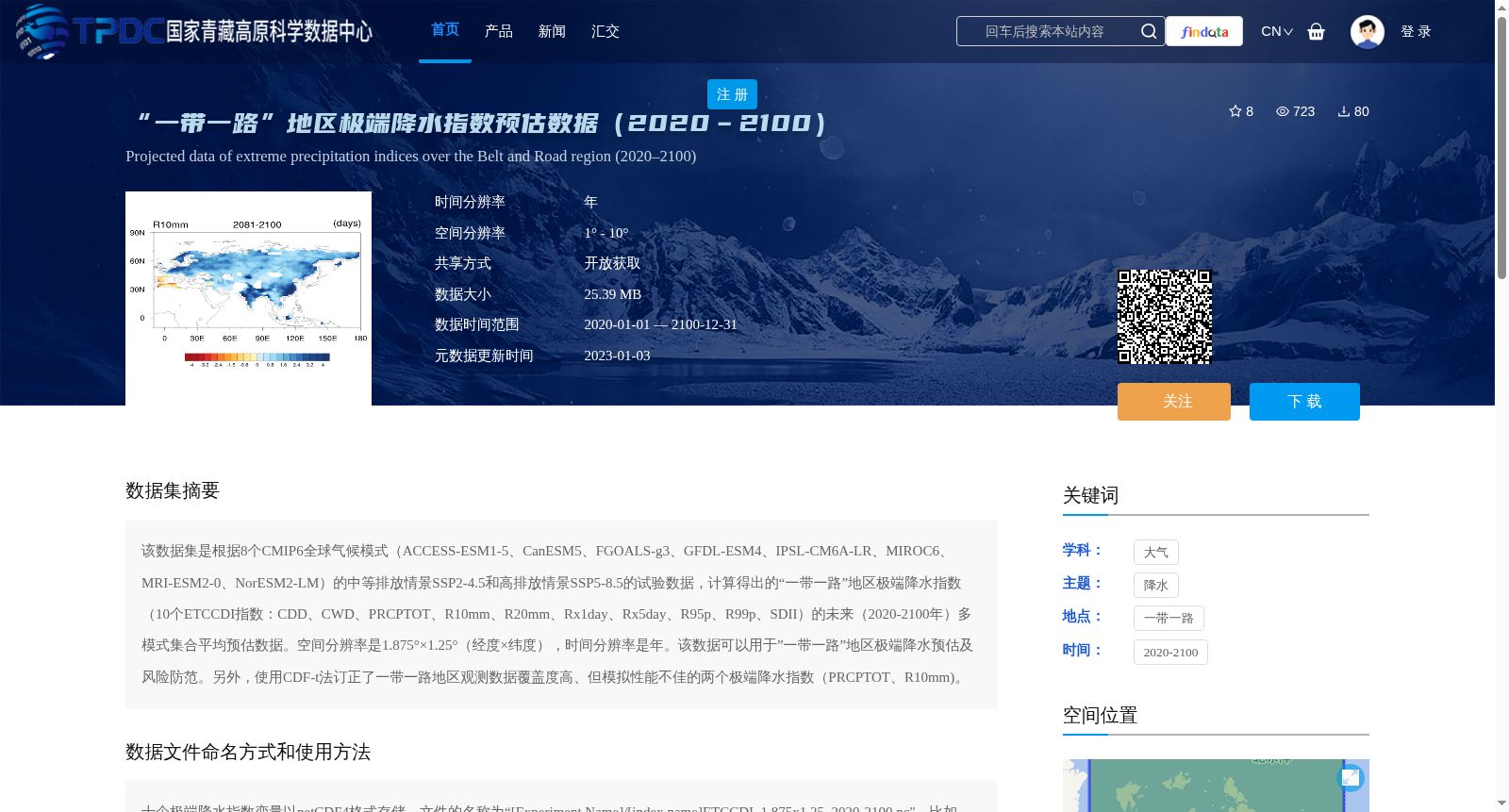
该数据集是根据8个CMIP6全球气候模式(ACCESS-ESM1-5、CanESM5、FGOALS-g3、GFDL-ESM4、IPSL-CM6A-LR、MIROC6、MRI-ESM2-0、NorESM2-LM)的中等排放情景SSP2-4.5和高排放情景SSP5-8.5的试验数据,计算得出的“一带一路”地区极端降水指数(10个ETCCDI指数:CDD、CWD、PRCPTOT、R10mm、R20mm、Rx1day、Rx5day、R95p、R99p、SDII)的未来(2020-2100年)多模式集合平均预估数据。空间分辨率是1.875°×1.25°(经度×纬度),时间分辨率是年。该数据可以用于”一带一路”地区极端降水预估及风险防范。另外,使用CDF-t法订正了一带一路地区观测数据覆盖度高、但模拟性能不佳的两个极端降水指数(PRCPTOT、R10mm)。
This dataset comprises future (2020–2100) multi-model ensemble mean projections of extreme precipitation indices over the Belt and Road region. The data were calculated using experimental outputs from 8 CMIP6 global climate models: ACCESS-ESM1-5, CanESM5, FGOALS-g3, GFDL-ESM4, IPSL-CM6A-LR, MIROC6, MRI-ESM2-0, and NorESM2-LM, under the moderate emission scenario SSP2-4.5 and high emission scenario SSP5-8.5. The 10 ETCCDI extreme precipitation indices included are CDD, CWD, PRCPTOT, R10mm, R20mm, Rx1day, Rx5day, R95p, R99p, and SDII. The dataset has a spatial resolution of 1.875° × 1.25° (longitude × latitude) and an annual temporal resolution. This dataset can be used for extreme precipitation projection and risk prevention over the Belt and Road region. Additionally, two extreme precipitation indices (PRCPTOT and R10mm), which have high observational data coverage but poor simulation performance over the Belt and Road region, were corrected using the CDF-t method.
提供机构:
钱诚
创建时间:
2022-12-31
搜集汇总
数据集介绍
背景与挑战
背景概述
该数据集包含'一带一路'地区2020-2100年间的极端降水指数预估,基于8个CMIP6模式在两种排放情景下的数据,涵盖10个ETCCDI指数,空间分辨率为1.875°×1.25°,时间分辨率为年,适用于气候研究和风险防范。
以上内容由遇见数据集搜集并总结生成


