Sentinel-5P TROPOMI – Cloud-Top Height (CTH), Level 3 – Global
收藏Mendeley Data2024-03-10 更新2024-06-27 收录
下载链接:
https://geoservice.dlr.de/data-assets/ozxr4ngp0473.html
下载链接
链接失效反馈官方服务:
资源简介:
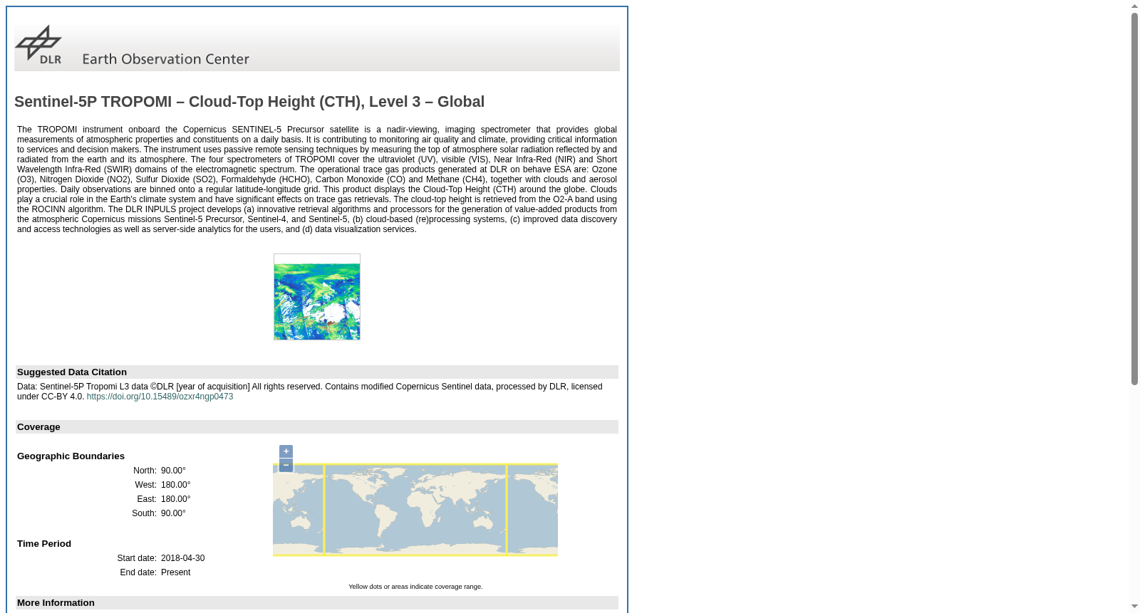
The TROPOMI instrument onboard the Copernicus SENTINEL-5 Precursor satellite is a nadir-viewing, imaging spectrometer that provides global measurements of atmospheric properties and constituents on a daily basis. It is contributing to monitoring air quality and climate, providing critical information to services and decision makers. The instrument uses passive remote sensing techniques by measuring the top of atmosphere solar radiation reflected by and radiated from the earth and its atmosphere. The four spectrometers of TROPOMI cover the ultraviolet (UV), visible (VIS), Near Infra-Red (NIR) and Short Wavelength Infra-Red (SWIR) domains of the electromagnetic spectrum. The operational trace gas products generated at DLR on behave ESA are: Ozone (O3), Nitrogen Dioxide (NO2), Sulfur Dioxide (SO2), Formaldehyde (HCHO), Carbon Monoxide (CO) and Methane (CH4), together with clouds and aerosol properties. Daily observations are binned onto a regular latitude-longitude grid. This product displays the Cloud-Top Height (CTH) around the globe. Clouds play a crucial role in the Earth's climate system and have significant effects on trace gas retrievals. The cloud-top height is retrieved from the O2-A band using the ROCINN algorithm. The DLR INPULS project develops (a) innovative retrieval algorithms and processors for the generation of value-added products from the atmospheric Copernicus missions Sentinel-5 Precursor, Sentinel-4, and Sentinel-5, (b) cloud-based (re)processing systems, (c) improved data discovery and access technologies as well as server-side analytics for the users, and (d) data visualization services.
搭载于哥白尼(Copernicus)计划的哨兵5号前驱卫星(SENTINEL-5 Precursor)的TROPOMI仪器,是一台天底观测型成像光谱仪,可每日开展全球大气属性与大气成分的全域探测。该仪器助力空气质量与气候监测工作,为相关服务机构及决策人员提供关键支撑信息。仪器采用被动遥感技术,通过测量地球及其大气反射与辐射的大气层顶太阳辐射完成探测。TROPOMI搭载的四台光谱仪覆盖了电磁频谱的紫外(UV)、可见光(VIS)、近红外(NIR)以及短波红外(SWIR)波段区间。受欧洲空间局(ESA)委托,德国航空航天中心(DLR)生成的业务痕量气体产品包括:臭氧(O₃)、二氧化氮(NO₂)、二氧化硫(SO₂)、甲醛(HCHO)、一氧化碳(CO)与甲烷(CH₄),同时涵盖云与气溶胶特性数据。每日观测数据会被网格化至标准经纬度网格。本产品展示了全球范围内的云顶高度(Cloud-Top Height, CTH)。云在地球气候系统中扮演关键角色,同时对痕量气体反演过程产生显著影响。云顶高度通过ROCINN算法基于O₂-A波段反演得到。德国航空航天中心(DLR)主导的INPULS项目研发内容涵盖四大方向:(a) 面向哥白尼大气监测任务SENTINEL-5 Precursor、SENTINEL-4及SENTINEL-5,开发用于生成增值产品的创新反演算法与处理系统;(b) 基于云的(重)处理系统;(c) 优化面向用户的数据发现与访问技术,以及服务端分析工具;(d) 数据可视化服务。
创建时间:
2024-03-06
搜集汇总
数据集介绍
背景与挑战
背景概述
该数据集提供全球每日云顶高度(CTH)测量数据,由Sentinel-5P卫星上的TROPOMI仪器采集,覆盖紫外至短波红外光谱范围,适用于气候和空气质量监测。数据从2018年4月30日开始持续更新,以经纬度网格形式呈现。
以上内容由遇见数据集搜集并总结生成


