东北三省花生20m分辨率空间分布图(2018年)
收藏国家地球系统科学数据中心2023-03-08 更新2024-03-04 收录
下载链接:
https://www.geodata.cn/data/datadetails.html?dataguid=171003034451839&docId=6147
下载链接
链接失效反馈官方服务:
资源简介:
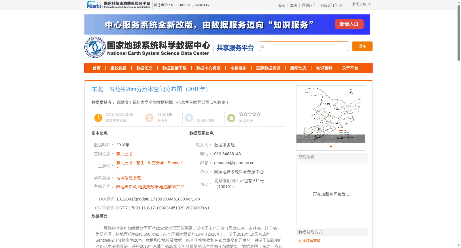
可靠的时空作物数据对于可持续农业管理至关重要。以中国东北三省(黑龙江省、吉林省、辽宁省)为研究区,耕地面积为249,600 km2,占全国耕地面积的15%(2018年)。基于2018年10天合成的Sentinel-2(分辨率为20m)数据和实地验证数据,结合作物物候和色素含量变化开发的一种基于知识的自动化花生制图算法,获得2018年东北三省20米空间分辨率的花生空间分布数据集。数据表明,东北三省花生种植分布面积为8371 km2,且集中分布在吉林省西部和辽宁省。该数据集存储为.tif 和.xslx格式,压缩后数据量为34.7MB。
Reliable spatiotemporal crop data is crucial for sustainable agricultural management. The study area covers the three northeastern provinces of China (Heilongjiang, Jilin and Liaoning), with a total arable land area of 249,600 km², accounting for 15% of the national arable land area in 2018. Based on 10-day composite Sentinel-2 data (20 m spatial resolution) from 2018 and field validation data, combined with crop phenology and pigment content changes, a knowledge-based automated peanut mapping algorithm was developed, and the peanut spatial distribution dataset with 20 m spatial resolution for the three northeastern provinces in 2018 was obtained. The dataset shows that the total peanut cultivation area in the three northeastern provinces is 8,371 km², and the cultivation is mainly concentrated in western Jilin Province and Liaoning Province. This dataset is stored in .tif and .xlsx formats, with a compressed size of 34.7 MB.
提供机构:
福州大学空间数据挖掘与信息共享教育部重点实验室
创建时间:
2023-03-08
搜集汇总
数据集介绍
背景与挑战
背景概述
该数据集为2018年东北三省花生种植的20米分辨率空间分布图,基于Sentinel-2数据和实地验证数据生成,存储为.tif和.xslx格式,压缩后数据量为34.7MB。数据表明花生种植主要集中分布在吉林省西部和辽宁省,总面积为8371平方公里。
以上内容由遇见数据集搜集并总结生成


