黄土高原1km归一化植被指数(NDVI)数据集(2000-2020年)
收藏国家地球系统科学数据中心2024-12-12 更新2024-06-25 收录
下载链接:
https://www.geodata.cn/data/datadetails.html?dataguid=80884031898237&docId=2038
下载链接
链接失效反馈官方服务:
资源简介:
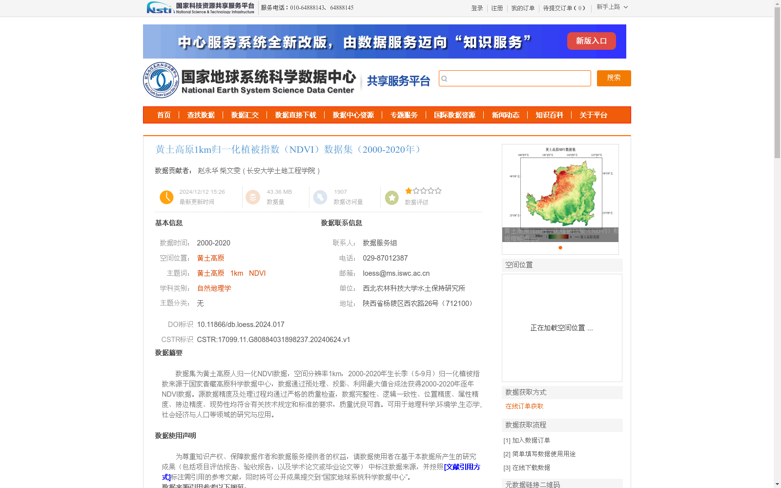
数据集为黄土高原人归一化NDVI数据,空间分辨率1km,2000-2020年生长季(5-9月)归一化植被指数来源于国家青藏高原科学数据中心,数据通过预处理、投影、利用最大值合成法获得2000-2020年逐年NDVI数据。源数据精度及处理过程均通过严格的质量检查,数据完整性、逻辑一致性、位置精度、属性精度、接边精度、现势性均符合有关技术规定和标准的要求,质量优良可靠。可用于地理科学,环境学,生态学,社会经济与人口等领域的研究与应用。
This dataset provides Normalized Difference Vegetation Index (NDVI) data for the Loess Plateau, with a spatial resolution of 1 km. The NDVI data collected during the growing seasons (May to September) from 2000 to 2020 were obtained from the National Tibetan Plateau Scientific Data Center. Annual NDVI datasets spanning 2000–2020 were generated via preprocessing, projection standardization, and the maximum value composite (MVC) method. Strict quality checks have been performed on both the original data accuracy and the entire processing pipeline. The data exhibits excellent and reliable quality, as its integrity, logical consistency, positional accuracy, attribute accuracy, edge-matching accuracy, and timeliness all comply with relevant technical regulations and standards. This dataset is suitable for research and application in fields such as geographic science, environmental science, ecology, socioeconomics, and population studies.
提供机构:
长安大学土地工程学院
创建时间:
2024-06-24
搜集汇总
数据集介绍
背景与挑战
背景概述
该数据集提供了黄土高原地区2000年至2020年生长季(5-9月)的1公里空间分辨率归一化植被指数(NDVI)数据,通过最大值合成法从国家青藏高原科学数据中心的源数据加工而成,并采用WGS_1984_UTM_Zone_48N投影以确保精度。数据质量经过严格检查,适用于地理科学、环境学、生态学等领域的研究与应用。
以上内容由遇见数据集搜集并总结生成


