黄土高原地区县域尺度退耕还林(草)工程面积数据集(1999-2020年)
收藏国家地球系统科学数据中心2025-12-31 更新2026-02-07 收录
下载链接:
https://www.geodata.cn/data/datadetails.html?dataguid=146902619076396&docId=299
下载链接
链接失效反馈官方服务:
资源简介:
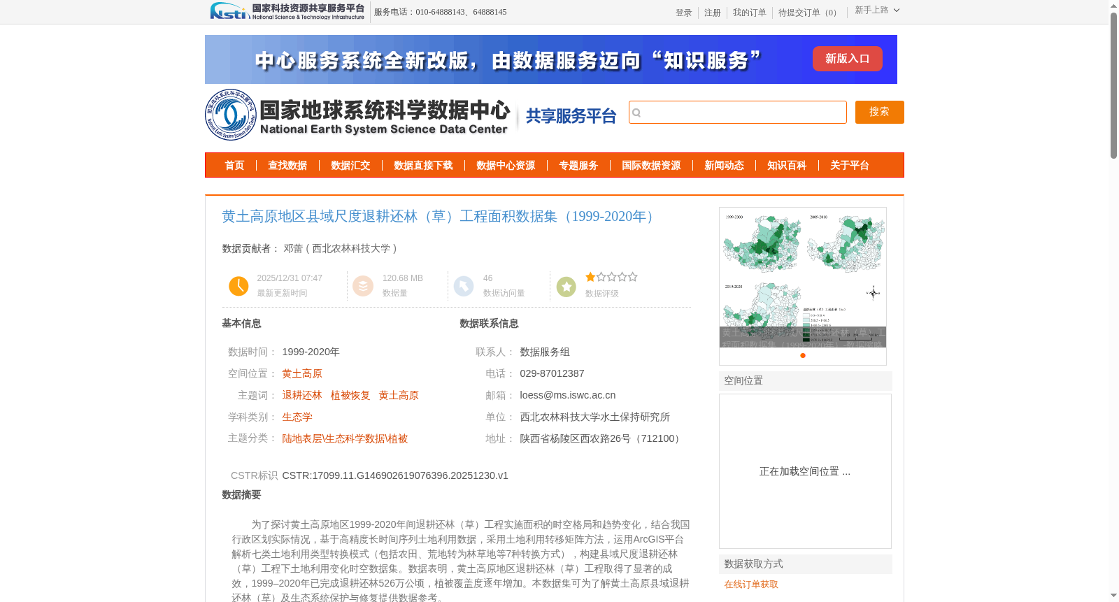
为了探讨黄土高原地区1999-2020年间退耕还林(草)工程实施面积的时空格局和趋势变化,结合我国行政区划实际情况,基于高精度长时间序列土地利用数据,采用土地利用转移矩阵方法,运用ArcGIS平台解析七类土地利用类型转换模式(包括农田、荒地转为林草地等7种转换方式),构建县域尺度退耕还林(草)工程下土地利用变化时空数据集。数据表明,黄土高原地区退耕还林(草)工程取得了显著的成效,1999–2020年已完成退耕还林526万公顷,植被覆盖度逐年增加。本数据集可为了解黄土高原县域退耕还林(草)及生态系统保护与修复提供数据参考。
To investigate the spatio-temporal patterns and temporal trends of the implemented area of the Grain for Green Project (converting farmland to forest and grassland) in the Loess Plateau during 1999–2020, combined with the actual situation of China's administrative divisions, this study adopted high-precision long-time-series land use data, the land use transfer matrix method, and the ArcGIS platform to analyze seven types of land use conversion patterns (including seven conversion modes such as converting farmland and wasteland to forest and grassland), and constructed a spatio-temporal dataset of land use changes under the Grain for Green Project at the county scale. The dataset indicates that the Grain for Green Project in the Loess Plateau has yielded remarkable outcomes: a cumulative 5.26 million hectares of farmland have been converted to forest and grassland from 1999 to 2020, and the vegetation coverage has increased year by year. This dataset can provide data references for understanding the county-scale Grain for Green Project and ecosystem conservation and restoration in the Loess Plateau.
提供机构:
西北农林科技大学
创建时间:
2025-12-30
搜集汇总
数据集介绍
背景与挑战
背景概述
该数据集提供了1999年至2020年黄土高原地区县域尺度的退耕还林(草)工程面积数据,基于高精度土地利用数据通过土地利用转移矩阵方法生成,涵盖七类土地利用转换模式。数据显示,在此期间已完成退耕还林526万公顷,植被覆盖度逐年增加,显著反映了工程实施的时空成效和生态恢复效果,为黄土高原生态系统保护与修复研究提供了重要数据参考。
以上内容由遇见数据集搜集并总结生成


