山东省30米分辨率土壤可蚀性因子数据集
收藏国家地球系统科学数据中心2020-06-19 更新2024-03-04 收录
下载链接:
https://www.geodata.cn/data/datadetails.html?dataguid=96150557972079&docId=13066
下载链接
链接失效反馈官方服务:
资源简介:
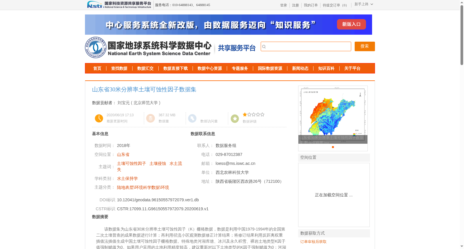
该数据集为山东省30米分辨率土壤可蚀性因子(K)栅格数据,数据是利用中国1979-1994年的全国第二次土壤普查的成果数据进行计算;再利用径流小区观测数据修正计算结果;将修订结果利用反距离权重插值法插值生成中国土壤可蚀性因子栅格数据。特殊地类河湖库塘、冰川及永久积雪、裸岩土地类型K因子值强制赋值为0。如果用户采用的土地利用精度较高,建议重新对以下土地类型的K因子强制赋值为0:河湖库塘、冰川及永久积雪、裸岩。如果有K值为0,但不属于上述类型的,K因子可按如下原则:取邻近相同土地类型图斑的K值,或取与该图斑邻近且不等于0的所有图斑K值的平均值。山东省土壤可蚀性因子(K)栅格数据的利用山东省边界在中国土壤可蚀性因子栅格数据中裁切出山东省土壤可蚀性因子数据。
This dataset is a 30-meter resolution raster dataset of soil erodibility factor (K) for Shandong Province. It was initially calculated using the results of the Second National Soil Survey of China conducted from 1979 to 1994, then the calculated results were revised with observation data from runoff plots. The revised results were interpolated via the inverse distance weighting (IDW) method to generate the national raster dataset of soil erodibility factors for China. For special land types, the K factor values of land types including rivers, lakes, reservoirs, ponds, glaciers and permanent snow, and bare rock are forcibly assigned a value of 0. If the user adopts higher-precision land use data, it is recommended to re-forcibly assign a K factor value of 0 to the following land types: rivers, lakes, reservoirs, ponds, glaciers and permanent snow, and bare rock. For areas where the K factor value is 0 but do not belong to the aforementioned land types, the K factor can be determined following these principles: take the K value of adjacent map patches with the same land type, or calculate the average K value of all adjacent map patches with non-zero K values. The Shandong Province soil erodibility factor (K) raster dataset was extracted by clipping the national soil erodibility factor raster dataset of China using the boundary of Shandong Province.
提供机构:
北京师范大学
创建时间:
2020-06-19
搜集汇总
数据集介绍
背景与挑战
背景概述
山东省30米分辨率土壤可蚀性因子数据集是基于全国土壤普查数据和观测数据计算生成的栅格数据,适用于土壤侵蚀和水土流失研究,数据质量可靠。
以上内容由遇见数据集搜集并总结生成


