南京市土地利用及城镇用地结构分布数据(2013年)
收藏国家地球系统科学数据中心2018-06-29 更新2024-04-21 收录
下载链接:
https://www.geodata.cn/data/datadetails.html?dataguid=238990791979153&docId=19438
下载链接
链接失效反馈官方服务:
资源简介:
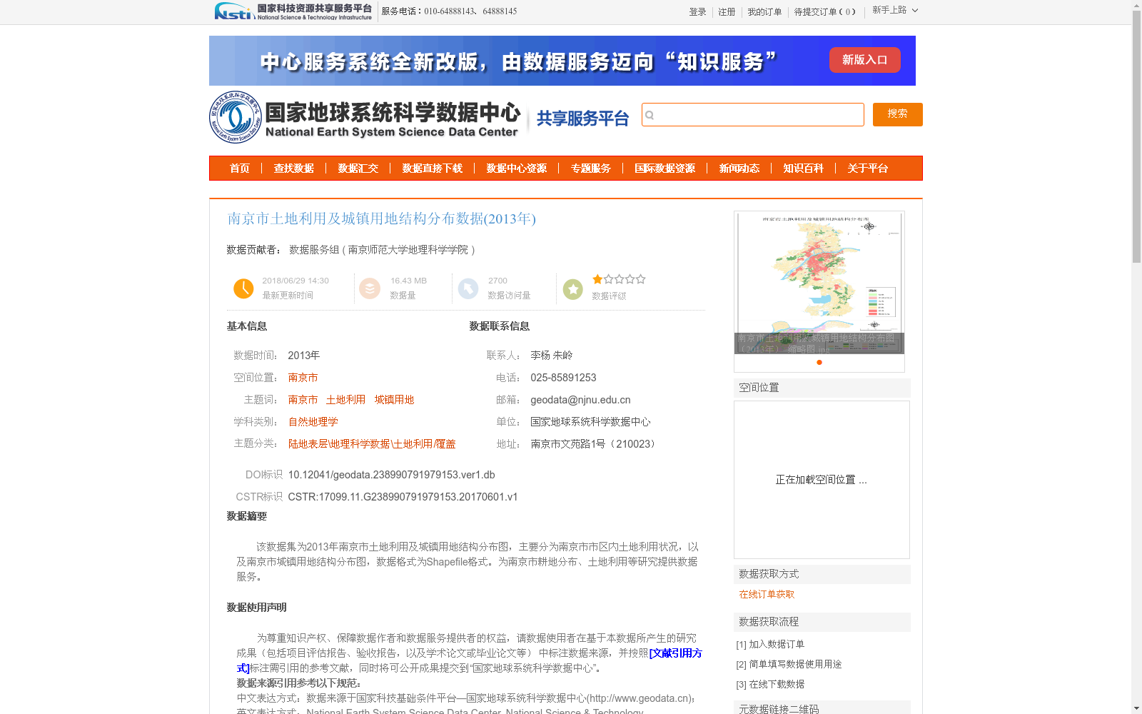
该数据集为2013年南京市土地利用及城镇用地结构分布图,主要分为南京市市区内土地利用状况,以及南京市城镇用地结构分布图,数据格式为Shapefile格式。为南京市耕地分布、土地利用等研究提供数据服务。
This dataset is the 2013 land use and urban land structure distribution map of Nanjing City. It is mainly divided into two parts: the land use status within the urban area of Nanjing, and the urban land structure distribution map of Nanjing. The data is formatted in Shapefile. It provides data services for studies on cultivated land distribution, land use and other relevant topics in Nanjing.
提供机构:
南京师范大学地理科学学院
创建时间:
2017-06-01
搜集汇总
数据集介绍
背景与挑战
背景概述
该数据集是2013年南京市土地利用及城镇用地结构分布数据,以Shapefile格式提供,包含市区土地利用状况和城镇用地结构分布图。数据基于高分辨率遥感影像(如2.5米和Landsat 8融合的15米数据)加工而成,采用ArcGIS和ENVI软件进行校正和数字化,投影为Transverse_Mercator,旨在支持南京市耕地分布和土地利用等相关研究。
以上内容由遇见数据集搜集并总结生成


