青藏高原流域边界数据集(2016)
收藏国家青藏高原科学数据中心2022-04-18 更新2024-03-01 收录
下载链接:
https://data.tpdc.ac.cn/zh-hans/data/dff6b437-90a1-4729-8140-faafc544860f
下载链接
链接失效反馈官方服务:
资源简介:
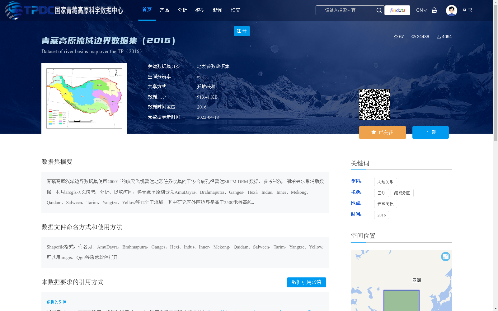
青藏高原流域边界数据集使用2000年的航天飞机雷达地形任务收集的干涉合成孔径雷达SRTM DEM 数据、参考河流、湖泊等水系辅助数据,利用arcgis水文模型,分析、提取河网,将青藏高原划分为AmuDayra、Brahmaputra、Ganges、Hexi、Indus、Inner、Mekong、Qaidam、Salween、Tarim、Yangtze、Yellow等12个子流域。其中研究区外围边界是基于2500米等高线。
The Qinghai-Tibet Plateau watershed boundary dataset uses SRTM DEM data collected by the 2000 Shuttle Radar Topography Mission (SRTM), which adopts Interferometric Synthetic Aperture Radar (InSAR) technology, together with auxiliary hydrological data including reference rivers and lakes. It applies the ArcGIS hydrological model to analyze and extract the river network, thus dividing the Qinghai-Tibet Plateau into 12 sub-watersheds: Amu Darya, Brahmaputra, Ganges, Hexi, Indus, Inner, Mekong, Qaidam, Salween, Tarim, Yangtze, and Yellow. The peripheral boundary of the study area is defined based on the 2500-meter contour line.
提供机构:
张国庆
创建时间:
2019-06-02
搜集汇总
数据集介绍
背景与挑战
背景概述
该数据集是基于2000年SRTM DEM和水系数据,利用ArcGIS水文模型提取的青藏高原流域边界数据,将区域划分为12个子流域。数据以Shapefile格式提供,适用于地理信息系统分析,主要用于青藏高原的流域分区和地表参数研究。
以上内容由遇见数据集搜集并总结生成


