2015-2023年黄土高原1km分辨率逐月土壤湿度数据集
收藏国家地球系统科学数据中心2024-03-26 更新2024-03-04 收录
下载链接:
https://www.geodata.cn/data/datadetails.html?dataguid=232606017096831&docId=3846
下载链接
链接失效反馈官方服务:
资源简介:
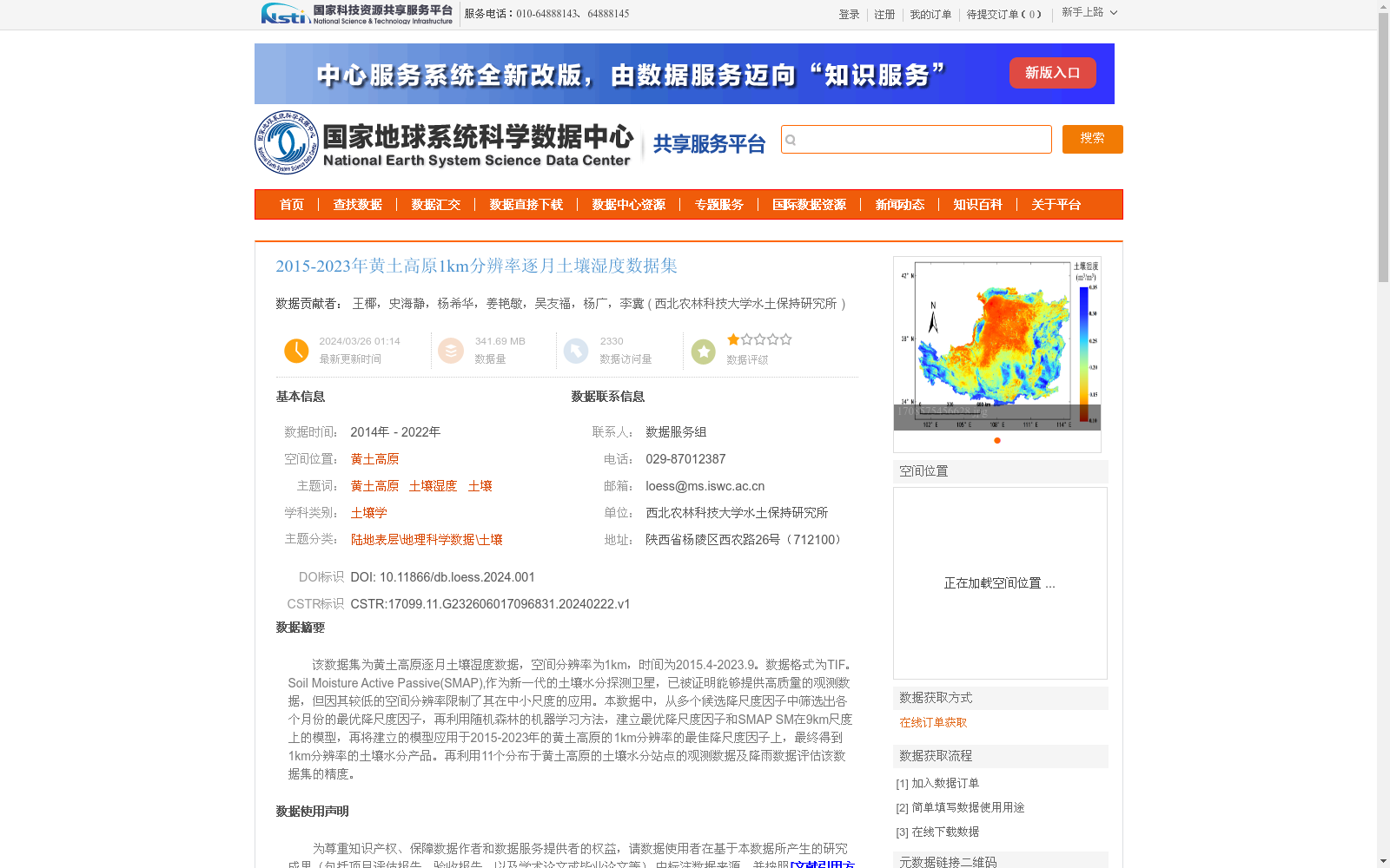
该数据集为黄土高原逐月土壤湿度数据,空间分辨率为1km,时间为2015.4-2023.9。数据格式为TIF。Soil Moisture Active Passive(SMAP),作为新一代的土壤水分探测卫星,已被证明能够提供高质量的观测数据,但因其较低的空间分辨率限制了其在中小尺度的应用。本数据中,从多个候选降尺度因子中筛选出各个月份的最优降尺度因子,再利用随机森林的机器学习方法,建立最优降尺度因子和SMAP SM在9km尺度上的模型,再将建立的模型应用于2015-2023年的黄土高原的1km分辨率的最佳降尺度因子上,最终得到1km分辨率的土壤水分产品。再利用11个分布于黄土高原的土壤水分站点的观测数据及降雨数据评估该数据集的精度。
This dataset is monthly soil moisture data over the Loess Plateau, with a spatial resolution of 1 km and a temporal coverage from April 2015 to September 2023. The data format is TIF. Soil Moisture Active Passive (SMAP), as the next-generation soil moisture detection satellite, has been proven to provide high-quality observational data, but its relatively low spatial resolution limits its application at medium and small scales. In this dataset, the optimal downscaling factor for each month is screened from multiple candidate downscaling factors. Then, a Random Forest-based machine learning model is established between the optimal downscaling factors and SMAP soil moisture (SMAP SM) at the 9 km scale. The trained model is then applied to the 1 km-resolution optimal downscaling factors over the Loess Plateau from 2015 to 2023, ultimately yielding the 1 km-resolution soil moisture product. The accuracy of this dataset is evaluated using observational data from 11 soil moisture stations distributed across the Loess Plateau and rainfall data.
提供机构:
西北农林科技大学水土保持研究所
创建时间:
2024-02-22
搜集汇总
数据集介绍
背景与挑战
背景概述
该数据集提供了2015-2023年黄土高原地区1km分辨率的逐月土壤湿度数据,通过随机森林模型对SMAP卫星数据进行降尺度处理并经过实地观测验证,具有较高的空间精度和可靠性,适用于土壤湿度相关研究。
以上内容由遇见数据集搜集并总结生成


