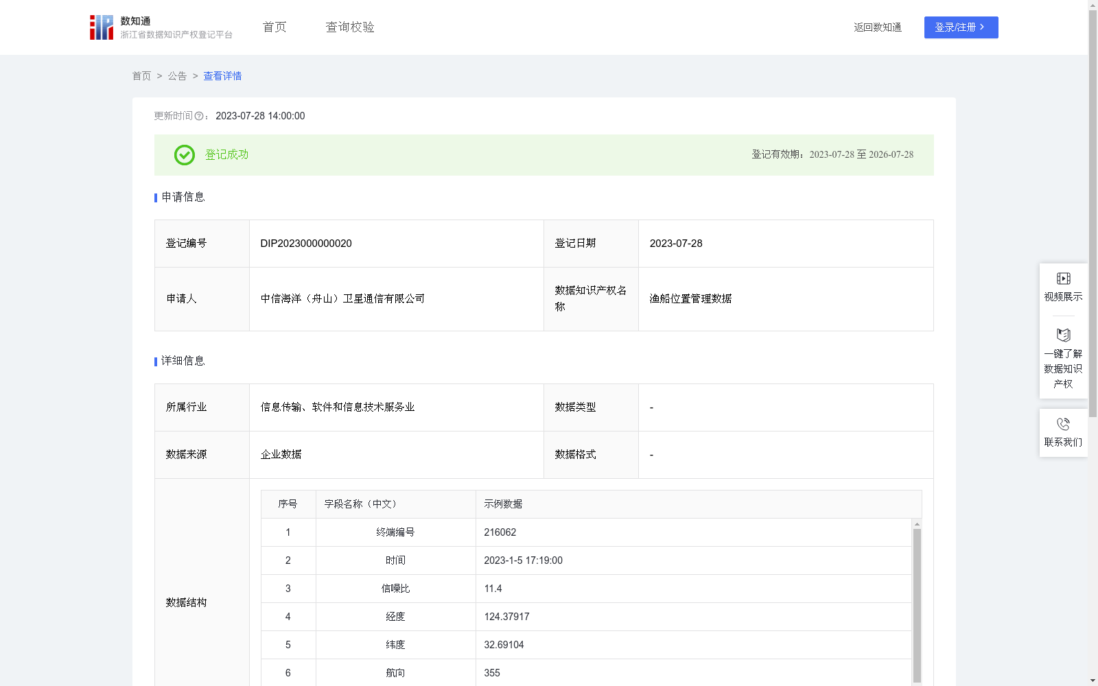
渔船位置管理数据
收藏浙江省数据知识产权登记平台2023-07-28 更新2024-05-08 收录
下载链接:
https://www.zjip.org.cn/home/announce/trends/949
下载链接
链接失效反馈官方服务:
资源简介:
海上卫星通信终端运行数据经卫星通信链路回传,包括卫星终端在线情况、卫星信号SNR值(信噪比)、船只经纬度、船只航行轨迹、航向、航速等,为运维部门提供远程查看与管理卫星通信终端运行情况的手段,协助渔业主管部门管理渔船位置。经纬度:由终端内置北斗模块获取,使用北斗原始数据;
航向、速度:系统在海面应用,设定高程为0,则两个时间点的大地坐标为(lat1, lon1, 0), (lat2, lon2, 0),以(lat1, lon1, 0)为基准位置(即坐标原点),将(lat2, lon2, 0)转换为空间直角坐标(x2, y2, z2),并将(x2, y2, z2)转换为站心坐标系(de, dn, du),则:航速=sqrt(de^2 + dn^2)/(t2-t1),其中:t1和t2为两点时间,真北航向=arctan2(de, dn),若结果<0,则在结果上加上360度;
风浪信息:惯导采集姿态数据,包括方位,俯仰,横滚等,每个数据平方值相加,相加结果开平方,得到相应的风浪数据。
Operating data of maritime satellite communication terminals is transmitted back via satellite communication links, including terminal online status, satellite signal SNR (Signal-to-Noise Ratio) values, vessel longitude and latitude, vessel navigation trajectory, heading, speed, etc. This dataset provides operation and maintenance departments with the means to remotely view and manage the operating status of satellite communication terminals, and assists fisheries authorities in managing the positions of fishing vessels.
Longitude and latitude: Obtained via the built-in Beidou module of the terminal, using original Beidou data;
Heading and speed: For the system applied at sea, the elevation is set to 0. The geodetic coordinates at two time points are (lat1, lon1, 0) and (lat2, lon2, 0). Taking (lat1, lon1, 0) as the reference position (i.e., coordinate origin), (lat2, lon2, 0) is converted to spatial rectangular coordinates (x2, y2, z2), which are then converted to the topocentric coordinate system (de, dn, du). Then:
Ship speed = sqrt(de^2 + dn^2)/(t2 - t1), where t1 and t2 are the times of the two points;
True north heading = arctan2(de, dn). If the result is less than 0, add 360 degrees to the result;
Wind and wave data: Attitude data including azimuth, pitch and roll is collected by the inertial navigation system (INS). The corresponding wind and wave data is obtained by summing the squares of each data point and then taking the square root of the total sum.
提供机构:
中信海洋(舟山)卫星通信有限公司
创建时间:
2023-06-05
搜集汇总
数据集介绍
特点
渔船位置管理数据集包含10001条记录,每日更新,涵盖渔船的终端编号、时间、信噪比、经纬度、航向、航速等信息。数据通过卫星通信链路回传,用于海上卫星通信终端的运维管理和渔业主管部门对渔船位置的监控。
以上内容由遇见数据集搜集并总结生成


