长江中下游主要水文站月均水位数据集(1970-1979年)
收藏国家地球系统科学数据中心2026-02-03 更新2024-03-04 收录
下载链接:
https://www.geodata.cn/data/datadetails.html?dataguid=98453859157745&docId=91
下载链接
链接失效反馈官方服务:
资源简介:
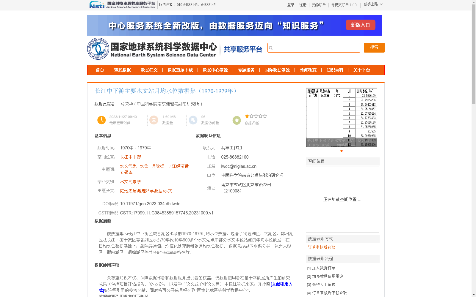
该数据集为长江中下游区域各湖区水系的1970-1979月均水位数据,包含了洞庭湖区、太湖区、鄱阳湖区及长江下游干流区等各湖区水系70年代10年900多个水文站点中部分水文水位站点的年均水位数据,在日均水位数据基础上,剔除异常值,均值化处理后得到月均水位数据。
数据集按湖区水系分类,包含太湖区、鄱阳湖区、洞庭湖区等共分9个excel表格存放。
月数据共享政策至多5年,5个站点 ,且同一个账号一个季度内限一次,请按照共享原则申请。
This dataset contains monthly average water level data of lake basin water systems in the middle and lower reaches of the Yangtze River from 1970 to 1979. It covers monthly average water level data from partial hydrological and water level stations among over 900 hydrological stations across various lake basin water systems including Dongting Lake Basin, Taihu Lake Basin, Poyang Lake Basin and the downstream mainstream area of the Yangtze River during the 1970s. The monthly average water level data was generated from daily average water level data after outlier elimination and averaging processing. The dataset is categorized by lake basin water systems, and stored in 9 Excel files covering Taihu Lake Basin, Poyang Lake Basin, Dongting Lake Basin and other regions. The sharing policy for this monthly data allows a maximum application scope of 5 years and 5 stations per request, with each account limited to one application per quarter. Please apply in accordance with the specified sharing principles.
提供机构:
中国科学院南京地理与湖泊研究所
创建时间:
2023-10-09
搜集汇总
数据集介绍
背景与挑战
背景概述
该数据集包含1970-1979年长江中下游区域各湖区水系的月均水位数据,涵盖洞庭湖区、太湖区、鄱阳湖区及长江下游干流区等900多个水文站点的数据。数据经过异常值剔除和均值化处理,按湖区水系分类存储于9个Excel表格中,质量可靠。
以上内容由遇见数据集搜集并总结生成


