1901-2024年中国1km分辨率逐年干燥度数据集
收藏国家地球系统科学数据中心2025-07-04 更新2024-04-21 收录
下载链接:
https://www.geodata.cn/data/datadetails.html?dataguid=188606016270010&docId=1107
下载链接
链接失效反馈官方服务:
资源简介:
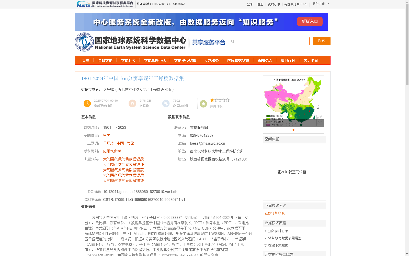
数据集为中国逐年干燥度指数,空间分辨率为0.0083333°(约1km),时间为1901-2024年(每年更新),为比值,没有单位。该数据集是基于中国1km逐月潜在蒸散发(PET)和降水量(PRE),采用比值法计算式得到(年AI =年PET/年PRE)。数据均为single型存于nc(NETCDF)文件中。nc数据可用ArcMAP软件打开制图,并可用Matlab、R软件提取处理。数据坐标系统建议使用WGS84。AI是表征一个地区干湿程度的指标,一般来说,根据AI分类可以概括地把区域分为湿润(AI<1,相当于森林)、半湿润(AI在1-1.5,相当于森林草原)、半干旱(AI在1.5-4,相当于干草原)和干旱地区(AI≥4,相当于荒漠)。详细信息见数据附件中的数据文档。本数据集受到第二次青藏高原综合科学考察研究(2022QZKK0101)和国家自然科学基金项目(U2243226、42077451)的联合资助。
This dataset contains the annual aridity index over China, with a spatial resolution of 0.0083333° (approximately 1 km), spanning the period from 1901 to 2024 and updated annually. It is a dimensionless ratio.
This dataset is calculated using the ratio method based on 1-km monthly potential evapotranspiration (PET) and precipitation (PRE) data over China, following the formula: annual AI = annual PET / annual PRE.
All data are stored as single-precision floating-point numbers in NETCDF (.nc) files. The nc files can be opened and mapped using ArcMap, and extracted or processed with Matlab or R software. The recommended coordinate system for the data is WGS84.
AI is an indicator characterizing the dry-wet condition of a region. Generally, regions can be broadly classified based on AI values: humid regions (AI < 1, corresponding to forests), sub-humid regions (1 ≤ AI < 1.5, corresponding to forest-steppes), semi-arid regions (1.5 ≤ AI < 4, corresponding to dry steppes), and arid regions (AI ≥ 4, corresponding to deserts).
For detailed information, please refer to the data documentation attached with this dataset.
This dataset was jointly funded by the Second Tibetan Plateau Scientific Expedition and Research Program (Grant No. 2022QZKK0101) and the National Natural Science Foundation of China (Grant Nos. U2243226, 42077451).
提供机构:
西北农林科技大学水土保持研究所
创建时间:
2023-07-11
搜集汇总
数据集介绍
背景与挑战
背景概述
该数据集是中国逐年干燥度指数数据集,空间分辨率约为1公里,时间覆盖1901年至2024年(每年更新),数据以NETCDF格式存储,采用WGS84坐标系统。数据集基于潜在蒸散发和降水量通过比值法计算得到,干燥度指数用于量化地区干湿程度,支持气象、生态和气候研究。
以上内容由遇见数据集搜集并总结生成


