HiWATER: Dataset of hydrometeorological observation network (automatic weather station of Huazhaizi desert steppe station, 2015)
收藏data.tpdc.ac.cn2025-01-15 收录
下载链接:
https://data.tpdc.ac.cn/en/data/98e1adbd-395e-4dba-a6e8-cf4185afe513
下载链接
链接失效反馈官方服务:
资源简介:
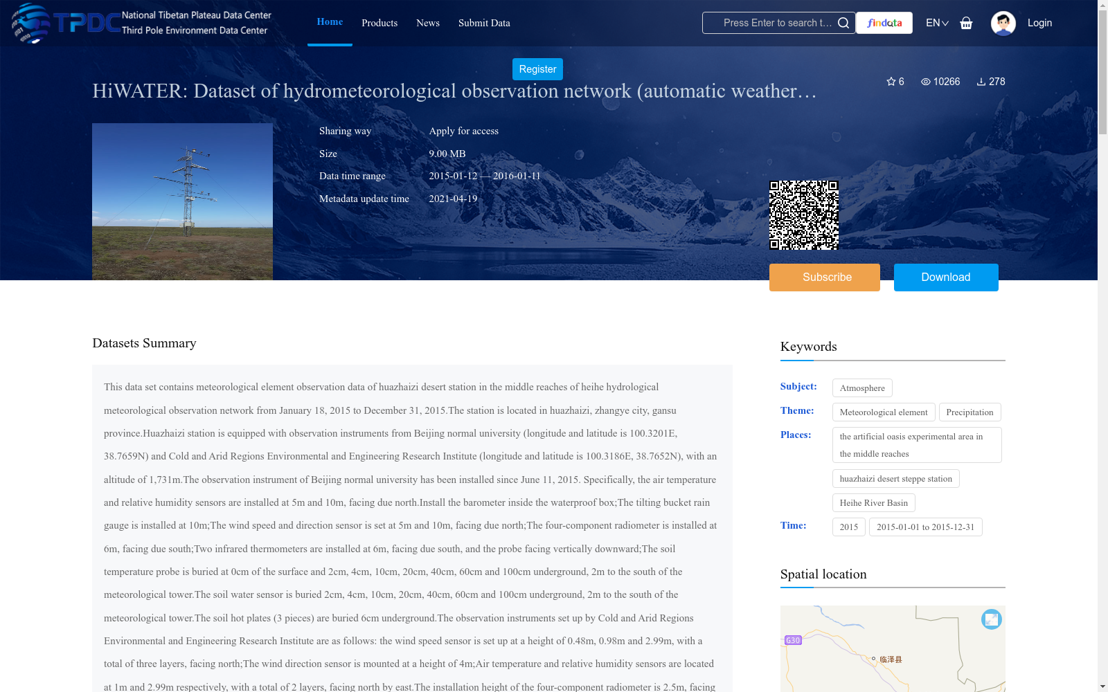
This data set contains meteorological element observation data of huazhaizi desert station in the middle reaches of heihe hydrological meteorological observation network from January 18, 2015 to December 31, 2015.The station is located in huazhaizi, zhangye city, gansu province.Huazhaizi station is equipped with observation instruments from Beijing normal university (longitude and latitude is 100.3201E, 38.7659N) and Cold and Arid Regions Environmental and Engineering Research Institute (longitude and latitude is 100.3186E, 38.7652N), with an altitude of 1,731m.The observation instrument of Beijing normal university has been installed since June 11, 2015. Specifically, the air temperature and relative humidity sensors are installed at 5m and 10m, facing due north.Install the barometer inside the waterproof box;The tilting bucket rain gauge is installed at 10m;The wind speed and direction sensor is set at 5m and 10m, facing due north;The four-component radiometer is installed at 6m, facing due south;Two infrared thermometers are installed at 6m, facing due south, and the probe facing vertically downward;The soil temperature probe is buried at 0cm of the surface and 2cm, 4cm, 10cm, 20cm, 40cm, 60cm and 100cm underground, 2m to the south of the meteorological tower.The soil water sensor is buried 2cm, 4cm, 10cm, 20cm, 40cm, 60cm and 100cm underground, 2m to the south of the meteorological tower.The soil hot plates (3 pieces) are buried 6cm underground.The observation instruments set up by Cold and Arid Regions Environmental and Engineering Research Institute are as follows: the wind speed sensor is set up at a height of 0.48m, 0.98m and 2.99m, with a total of three layers, facing north;The wind direction sensor is mounted at a height of 4m;Air temperature and relative humidity sensors are located at 1m and 2.99m respectively, with a total of 2 layers, facing north by east.The installation height of the four-component radiometer is 2.5m, facing due south;The air pressure sensor is placed in the waterproof box;The installation height of the tilting bucket rain gauge is 0.7m;The soil temperature probe is buried at depths of 4cm, 10cm, 18cm, 26cm, 34cm, 42cm and 50cm underground.The soil moisture sensors were buried underground 2cm, 10cm, 18cm, 26cm, 34cm, 42cm, 50cm and 58cm, respectively, with 3 repetitions buried in 2cm.Specific observation items are as follows:(1) observation items of Beijing normal university : air temperature and humidity (Ta_5m RH_5m Ta_10m, RH_10m) (unit: c, percentage), pressure (Press) (unit: hundred mpa), precipitation (Rain) (unit: mm), wind speed (WS_5m, WS_10m) (unit: m/s), wind (WD_10m) (unit: degrees), the radiation of four component (DR, UR, DLR_Cor, ULR_Cor, Rn) (unit:Watts/m2), surface radiant temperature (IRT_1, IRT_2) (unit: Celsius), soil heat flux (Gs_1, Gs_2, Gs_3) (unit: watts/m2), soil moisture (Ms_2cm, Ms_4cm, Ms_10cm, Ms_20cm, Ms_40cm, Ms_60cm, Ms_100cm) (unit:Volume moisture content, percentage) and soil temperature (Ts_0cm, Ts_2cm, Ts_4cm, Ts_10cm, Ts_20cm, Ts_40cm, Ts_60cm, Ts_100cm) (unit: Celsius).(2) observation items of Cold and Arid Regions Environmental and Engineering Research Institute : wind speed (WS_0. 48 m, WS_0. 98 m, WS_2. 99 m) (unit: m/s), wind (WD_4m) (unit: degrees), the radiation of four component (DR, UR, DLR_Cor, ULR_Cor) (unit: watts per square meter), air temperature and humidity (Ta_1m, Ta_2. 99 m, RH_1m, RH_2 99 m) (unit: c, percentage), pressure (Press) (unit: hundred mpa), precipitation (Rain) (unit:Mm), soil temperature (Ts_4cm, Ts_10cm, Ts_18cm, Ts_26cm, Ts_34cm, Ts_42cm, Ts_50cm) (unit: Celsius), soil moisture (Ms_2cm_1, Ms_2cm_2, Ms_2cm_3, Ms_10cm, Ms_18cm, Ms_26cm, Ms_34cm, Ms_42cm, Ms_50cm, Ms_58cm) (unit: volumetric water content, percentage).The observed elements of Beijing normal university were the mean value of 10min, and those of Cold and Arid Regions Environmental and Engineering Research Institute were the mean value of 30min.Processing and quality control of observation data :(1) ensure 144 observation data elements of Beijing normal university every day (every 10min); Ensure the observed elements of Cold and Arid Regions Environmental and Engineering Research Institute are 48 data per day (every 30min). If the data is missing, it will be marked by -6999.Due to the problem of the wind speed sensor, the 10m wind speed observed by Beijing normal university was missing between June 21-7.09, 2015 and December 16-12.25.Due to the problem of data storage, the precipitation observed by Cold and Arid Regions Environmental and Engineering Research Institute is missing between 1.18 and 1.22.(2) excluding the time with duplicate records;(3) data that obviously exceeds the physical significance or the range of the instrument is deleted;(4) the part marked with red letter in the data is the data in question;(5) date and time have the same format, and date and time are in the same column.For example, the time is: June 10, 2015, 10:30;(
本数据集收录了黑河水文气象观测网络中花寨子沙漠站自2015年1月18日至2015年12月31日的气象要素观测数据。该站位于甘肃省张掖市花寨子,配备有来自北京师范大学(经纬度:100.3201E, 38.7659N)和寒区旱区环境与工程研究所(经纬度:100.3186E, 38.7652N)的观测仪器,海拔高度为1,731米。北京师范大学的观测仪器自2015年6月11日起安装。具体而言,空气温度和相对湿度传感器分别安装在5米和10米处,朝正北方向;气压计安装在防水箱内;倾斜式雨量计安装在10米处;风速和风向传感器设置在5米和10米处,朝正北方向;四分量辐射计安装在6米处,朝正南方向;两台红外温度计安装在6米处,朝正南方向,探头垂直向下;土壤温度探头埋设在地面0厘米、地下2厘米、4厘米、10厘米、20厘米、40厘米、60厘米和100厘米处,距离气象塔南2米处。土壤水分传感器埋设在地下2厘米、4厘米、10厘米、20厘米、40厘米、60厘米和100厘米处,距离气象塔南2米处。土壤加热板(3块)埋设在地下6厘米处。寒区旱区环境与工程研究所设置的观测仪器如下:风速传感器设置在0.48米、0.98米和2.99米的高度,共分为三层,朝北方向;风向传感器安装在4米高度;空气温度和相对湿度传感器分别位于1米和2.99米处,共分为两层,朝北偏东方向;四分量辐射计的安装高度为2.5米,朝正南方向;气压传感器放置在防水箱内;倾斜式雨量计的安装高度为0.7米;土壤温度探头埋设在地下4厘米、10厘米、18厘米、26厘米、34厘米、42厘米和50厘米处。土壤水分传感器分别埋设在地下2厘米、10厘米、18厘米、26厘米、34厘米、42厘米、50厘米和58厘米处,其中2厘米深处重复埋设3次。具体的观测项目包括:(1)北京师范大学的观测项目:空气温度和湿度(Ta_5m, RH_5m, Ta_10m, RH_10m)(单位:摄氏度,百分比)、气压(Press)(单位:百帕)、降水量(Rain)(单位:毫米)、风速(WS_5m, WS_10m)(单位:米/秒)、风向(WD_10m)(单位:度)、四分量辐射(DR, UR, DLR_Cor, ULR_Cor, Rn)(单位:瓦特/平方米)、地表辐射温度(IRT_1, IRT_2)(单位:摄氏度)、土壤热通量(Gs_1, Gs_2, Gs_3)(单位:瓦特/平方米)、土壤水分(Ms_2cm, Ms_4cm, Ms_10cm, Ms_20cm, Ms_40cm, Ms_60cm, Ms_100cm)(单位:体积水分含量,百分比)和土壤温度(Ts_0cm, Ts_2cm, Ts_4cm, Ts_10cm, Ts_20cm, Ts_40cm, Ts_60cm, Ts_100cm)(单位:摄氏度)。(2)寒区旱区环境与工程研究所的观测项目:风速(WS_0.48m, WS_0.98m, WS_2.99m)(单位:米/秒)、风向(WD_4m)(单位:度)、四分量辐射(DR, UR, DLR_Cor, ULR_Cor)(单位:每平方米瓦特)、空气温度和湿度(Ta_1m, Ta_2.99m, RH_1m, RH_2.99m)(单位:摄氏度,百分比)、气压(Press)(单位:百帕)、降水量(Rain)(单位:毫米)、土壤温度(Ts_4cm, Ts_10cm, Ts_18cm, Ts_26cm, Ts_34cm, Ts_42cm, Ts_50cm)(单位:摄氏度)、土壤水分(Ms_2cm_1, Ms_2cm_2, Ms_2cm_3, Ms_10cm, Ms_18cm, Ms_26cm, Ms_34cm, Ms_42cm, Ms_50cm, Ms_58cm)(单位:体积水分含量,百分比)。北京师范大学观测的要素为10分钟的平均值,而寒区旱区环境与工程研究所观测的要素为30分钟的平均值。观测数据的处理与质量控制:(1)确保北京师范大学每天(每10分钟)有144个观测数据元素;(2)确保寒区旱区环境与工程研究所每天(每30分钟)有48个观测数据元素。如果数据缺失,则标记为-6999。由于风速传感器的故障,北京师范大学在2015年6月21日至7月9日和12月16日至12月25日期间缺失了10米处的风速观测数据。由于数据存储问题,寒区旱区环境与工程研究所在1月18日至1月22日期间缺失了降水量观测数据。(3)排除重复记录的时间;(4)删除明显超出物理意义或仪器量程范围的数据;(5)数据中用红字标注的部分为可疑数据;(6)日期和时间格式相同,且位于同一列。例如,时间为:2015年6月10日,10:30;
提供机构:
TPDC
搜集汇总
数据集介绍
背景与挑战
背景概述
该数据集包含2015年花寨子荒漠站的气象和土壤要素观测数据,由两个机构的仪器采集,时间分辨率为10分钟和30分钟平均值,数据经过质量控制,部分时间段存在缺失。
以上内容由遇见数据集搜集并总结生成


