藏东南地区边界、地形数据(2000)
收藏国家青藏高原科学数据中心2022-04-06 更新2024-03-01 收录
下载链接:
https://data.tpdc.ac.cn/zh-hans/data/02ee6fee-a320-4af0-b199-4790c37101f2
下载链接
链接失效反馈官方服务:
资源简介:
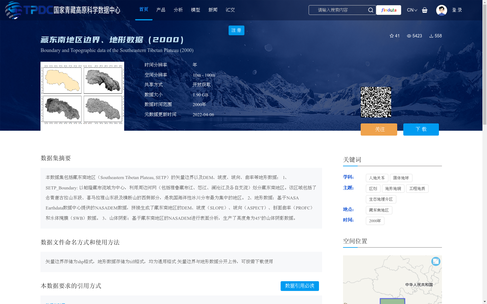
本数据集包括藏东南地区(Southeastern Tibetan Plateau, SETP)的矢量边界以及DEM、坡度、坡向、曲率等地形数据:
1、SETP_Boundary: 以帕隆藏布流域为中心,利用周边河网(包括雅鲁藏布江、怒江、澜沧江及各自支流)划分藏东南地区。该区域包括了念青唐古拉山东段、喜马拉雅山东段及横断山的西侧部分,是我国海洋性冰川分布最为集中的地区。
2、地形数据:基于NASA Earthdata数据中心提供的NASADEM数据,拼接生成了藏东南地区的DEM、坡度(SLOPE)、坡向(ASPECT)、剖面曲率(PROFC)和水体掩膜(SWB)数据。
3、山体阴影:基于藏东南地区的NASADEM进行表面分析,生产了高度角为45°的山体阴影数据。
This dataset contains the vector boundary of the Southeastern Tibetan Plateau (SETP) and topographic data including DEM, slope, aspect, curvature and others:
1. SETP_Boundary: Centered on the Parlung Tsangpo River Basin, the Southeastern Tibetan Plateau is delineated using surrounding river networks including the Yarlung Zangbo River, Nu River, Lancang River and their respective tributaries. This region covers the eastern section of the Nyainqentanglha Mountains, the eastern section of the Himalayas and the western part of the Hengduan Mountains, and is the most concentrated area for maritime glacier distribution in China.
2. Topographic data: Based on the NASADEM data provided by the NASA Earthdata Data Center, the DEM, slope (SLOPE), aspect (ASPECT), profile curvature (PROFC) and water body mask (SWB) data of the Southeastern Tibetan Plateau are mosaicked and generated.
3. Hillshade data: Surface analysis is conducted based on the NASADEM of the Southeastern Tibetan Plateau, and the hillshade data with an altitude angle of 45° is produced.
提供机构:
赵凡玉,龙笛,李兴东,黄琦,韩鹏飞
创建时间:
2022-03-28
搜集汇总
数据集介绍
背景与挑战
背景概述
该数据集提供了2000年藏东南地区的矢量边界和地形数据,包括DEM、坡度、坡向、曲率及山体阴影等,空间分辨率为10米至100米,数据大小为1.90 GB。它基于NASADEM数据生成,覆盖念青唐古拉山、喜马拉雅山东段等区域,是我国海洋性冰川集中区,适用于地理、地质和生态研究。
以上内容由遇见数据集搜集并总结生成


