2010年中国区域TM-30m土地利用分类样本数据集
收藏地球大数据科学工程2024-03-04 收录
下载链接:
https://data.casearth.cn/sdo/detail/636e17ec819aec5df66b51ff
下载链接
链接失效反馈官方服务:
资源简介:
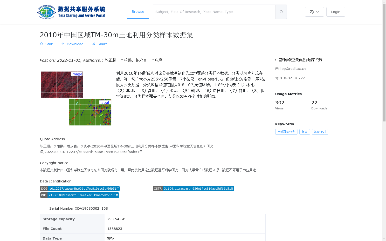
利用2010年TM影像和对应分类数据制作的土地覆盖分类样本数据。分类以切片方式存储,每一切片大小为256×256像素,7个波段,envi bsq格式。前6波段为影像,第7波段为分类数据,分类数据取值范围为0-8,0为无值区域,1-8分别代表(1)林地、(2)草地、(3)湿地、(4)水体、(5)耕地、(6)居民地、(7)裸地、(8)积雪等8类。分类样本覆盖全国,部分区域有多个时相的影像。
This land cover classification sample dataset was developed using 2010 TM imagery and its corresponding classification data. All samples are stored as slices, with each slice measuring 256×256 pixels and containing 7 bands, saved in ENVI BSQ format. The first 6 bands are image data, while the 7th band holds the classification labels. The values of the classification data range from 0 to 8, where 0 represents no-data regions, and values 1 through 8 respectively correspond to 8 land cover categories: (1) forest, (2) grassland, (3) wetland, (4) water body, (5) cropland, (6) residential area, (7) bare land, and (8) snow cover. The dataset covers the entire territory of China, with multi-temporal images available for some regions.
提供机构:
中国科学院空天信息创新研究院
搜集汇总
数据集介绍
背景与挑战
背景概述
该数据集是基于2010年TM影像制作的中国区域土地利用分类样本数据,以256×256像素的切片形式存储,包含7个波段(前6个为影像波段,第7个为分类数据),分类值覆盖林地、草地、湿地等8类地物。数据集具有30米空间分辨率,覆盖全国范围,部分区域提供多时相影像,总存储容量达290.54 GB,适用于土地覆盖分类和深度学习等科学研究。
以上内容由遇见数据集搜集并总结生成


