中国1km2以上湖泊透明度遥感反演数据集(1986-2020年)
收藏国家地球系统科学数据中心2024-09-03 更新2024-03-04 收录
下载链接:
https://www.geodata.cn/data/datadetails.html?dataguid=190771186626659&docId=2719
下载链接
链接失效反馈官方服务:
资源简介:
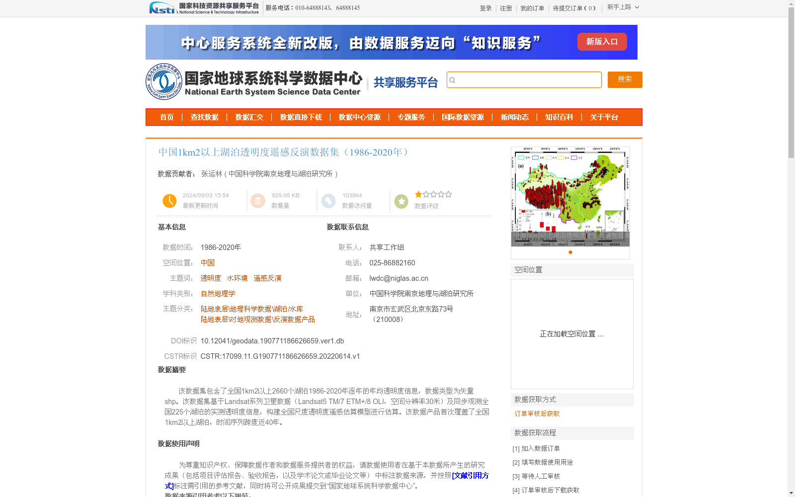
该数据集包含了全国1km2以上2660个湖泊1986-2020年逐年的年均透明度信息,数据类型为矢量shp。该数据集基于Landsat系列卫星数据(Landsat5 TM/7 ETM+/8 OLI,空间分辨率30米)及同步观测全国225个湖泊的实测透明度信息,构建全国尺度透明度遥感估算模型进行估算。该数据产品首次覆盖了全国1km2以上湖泊,时间序列跨度近40年。
This dataset contains annual average transparency data for each year from 1986 to 2020 of 2660 lakes across China with an area of 1 km² or larger, and the data format is vector shapefile (SHP). This dataset was developed by constructing a national-scale remote sensing estimation model for lake transparency, which is based on Landsat series satellite data (Landsat 5 TM/7 ETM+/8 OLI, with a spatial resolution of 30 meters) and synchronous in-situ transparency measurements of 225 lakes across China. This data product is the first to cover all lakes in China with an area of 1 km² or larger, with a time series spanning nearly 40 years.
提供机构:
中国科学院南京地理与湖泊研究所
创建时间:
2022-06-14
搜集汇总
数据集介绍
背景与挑战
背景概述
该数据集是中国范围内面积1平方公里以上的2660个湖泊在1986年至2020年期间的逐年平均透明度遥感反演产品,数据格式为矢量shp。其特点是首次实现了全国尺度湖泊透明度的近40年长时间序列覆盖,基于Landsat系列卫星影像和同步实测数据构建模型生成,空间分辨率为30米,数据质量经过学术期刊验证,适用于水环境、自然地理学等相关研究。
以上内容由遇见数据集搜集并总结生成


