城市热污染监测服务
收藏郑州数据交易中心2023-10-31 更新2024-10-10 收录
下载链接:
https://market.zzbdex.com/trade/service/1719185902065586177
下载链接
链接失效反馈官方服务:
资源简介:
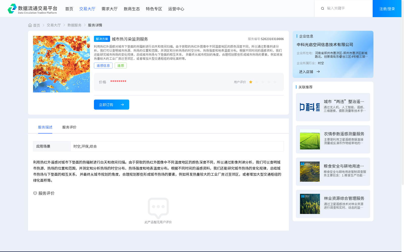
利用热红外遥感对城市下垫面的热辐射进行白天和夜间扫描。由于获取的热红外图像中不同温度地区的颜色深度不同,所以通过影像判读分析,我们可以查明城市热源、热场的位置和范围,并测定和分析热场的时空分布、热场强度和地表温度分布。根据不同时间的遥感资料,我们还能研究城市热场的变化规律,总结城市热场与下垫面的相互关系, 并最终从城市规划的角度,合理规划那些形成城市热场的要素,例如将发热量较大的工业厂房迁至郊区,或者增加大型交通枢纽的绿化面积等。
Thermal infrared remote sensing is employed to scan the thermal radiation of urban underlying surfaces during both daytime and nighttime. Since the grayscale intensity varies across regions with different temperatures in the acquired thermal infrared images, the locations and extents of urban heat sources and thermal fields can be identified, and the spatiotemporal distribution, intensity of the thermal field, as well as the surface temperature distribution can be measured and analyzed through image interpretation and analysis. Based on remote sensing data collected at different time points, we can also study the variation laws of urban thermal fields, summarize the interactive relationship between urban thermal fields and underlying surfaces, and ultimately rationally plan the factors contributing to the formation of urban thermal fields from the perspective of urban planning—for example, relocating high-heat-emitting industrial plants to suburban areas, or increasing the green space area of large transportation hubs, and so on.
提供机构:
中科光启空间信息技术有限公司
创建时间:
2023-10-31
搜集汇总
数据集介绍
背景与挑战
背景概述
该数据集提供城市热污染监测服务,利用热红外遥感技术分析城市热场分布和变化规律,为城市规划提供科学依据。
以上内容由遇见数据集搜集并总结生成


