Dai干旱指数
收藏地球大数据科学工程2024-03-04 收录
下载链接:
https://data.casearth.cn/sdo/detail/653fb1dc819aec161b7f021f
下载链接
链接失效反馈官方服务:
资源简介:
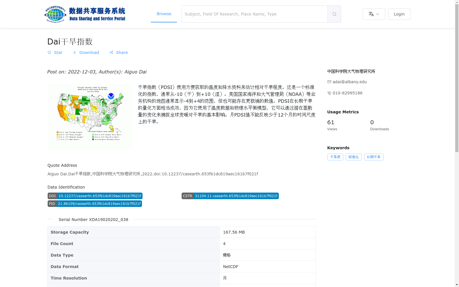
干旱指数(PDSI)使用方便获取的温度和降水资料来估计相对干旱程度。这是一个标准化的指数,通常从-10(干)到+10(湿)。美国国家海洋和大气管理局(NOAA)等业务机构的地图通常显示-4到+4的范围,但也可能存在更极端的数值。PDSI在长期干旱的量化方面相当成功,因为它使用了温度数据和物理水平衡模型,它可以通过潜在蒸散量的变化来捕捉全球变暖对干旱的基本影响。月PDSI值不能反映少于12个月的时间尺度上的干旱。
The Palmer Drought Severity Index (PDSI) uses readily accessible temperature and precipitation data to estimate relative drought severity. As a standardized index, it generally ranges from -10 (dry) to +10 (wet). Maps from operational agencies such as the U.S. National Oceanic and Atmospheric Administration (NOAA) typically display a range of -4 to +4, though more extreme values may also exist. PDSI has achieved considerable success in quantifying long-term droughts, as it incorporates temperature data and physical water balance models, and can capture the fundamental impacts of global warming on drought through changes in potential evapotranspiration. Monthly PDSI values cannot reflect drought on timescales shorter than 12 months.
提供机构:
中国科学院大气物理研究所
搜集汇总
数据集介绍
背景与挑战
背景概述
该数据集提供全球范围的月尺度干旱指数(PDSI)数据,基于温度和降水资料计算,用于量化长期干旱程度并反映全球变暖的影响。数据以NetCDF栅格格式存储,空间分辨率为2.5°,适用于气候分析和干旱监测研究。
以上内容由遇见数据集搜集并总结生成


