西风-季风协同作用区地气相互作用关键地表特征参数数据集(2019-2022)
收藏国家青藏高原科学数据中心2025-03-25 更新2025-03-22 收录
下载链接:
https://data.tpdc.ac.cn/zh-hans/data/b654c132-e491-4e9e-b168-e70a82b7f7bc
下载链接
链接失效反馈官方服务:
资源简介:
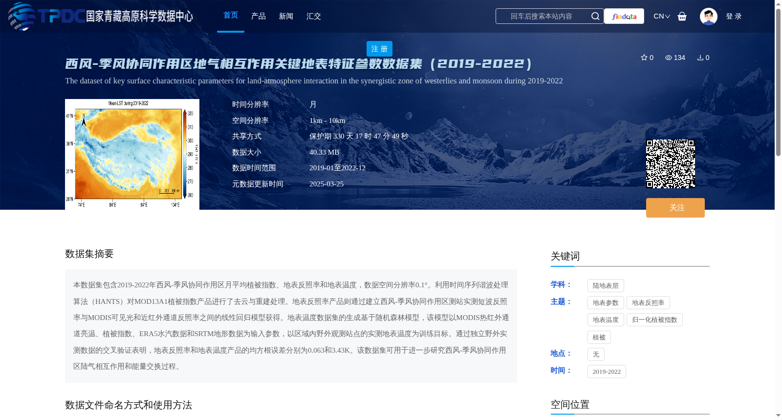
本数据集包含2019-2022年西风-季风协同作用区月平均植被指数、地表反照率和地表温度,数据空间分辨率0.1°。利用时间序列谐波处理算法(HANTS)对MOD13A1植被指数产品进行了去云与重建处理。地表反照率产品则通过建立西风-季风协同作用区测站实测短波反照率与MODIS可见光和近红外通道反照率之间的线性回归模型获得。地表温度数据集的生成基于随机森林模型,该模型以MODIS热红外通道亮温、植被指数、ERA5水汽数据和SRTM地形数据为输入参数,以区域内野外观测站点的实测地表温度为训练目标。通过独立野外实测数据的交叉验证表明,地表反照率和地表温度产品的均方根误差分别为0.063和3.43K。该数据集可用于进一步研究西风-季风协同作用区陆气相互作用和能量交换过程。
This dataset contains monthly averaged vegetation index, surface albedo and surface temperature in the westerly-monsoon interaction region from 2019 to 2022, with a spatial resolution of 0.1°. The MOD13A1 vegetation index product was processed for cloud removal and reconstruction using the Harmonic Analysis of Time Series (HANTS) algorithm. The surface albedo product was developed by establishing a linear regression model between the in-situ shortwave albedo measured by stations in the westerly-monsoon interaction region and the albedo of MODIS visible and near-infrared bands. The surface temperature dataset was generated based on a random forest model, which took MODIS thermal infrared channel brightness temperature, vegetation index, ERA5 water vapor data and SRTM topographic data as input parameters, and used the in-situ surface temperature measured by field observation stations in the region as the training target. Cross-validation using independent field measurement data showed that the root mean square errors (RMSE) of the surface albedo and surface temperature products were 0.063 and 3.43 K, respectively. This dataset can be used for further research on land-atmosphere interaction and energy exchange processes in the westerly-monsoon interaction region.
提供机构:
仲雷,王显
创建时间:
2025-03-07
搜集汇总
数据集介绍
背景与挑战
背景概述
该数据集包含2019-2022年西风-季风协同作用区的月平均植被指数、地表反照率和地表温度数据,空间分辨率为0.1°,采用多种先进算法处理,并经过交叉验证,数据质量可靠,适用于陆气相互作用和能量交换过程研究。
以上内容由遇见数据集搜集并总结生成


