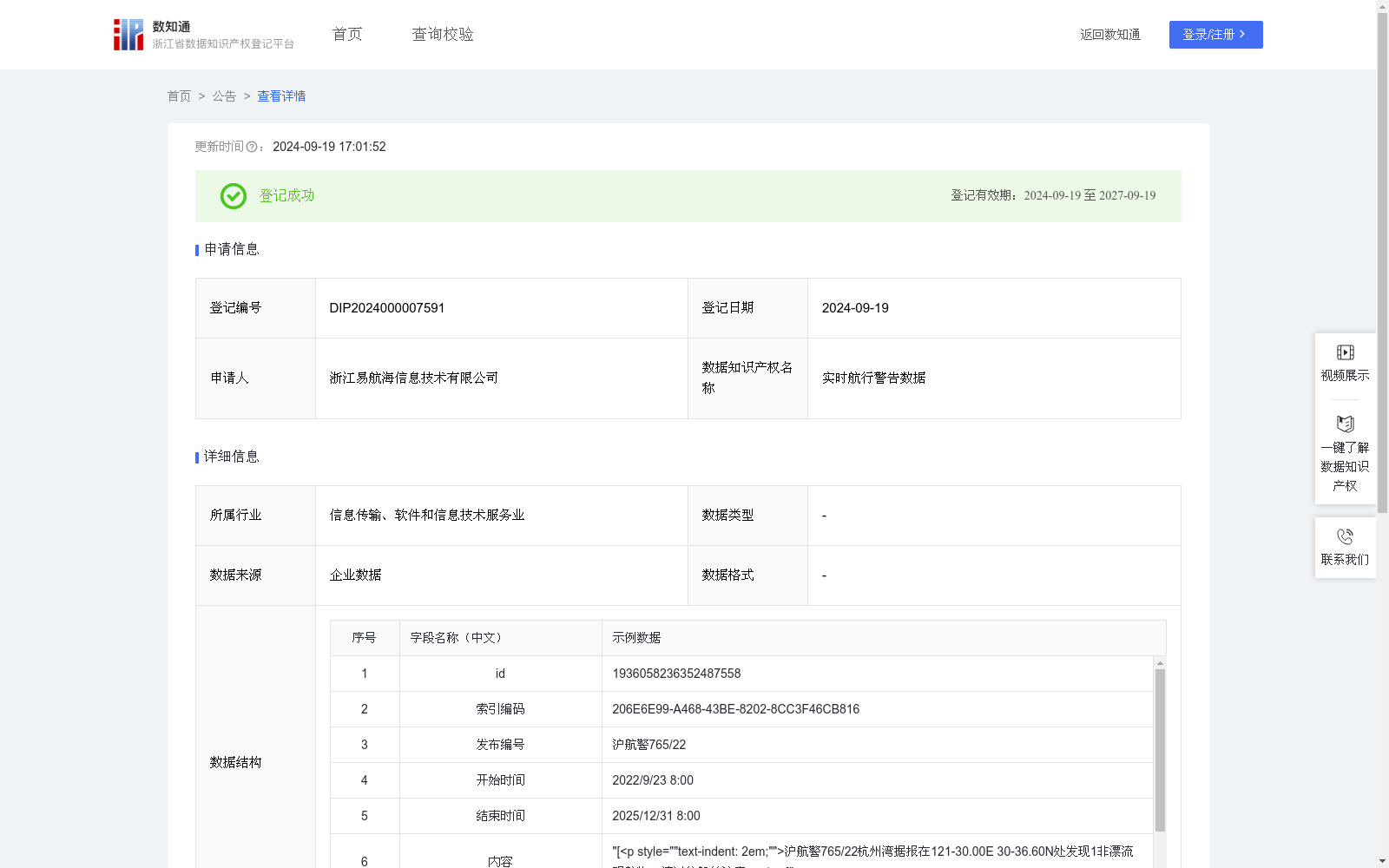
实时航行警告数据
收藏浙江省数据知识产权登记平台2024-09-19 更新2024-09-21 收录
下载链接:
https://www.zjip.org.cn/home/announce/trends/63059
下载链接
链接失效反馈资源简介:
航行警告数据集成了军事演习、水上水下作业、交通管制、沉船沉锚等信息。通过将航行警告数据可视化,在电子海图上以多边形图形标注航行警告区域范围,在电子海图上点击可视化区域查看航行警告详情或通过查询功能搜索警告信息。数据采集:通过海事局公告获取航行警告内容和地理位置。 数据处理:对原始地理位置数据进行可视化处理,数据存储为WKT格式。WKT格式由两部分组成,一部分描述空间几何对象的类型和坐标系信息(例:LINESTRING (x1 y1, x2 y2, ..., xn yn)),另一部分则是空间几何对象的坐标点的序列,系统通过坐标类型的枚举匹配识别出当前WKT的对象类型(几 何 位 置 类 型 点 1 、线 2 、 面 3 、 多点4 、 多 线为5 、多面为6),然后根据对象类型对其包含的空间信息进行二次处理,根据点、线、面、多线、多面等情况进行处理后生成经纬度列表数据。按照数据类型,存储相关属性至数据后台,在我司后台上进行点位绘制,绘制几何图形同步到电子海图中。
The navigation warning dataset integrates information including military exercises, surface and subsurface operations, traffic control, sunken vessels and dropped anchors, among others. By visualizing the navigation warning data, the scope of navigation warning areas is marked with polygonal graphics on electronic navigational charts (ENCs). Users can either click on the visualized areas on the ENCs to view detailed navigation warning information, or search for warning messages through the built-in query function.
Data Collection: The content and geographic coordinates of navigation warnings are acquired from official announcements issued by maritime administrations.
Data Processing: Visualization processing is conducted on the original geographic coordinate data, which is subsequently stored in the Well-Known Text (WKT) format. The WKT format comprises two components: one part specifies the type of spatial geometric object and coordinate system information (e.g., LINESTRING (x1 y1, x2 y2, ..., xn yn)), while the other part consists of the coordinate point sequence of the spatial geometric object. The system identifies the object type of the current WKT via enumeration matching of coordinate types, where the geographic position types are defined as: point (1), line (2), polygon (3), multi-point (4), multi-line (5), and multi-polygon (6). Secondary processing is then performed on the contained spatial information based on the identified object type, and longitude-latitude list data is generated after handling cases such as points, lines, polygons, multi-lines and multi-polygons.
Relevant attributes are stored in the company's data backend according to the data type. Point plotting is carried out on our company's backend, and the generated geometric graphics are synchronized to the electronic navigational charts.
提供机构:
浙江易航海信息技术有限公司
创建时间:
2024-09-03
搜集汇总
数据集介绍
特点
该数据集为实时航行警告数据,包含756条记录,每日更新,主要应用于航行警告的可视化展示。数据来源于海事局公告,经过处理后以WKT格式存储,用于电子海图上的图形标注和查询。
以上内容由遇见数据集搜集并总结生成


