祁连山“山水林田湖草”的空间分布遥感反演数据集(1985-2020)
收藏国家青藏高原科学数据中心2022-06-19 更新2024-03-01 收录
下载链接:
https://data.tpdc.ac.cn/zh-hans/data/8421829f-5a34-4c18-bdec-958267898968
下载链接
链接失效反馈官方服务:
资源简介:
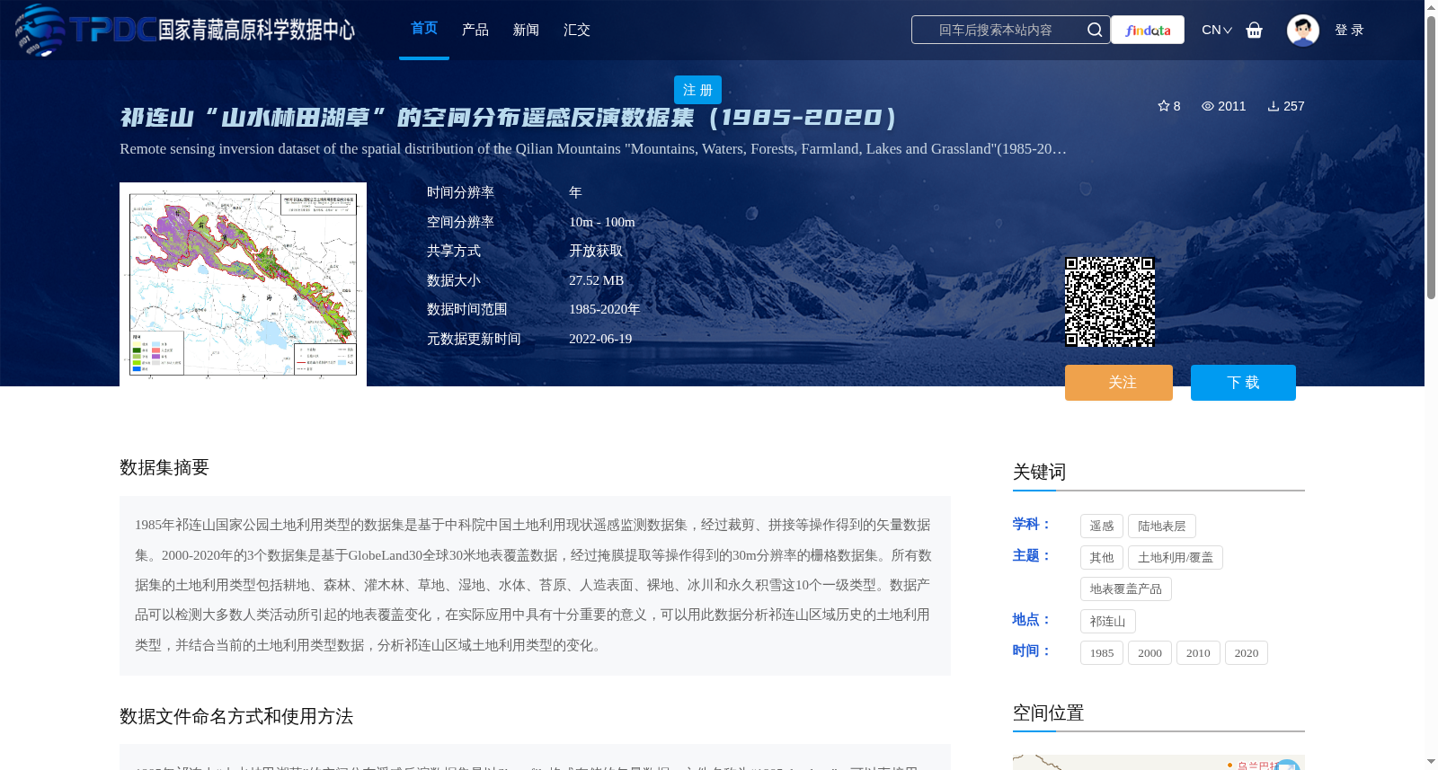
1985年祁连山国家公园土地利用类型的数据集是基于中科院中国土地利用现状遥感监测数据集,经过裁剪、拼接等操作得到的矢量数据集。2000-2020年的3个数据集是基于GlobeLand30全球30米地表覆盖数据,经过掩膜提取等操作得到的30m分辨率的栅格数据集。所有数据集的土地利用类型包括耕地、森林、灌木林、草地、湿地、水体、苔原、人造表面、裸地、冰川和永久积雪这10个一级类型。数据产品可以检测大多数人类活动所引起的地表覆盖变化,在实际应用中具有十分重要的意义,可以用此数据分析祁连山区域历史的土地利用类型,并结合当前的土地利用类型数据,分析祁连山区域土地利用类型的变化。
The 1985 land use type dataset for the Qilian Mountain National Park is a vector dataset derived from the Chinese Academy of Sciences (CAS) Remote Sensing Monitoring Dataset of Current Land Use in China via processing steps including cropping and mosaicking. The three datasets covering the years 2000 to 2020 are 30-meter resolution raster datasets generated from the GlobeLand30 global 30-meter land cover product through operations such as mask extraction. All datasets adopt 10 first-level land use classification categories, including cropland, forest, shrubland, grassland, wetland, water bodies, tundra, artificial surfaces, bare land, glaciers and permanent snow cover. These data products can detect most land cover changes induced by human activities, holding substantial practical significance. They can be utilized to analyze the historical land use patterns in the Qilian Mountain National Park, and combined with current land use type data, to investigate the changes in land use types within this region.
提供机构:
年雁云
创建时间:
2022-06-19
搜集汇总
数据集介绍
背景与挑战
背景概述
该数据集是祁连山国家公园1985-2020年的土地利用类型遥感反演数据,包括耕地、森林等10个一级类型,空间分辨率为10m-100m。1985年为矢量数据,基于中科院土地利用数据集;2000-2020年为栅格数据,基于GlobeLand30。数据集可用于分析祁连山区域土地利用历史变化和人类活动影响,支持环境监测和研究。
以上内容由遇见数据集搜集并总结生成


