青藏高原1000米分辨率植物物种丰富度空间分布数据集(2022年)
收藏国家地球系统科学数据中心2025-11-27 更新2025-12-20 收录
下载链接:
https://www.geodata.cn/data/datadetails.html?dataguid=85327107929424&docId=524
下载链接
链接失效反馈官方服务:
资源简介:
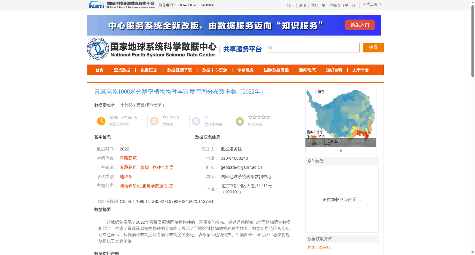
该数据集展示了2022年青藏高原地区植物物种的丰富度空间分布。通过遥感影像与地面植物调查数据相结合,生成了青藏高原植物物种的分布图,展示了不同区域植物的物种种类数量。数据使用色阶从蓝色到红色表示,从低物种丰富度到高物种丰富度的变化。该数据为植物保护、生物多样性研究及生态恢复规划提供了重要依据。
This dataset displays the spatial distribution of plant species richness in the Qinghai-Tibet Plateau region in 2022. The plant species distribution map of the Qinghai-Tibet Plateau was generated by integrating remote sensing imagery and ground-based plant survey data, illustrating the count of plant species across different areas. A color gradient ranging from blue to red is used to represent the transition from low to high species richness. This dataset provides critical evidence for plant conservation, biodiversity research and ecological restoration planning.
提供机构:
西北师范大学
创建时间:
2025-11-27
搜集汇总
数据集介绍
背景与挑战
背景概述
该数据集是2022年青藏高原地区植物物种丰富度的空间分布数据,以1000米分辨率栅格形式呈现,通过遥感影像与地面调查数据结合,并经过空间插值和栅格化处理生成。数据展示了从低到高物种丰富度的空间变化,为植物保护、生物多样性研究和生态恢复规划提供了重要科学依据。
以上内容由遇见数据集搜集并总结生成


