澜沧江-湄公河流域高精度汇流网络数据集(流向、汇流累积、矢量河网)
收藏国家青藏高原科学数据中心2021-05-06 更新2024-03-06 收录
下载链接:
https://data.tpdc.ac.cn/zh-hans/data/512bb48e-d3c7-4964-9578-a4da92af62ad
下载链接
链接失效反馈官方服务:
资源简介:
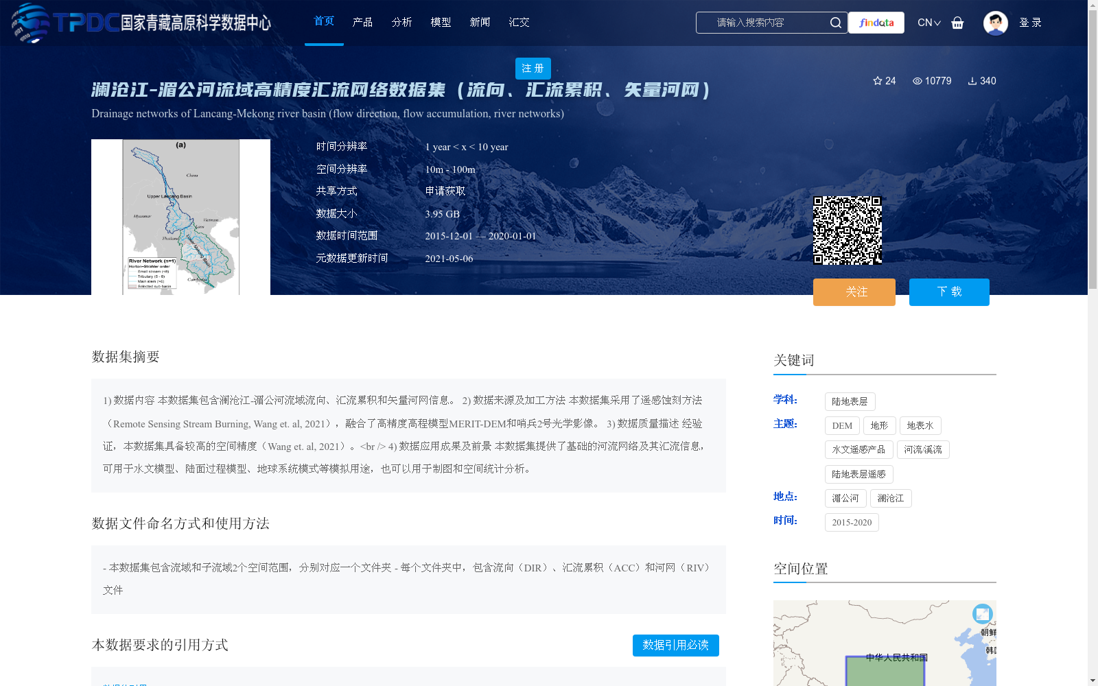
1) 数据内容
本数据集包含澜沧江-湄公河流域流向、汇流累积和矢量河网信息。
2) 数据来源及加工方法
本数据集采用了遥感蚀刻方法(Remote Sensing Stream Burning, Wang et. al, 2021),融合了高精度高程模型MERIT-DEM和哨兵2号光学影像。
3) 数据质量描述
经验证,本数据集具备较高的空间精度(Wang et. al, 2021)。<br />
4) 数据应用成果及前景
本数据集提供了基础的河流网络及其汇流信息,可用于水文模型、陆面过程模型、地球系统模式等模拟用途,也可以用于制图和空间统计分析。
1) Data Content
This dataset contains flow direction, flow accumulation, and vector river network information for the Lancang-Mekong River Basin.
2) Data Source and Processing Method
This dataset adopts the Remote Sensing Stream Burning method (Wang et. al, 2021), and fuses the high-precision elevation model MERIT-DEM and Sentinel-2 optical imagery.
3) Data Quality Description
This dataset has been verified to have high spatial accuracy (Wang et. al, 2021).
4) Data Application Achievements and Prospects
This dataset provides basic river network and flow accumulation information, which can be used for simulations such as hydrological models, land surface process models, and Earth system models, as well as cartography and spatial statistical analysis.
提供机构:
王子丰
创建时间:
2020-12-30
搜集汇总
数据集介绍
背景与挑战
背景概述
该数据集提供了澜沧江-湄公河流域的高精度汇流网络信息,包括流向、汇流累积和矢量河网数据,空间分辨率为10m-100m,时间覆盖2015年至2020年。数据集采用遥感蚀刻方法融合MERIT-DEM和哨兵2号影像,经验证具备较高空间精度,适用于水文模型、陆面过程模拟及空间统计分析等用途。
以上内容由遇见数据集搜集并总结生成


