青藏高原30m空间分辨率光合有效辐射吸收系数FPAR(2013、2018)
收藏国家青藏高原科学数据中心2022-11-15 更新2024-03-01 收录
下载链接:
https://data.tpdc.ac.cn/zh-hans/data/2824ccf2-f911-420f-89c8-881c92f8d466
下载链接
链接失效反馈官方服务:
资源简介:
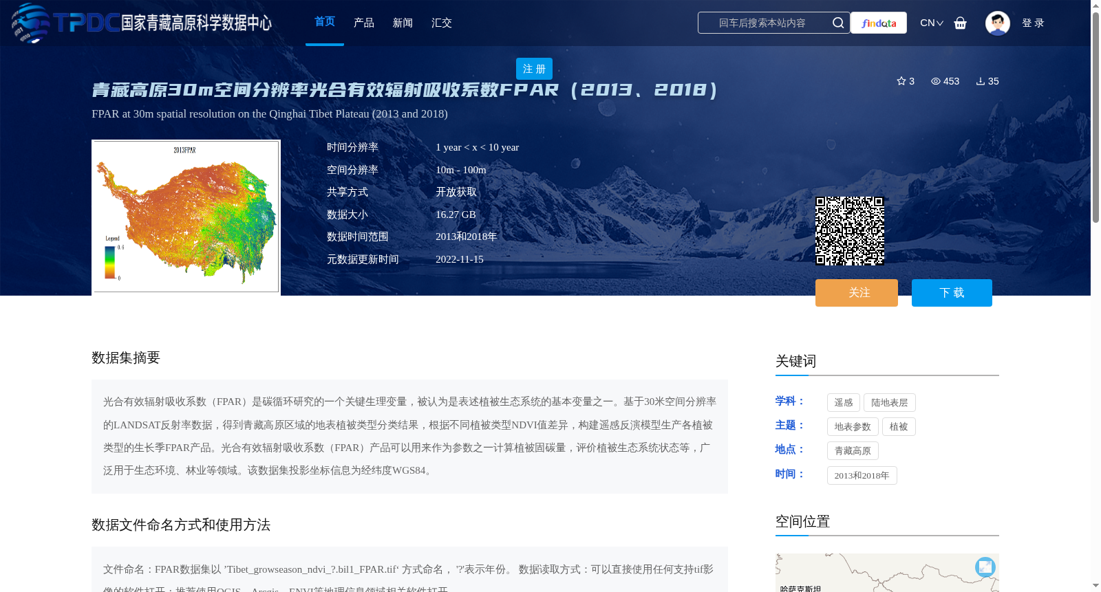
光合有效辐射吸收系数(FPAR)是碳循环研究的一个关键生理变量,被认为是表述植被生态系统的基本变量之一。基于30米空间分辨率的LANDSAT反射率数据,得到青藏高原区域的地表植被类型分类结果,根据不同植被类型NDVI值差异,构建遥感反演模型生产各植被类型的生长季FPAR产品。光合有效辐射吸收系数(FPAR)产品可以用来作为参数之一计算植被固碳量,评价植被生态系统状态等,广泛用于生态环境、林业等领域。该数据集投影坐标信息为经纬度WGS84。
Fraction of Photosynthetically Active Radiation absorbed (FPAR) is a key physiological variable in carbon cycle research, and is recognized as one of the fundamental variables for characterizing terrestrial vegetation ecosystems. Based on Landsat reflectance data with a 30-meter spatial resolution, land vegetation type classification results for the Qinghai-Tibet Plateau were obtained. Then, a remote sensing inversion model was constructed based on the differences in NDVI values across various vegetation types to produce growing-season FPAR products for each vegetation category. The FPAR product can be used as one of the parameters to calculate vegetation carbon sequestration, evaluate the status of vegetation ecosystems, and other related applications, and is widely applied in fields such as ecological environment and forestry. The projection coordinate system of this dataset is the WGS84 geographic coordinate system (longitude and latitude).
提供机构:
徐希燕
创建时间:
2022-11-11
搜集汇总
数据集介绍
背景与挑战
背景概述
该数据集提供了2013年和2018年青藏高原地区30米空间分辨率的光合有效辐射吸收系数(FPAR)数据,用于植被生态系统状态评估和碳循环研究。数据以开放获取方式共享,大小为16.27 GB,适用于生态环境和林业等领域的研究。
以上内容由遇见数据集搜集并总结生成


